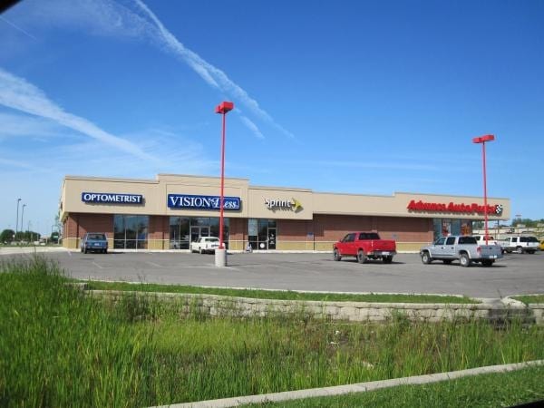
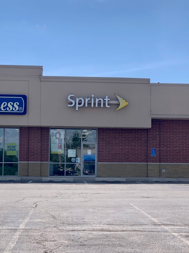
Property Record
2018 Sears St, Waterloo, IA 50702

Save to a Folder
{{folder.Name}}
{{folder.ListingIds.length}} Properties
{{folder.ListingIds.length}} Property
Create a New Folder
Property Detail
2018 Sears St
8813-02-377-009
A PARCEL OF LAND LOC IN THE E 1/2 OF SEC 2 T 88 R 13 BOUNDED AS FOL: BEG AT PT OF INTERSECTION OF SELY ROW LINE OF E SAN
Stripcommercialcenter
Black Hawk
B and X Area of moderate flood hazard, usually the area between the limits of the 100-year and 500-year floods.
Iowa
2025
1.39 AC
2025
Iowa City/Waterloo
000900
Other Market Areas
12,065 SF
Waterloo-Cedar Falls, IA
NEARBY LISTINGS FOR SALE OR LEASE
DEMOGRAPHICS near 2018 Sears St
1 mile
3 mile
5 mile
2025 Total Population
5,449
48,494
73,704
2030 Population
5,507
49,361
74,931
Pop Growth 2025-2030
+ 1.06%
+ 1.79%
+ 1.66%
Average Age
39
39
39
2025 Total Households
2,453
20,908
31,771
HH Growth 2025-2030
+ 1.10%
+ 1.88%
+ 1.72%
Median Household Inc
$54,389
$51,749
$53,847
Avg Household Size
2.20
2.20
2.20
2025 Avg HH Vehicles
2.00
2.00
2.00
Median Home Value
$161,087
$156,210
$156,068
Median Year Built
1963
1961
1962
Nearby Places
Map Layers
Map Styles
 Street
 Aerial
Layers
 Traffic
 Biking
Places
Listings with unknown addresses are not visible on the map
- Restaurants
- Banks
- Shops
- Fitness
- Groceries
Nearby Properties
Address
Land Use
TOTAL SIZE
Lot Size
Zoning
Address
Land Use
TOTAL SIZE
Lot Size
Zoning
156,098 SF
52.58 AC
Address
Land Use
TOTAL SIZE
Lot Size
Zoning
596,653 SF
31.45 AC
Address
Land Use
TOTAL SIZE
Lot Size
Zoning
108,671 SF
3.72 AC
Address
Land Use
TOTAL SIZE
Lot Size
Zoning
186,130 SF
10.89 AC
Address
Land Use
TOTAL SIZE
Lot Size
Zoning
622 SF
106.81 AC
Address
Land Use
TOTAL SIZE
Lot Size
Zoning
172,479 SF
9.39 AC
Address
Land Use
TOTAL SIZE
Lot Size
Zoning
341 SF
1.83 AC
Address
Land Use
TOTAL SIZE
Lot Size
Zoning
101,633 SF
7 AC
Address
Land Use
TOTAL SIZE
Lot Size
Zoning
110,177 SF
1.19 AC
Address
Land Use
TOTAL SIZE
Lot Size
Zoning
202,974 SF
19.11 AC
Address
Land Use
TOTAL SIZE
Lot Size
Zoning
174,244 SF
34.27 AC
Address
Land Use
TOTAL SIZE
Lot Size
Zoning
1,473 SF
25.70 AC
Address
Land Use
TOTAL SIZE
Lot Size
Zoning
2,735 SF
158.87 AC
Address
Land Use
TOTAL SIZE
Lot Size
Zoning
59,565 SF
0.28 AC
Address
Land Use
TOTAL SIZE
Lot Size
Zoning
205,163 SF
15 AC
Address
Land Use
TOTAL SIZE
Lot Size
Zoning
115,819 SF
2.07 AC
Address
Land Use
TOTAL SIZE
Lot Size
Zoning
129,863 SF
11.40 AC
Address
Land Use
TOTAL SIZE
Lot Size
Zoning
125,340 SF
0.80 AC
Address
Land Use
TOTAL SIZE
Lot Size
Zoning
60,496 SF
4.96 AC
Address
Land Use
TOTAL SIZE
Lot Size
Zoning
197,968 SF
6.10 AC
Address
Land Use
TOTAL SIZE
Lot Size
Zoning
82,449 SF
10.62 AC
Address
Land Use
TOTAL SIZE
Lot Size
Zoning
157,119 SF
15.78 AC
Address
Land Use
TOTAL SIZE
Lot Size
Zoning
77,366 SF
38.51 AC
Address
Land Use
TOTAL SIZE
Lot Size
Zoning
86,363 SF
21.46 AC
Address
Land Use
TOTAL SIZE
Lot Size
Zoning
960 SF
39.19 AC
Address
Land Use
TOTAL SIZE
Lot Size
Zoning
70,933 SF
27.58 AC
Address
Land Use
TOTAL SIZE
Lot Size
Zoning
102,131 SF
9.16 AC
Address
Land Use
TOTAL SIZE
Lot Size
Zoning
71,035 SF
8.27 AC
Address
Land Use
TOTAL SIZE
Lot Size
Zoning
145,720 SF
17.98 AC
Address
Land Use
TOTAL SIZE
Lot Size
Zoning
84,388 SF
7.79 AC
The World's #1 Commercial Real Estate Marketplace
Connect with us
© 2026 CoStar Group
The information above has been obtained from sources believed reliable. While we do not doubt its accuracy we have not verified it and make no guarantee, warranty or representation about it. It is your responsibility to independently confirm its accuracy and completeness. Any projections, opinions, assumptions, or estimates used are for example only and do not represent the current or future performance of the property. The value of this transaction to you depends on tax and other factors which should be evaluated by your tax, financial, and legal advisors. You and your advisors should conduct a careful, independent investigation of the property to determine to your satisfaction the suitability of the property for your needs.