Property Record
2 Myers Dr, Forest Hill, MD 21050
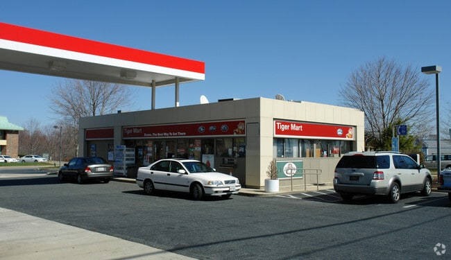

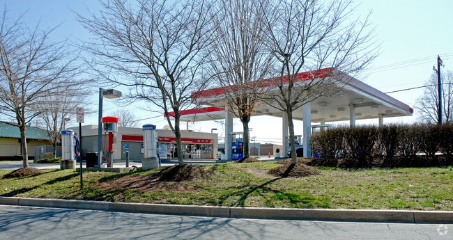
Property Detail
2 Myers Dr
03-225348
LT 2 1.497 AC 2 MYERS DRIVE KLEIN BUS COMM PT 58/64
Conveniencestore
HARFORD
B2
Maryland
B and X Area of moderate flood hazard, usually the area between the limits of the 100-year and 500-year floods.
2
2025
1.50 AC
2025
Outlying Harford County
303204
Baltimore
1,595 SF
Baltimore-Columbia-Towson, MD
NEARBY LISTINGS FOR SALE OR LEASE
DEMOGRAPHICS near 2 Myers Dr
1 mile
3 mile
5 mile
2025 Total Population
6,203
35,109
76,133
2030 Population
6,252
35,205
76,467
Pop Growth 2025-2030
+ 0.79%
+ 0.27%
+ 0.44%
Average Age
42
41
42
2025 Total Households
2,353
12,871
28,419
HH Growth 2025-2030
+ 0.72%
+ 0.26%
+ 0.49%
Median Household Inc
$112,755
$120,762
$117,836
Avg Household Size
2.60
2.60
2.60
2025 Avg HH Vehicles
2.00
2.00
2.00
Median Home Value
$435,180
$437,170
$436,827
Median Year Built
1996
1990
1986
Nearby Places
Map Layers
Map Styles
 Street
 Aerial
Transit
 Traffic
 Biking
Places
Listings with unknown addresses are not visible on the map
- Restaurants
- Banks
- Shops
- Fitness
- Groceries
PUBLIC TRANSPORTATION
AIRPORT
Baltimore/Washington International Thurgood Marshall
Drive
Walk
Distance
Baltimore/Washington International Thurgood Marshall
59 min
40.0 mi
Freight Ports
Port Newark Container Terminal
Drive
Walk
Distance
Port Newark Container Terminal
52 min
32.8 mi
SALE & LEASE HISTORY
LISTING DATE
SALE/LEASE

Mar 10, 2020
For Lease
Nearby Properties
Address
Land Use
TOTAL SIZE
Lot Size
Zoning
Address
Land Use
TOTAL SIZE
Lot Size
Zoning
51,475 SF
7.85 AC
C1
Address
Land Use
TOTAL SIZE
Lot Size
Zoning
12.38 AC
R2
Address
Land Use
TOTAL SIZE
Lot Size
Zoning
6,084 SF
6.03 AC
B2
Address
Land Use
TOTAL SIZE
Lot Size
Zoning
101,236 SF
23.52 AC
R1
Address
Land Use
TOTAL SIZE
Lot Size
Zoning
78,264 SF
16.71 AC
AG
Address
Land Use
TOTAL SIZE
Lot Size
Zoning
52,245 SF
2.43 AC
R3/B1
Address
Land Use
TOTAL SIZE
Lot Size
Zoning
10.73 AC
B2
Address
Land Use
TOTAL SIZE
Lot Size
Zoning
46,247 SF
10.45 AC
R2 B2
Address
Land Use
TOTAL SIZE
Lot Size
Zoning
78,394 SF
24.56 AC
CI
Address
Land Use
TOTAL SIZE
Lot Size
Zoning
7,104 SF
10.95 AC
R2 R3
Address
Land Use
TOTAL SIZE
Lot Size
Zoning
77,649 SF
10.42 AC
GI
Address
Land Use
TOTAL SIZE
Lot Size
Zoning
63,392 SF
8.44 AC
VR
Address
Land Use
TOTAL SIZE
Lot Size
Zoning
9,464 SF
3.51 AC
R3
Address
Land Use
TOTAL SIZE
Lot Size
Zoning
97,060 SF
8.39 AC
B2
Address
Land Use
TOTAL SIZE
Lot Size
Zoning
19,224 SF
6.43 AC
R2
Address
Land Use
TOTAL SIZE
Lot Size
Zoning
84,100 SF
2.58 AC
B3
Address
Land Use
TOTAL SIZE
Lot Size
Zoning
5,690 SF
10.86 AC
R2
Address
Land Use
TOTAL SIZE
Lot Size
Zoning
45,890 SF
20.67 AC
R2
Address
Land Use
TOTAL SIZE
Lot Size
Zoning
49,265 SF
4.30 AC
B3
Address
Land Use
TOTAL SIZE
Lot Size
Zoning
49,700 SF
5.89 AC
B2
Address
Land Use
TOTAL SIZE
Lot Size
Zoning
52,530 SF
5.60 AC
B3
Address
Land Use
TOTAL SIZE
Lot Size
Zoning
52,000 SF
2.12 AC
B2A
Address
Land Use
TOTAL SIZE
Lot Size
Zoning
67,606 SF
23.04 AC
AG
Address
Land Use
TOTAL SIZE
Lot Size
Zoning
16,000 SF
6.16 AC
GI
Address
Land Use
TOTAL SIZE
Lot Size
Zoning
7,773 SF
1.39 AC
B3
Address
Land Use
TOTAL SIZE
Lot Size
Zoning
14,735 SF
2.37 AC
B2
Address
Land Use
TOTAL SIZE
Lot Size
Zoning
2,943 SF
10.30 AC
B3
Address
Land Use
TOTAL SIZE
Lot Size
Zoning
16,157 SF
4.21 AC
B2
Address
Land Use
TOTAL SIZE
Lot Size
Zoning
80,604 SF
5.38 AC
B2
Address
Land Use
TOTAL SIZE
Lot Size
Zoning
58,438 SF
6.74 AC
B2
The World's #1 Commercial Real Estate Marketplace
Connect with us
© 2026 CoStar Group
The information above has been obtained from sources believed reliable. While we do not doubt its accuracy we have not verified it and make no guarantee, warranty or representation about it. It is your responsibility to independently confirm its accuracy and completeness. Any projections, opinions, assumptions, or estimates used are for example only and do not represent the current or future performance of the property. The value of this transaction to you depends on tax and other factors which should be evaluated by your tax, financial, and legal advisors. You and your advisors should conduct a careful, independent investigation of the property to determine to your satisfaction the suitability of the property for your needs.