Property Record
20193 Ashbrook Pl, Ashburn, VA 20147
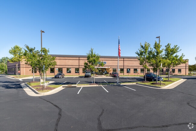


Property Detail
20193 Ashbrook Pl
Washington-Arlington-Alexandria, DC-VA-MD-WV
ASHBROOK PARCEL 5A2 LOT 5A2A 201503040012896ESMT 201501080001042P
057-27-3034
Loudoun
Officebuilding
Virginia
PDIP
5
2025
3.06 AC
2025
Route 7 Corridor
611015
Washington, DC
32,675 SF
NEARBY LISTINGS FOR SALE OR LEASE
DEMOGRAPHICS near 20193 Ashbrook Pl
1 mile
3 mile
5 mile
2025 Total Population
12,713
79,546
185,222
2030 Population
13,371
82,761
192,845
Pop Growth 2025-2030
+ 5.18%
+ 4.04%
+ 4.12%
Average Age
43
41
39
2025 Total Households
5,311
29,540
64,231
HH Growth 2025-2030
+ 5.18%
+ 4.23%
+ 4.31%
Median Household Inc
$158,591
$157,284
$160,217
Avg Household Size
2.40
2.70
2.80
2025 Avg HH Vehicles
2.00
2.00
2.00
Median Home Value
$721,273
$704,547
$708,129
Median Year Built
2007
2000
2000
Nearby Places
Map Layers
Map Styles
 Street
 Aerial
Layers
 Traffic
 Biking
Places
Listings with unknown addresses are not visible on the map
- Restaurants
- Banks
- Shops
- Fitness
- Groceries
PUBLIC TRANSPORTATION
AIRPORT
Washington Dulles International
Drive
Walk
Distance
Washington Dulles International
21 min
10.8 mi
Ronald Reagan Washington Ntl
Drive
Walk
Distance
Ronald Reagan Washington Ntl
51 min
32.4 mi
Freight Ports
Port of Baltimore
Drive
Walk
Distance
Port of Baltimore
91 min
64.4 mi
Nearby Properties
Address
Land Use
TOTAL SIZE
Lot Size
Zoning
Address
Land Use
TOTAL SIZE
Lot Size
Zoning
518,449 SF
32.11 AC
IP
Address
Land Use
TOTAL SIZE
Lot Size
Zoning
650,346 SF
PDMUB
Address
Land Use
TOTAL SIZE
Lot Size
Zoning
446,512 SF
25.41 AC
IP
Address
Land Use
TOTAL SIZE
Lot Size
Zoning
368,624 SF
8.85 AC
PDOP
Address
Land Use
TOTAL SIZE
Lot Size
Zoning
672,272 SF
44.53 AC
PDIP
Address
Land Use
TOTAL SIZE
Lot Size
Zoning
679,455 SF
31.97 AC
PDIP
Address
Land Use
TOTAL SIZE
Lot Size
Zoning
2,735,138 SF
123.03 AC
PDAAAR
Address
Land Use
TOTAL SIZE
Lot Size
Zoning
288,403 SF
16.56 AC
PDOP
Address
Land Use
TOTAL SIZE
Lot Size
Zoning
286,865 SF
18.56 AC
IP
Address
Land Use
TOTAL SIZE
Lot Size
Zoning
684,976 SF
85.31 AC
PDOP
Address
Land Use
TOTAL SIZE
Lot Size
Zoning
286,800 SF
10.97 AC
IP
Address
Land Use
TOTAL SIZE
Lot Size
Zoning
455,793 SF
22.60 AC
IP
Address
Land Use
TOTAL SIZE
Lot Size
Zoning
362,108 SF
18.82 AC
PDOP
Address
Land Use
TOTAL SIZE
Lot Size
Zoning
400,232 SF
21.38 AC
IP
Address
Land Use
TOTAL SIZE
Lot Size
Zoning
169,092 SF
PDMUB
Address
Land Use
TOTAL SIZE
Lot Size
Zoning
109,320 SF
7.20 AC
PDIP
Address
Land Use
TOTAL SIZE
Lot Size
Zoning
1,070,060 SF
197.44 AC
PDRDP
Address
Land Use
TOTAL SIZE
Lot Size
Zoning
685,682 SF
53.96 AC
PDIP
Address
Land Use
TOTAL SIZE
Lot Size
Zoning
123,200 SF
4.74 AC
PDIP
Address
Land Use
TOTAL SIZE
Lot Size
Zoning
108.01 AC
PDOP
Address
Land Use
TOTAL SIZE
Lot Size
Zoning
481,791 SF
41.28 AC
PDIP
Address
Land Use
TOTAL SIZE
Lot Size
Zoning
414,268 SF
43.68 AC
R16
Address
Land Use
TOTAL SIZE
Lot Size
Zoning
259,194 SF
10.18 AC
PDIP
Address
Land Use
TOTAL SIZE
Lot Size
Zoning
148,717 SF
PDIP
Address
Land Use
TOTAL SIZE
Lot Size
Zoning
341,831 SF
31.21 AC
PDH6
Address
Land Use
TOTAL SIZE
Lot Size
Zoning
87,560 SF
PDIP
Address
Land Use
TOTAL SIZE
Lot Size
Zoning
446,732 SF
37.94 AC
PDIP
Address
Land Use
TOTAL SIZE
Lot Size
Zoning
119,087 SF
339.95 AC
PDIP
Address
Land Use
TOTAL SIZE
Lot Size
Zoning
429,711 SF
34.74 AC
PDH4
Address
Land Use
TOTAL SIZE
Lot Size
Zoning
274,751 SF
18.87 AC
PDH3
The World's #1 Commercial Real Estate Marketplace
Connect with us
© 2026 CoStar Group
The information above has been obtained from sources believed reliable. While we do not doubt its accuracy we have not verified it and make no guarantee, warranty or representation about it. It is your responsibility to independently confirm its accuracy and completeness. Any projections, opinions, assumptions, or estimates used are for example only and do not represent the current or future performance of the property. The value of this transaction to you depends on tax and other factors which should be evaluated by your tax, financial, and legal advisors. You and your advisors should conduct a careful, independent investigation of the property to determine to your satisfaction the suitability of the property for your needs.