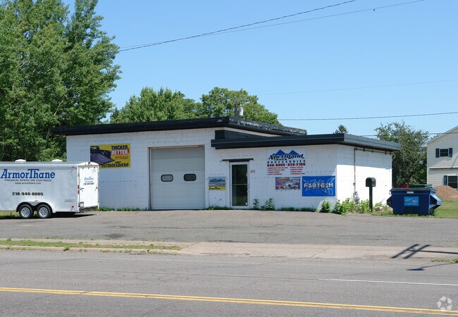
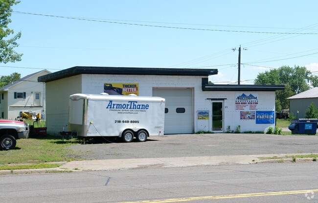
Property Record
202 Commonwealth Ave, Duluth, MN 55808

Property Detail
202 Commonwealth Ave
Duluth, MN-WI
LOT: 0017 BLOCK:008 SERIAL #
010343002720
Saint Louis
Commercialnec
Minnesota
B and X Area of moderate flood hazard, usually the area between the limits of the 100-year and 500-year floods.
17
2025
0.08 AC
2024
West End
003800
Duluth
1,288 SF
NEARBY LISTINGS FOR SALE OR LEASE
-
-
View all Duluth listings for sale on LoopNet.com
DEMOGRAPHICS near 202 Commonwealth Ave
1 mile
3 mile
5 mile
2025 Total Population
2,073
5,481
8,018
2030 Population
2,034
5,446
7,947
Pop Growth 2025-2030
(1.88%)
(0.64%)
(0.89%)
Average Age
43
41
42
2025 Total Households
890
2,352
3,409
HH Growth 2025-2030
(2.02%)
(0.64%)
(0.94%)
Median Household Inc
$70,356
$62,386
$64,993
Avg Household Size
2.20
2.20
2.20
2025 Avg HH Vehicles
2.00
2.00
2.00
Median Home Value
$166,015
$171,184
$189,951
Median Year Built
1956
1954
1955
Nearby Places
Map Layers
Map Styles
 Street
 Aerial
Transit
 Traffic
 Biking
Places
Listings with unknown addresses are not visible on the map
- Restaurants
- Banks
- Shops
- Fitness
- Groceries
PUBLIC TRANSPORTATION
AIRPORT
Duluth International
Drive
Walk
Distance
Duluth International
35 min
19.7 mi
SALE & LEASE HISTORY
LISTING DATE
SALE/LEASE

Jun 27, 2017
For Sale
Dec 06, 2016
For Sale
Nearby Properties
Address
Land Use
TOTAL SIZE
Lot Size
Zoning
Address
Land Use
TOTAL SIZE
Lot Size
Zoning
82,679 SF
3.27 AC
Address
Land Use
TOTAL SIZE
Lot Size
Zoning
58,368 SF
7.10 AC
Address
Land Use
TOTAL SIZE
Lot Size
Zoning
284,827 SF
47.09 AC
Address
Land Use
TOTAL SIZE
Lot Size
Zoning
59,368 SF
0.46 AC
R1C
Address
Land Use
TOTAL SIZE
Lot Size
Zoning
47,993 SF
2.72 AC
R2
Address
Land Use
TOTAL SIZE
Lot Size
Zoning
27,275 SF
112.47 AC
Address
Land Use
TOTAL SIZE
Lot Size
Zoning
38,160 SF
2.28 AC
Address
Land Use
TOTAL SIZE
Lot Size
Zoning
38,160 SF
1.97 AC
Address
Land Use
TOTAL SIZE
Lot Size
Zoning
6,970 SF
31.98 AC
R1C
Address
Land Use
TOTAL SIZE
Lot Size
Zoning
7,800 SF
3.33 AC
R3
Address
Land Use
TOTAL SIZE
Lot Size
Zoning
1,395 SF
8.50 AC
R1C
Address
Land Use
TOTAL SIZE
Lot Size
Zoning
39.98 AC
C1
Address
Land Use
TOTAL SIZE
Lot Size
Zoning
9,825 SF
2.16 AC
Address
Land Use
TOTAL SIZE
Lot Size
Zoning
20,746 SF
4.41 AC
Address
Land Use
TOTAL SIZE
Lot Size
Zoning
20,800 SF
Address
Land Use
TOTAL SIZE
Lot Size
Zoning
20,800 SF
Address
Land Use
TOTAL SIZE
Lot Size
Zoning
20,800 SF
Address
Land Use
TOTAL SIZE
Lot Size
Zoning
20,800 SF
2.07 AC
Address
Land Use
TOTAL SIZE
Lot Size
Zoning
20,800 SF
Address
Land Use
TOTAL SIZE
Lot Size
Zoning
20,800 SF
Address
Land Use
TOTAL SIZE
Lot Size
Zoning
20,800 SF
Address
Land Use
TOTAL SIZE
Lot Size
Zoning
8,928 SF
1.03 AC
R3
Address
Land Use
TOTAL SIZE
Lot Size
Zoning
3,862 SF
40 AC
Address
Land Use
TOTAL SIZE
Lot Size
Zoning
6,800 SF
18.10 AC
Address
Land Use
TOTAL SIZE
Lot Size
Zoning
5,620 SF
0.49 AC
Address
Land Use
TOTAL SIZE
Lot Size
Zoning
26,066 SF
1.29 AC
C1
Address
Land Use
TOTAL SIZE
Lot Size
Zoning
11,660 SF
1.24 AC
Address
Land Use
TOTAL SIZE
Lot Size
Zoning
20,000 SF
13.55 AC
Address
Land Use
TOTAL SIZE
Lot Size
Zoning
6,360 SF
0.16 AC
Address
Land Use
TOTAL SIZE
Lot Size
Zoning
8,160 SF
0.19 AC
R2
The World's #1 Commercial Real Estate Marketplace
Connect with us
© 2026 CoStar Group
The information above has been obtained from sources believed reliable. While we do not doubt its accuracy we have not verified it and make no guarantee, warranty or representation about it. It is your responsibility to independently confirm its accuracy and completeness. Any projections, opinions, assumptions, or estimates used are for example only and do not represent the current or future performance of the property. The value of this transaction to you depends on tax and other factors which should be evaluated by your tax, financial, and legal advisors. You and your advisors should conduct a careful, independent investigation of the property to determine to your satisfaction the suitability of the property for your needs.