Property Record
202 Cr-202, Kyle, TX 78640


Save to a Folder
{{folder.Name}}
{{folder.ListingIds.length}} Properties
{{folder.ListingIds.length}} Property
Create a New Folder
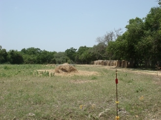
Property Detail
202 Cr-202
Austin-Round Rock-San Marcos, TX
A0221 WILLIAM HEMPHILL SURVEY, ACRES 7.627
R14960
HAYS
Farms
Texas
A Areas with a 1% annual chance of flooding and a 26% chance of flooding over the life of a 30-year mortgage.
30.29 AC
2024
Hays County
2025
Austin
010916
NEARBY LISTINGS FOR SALE OR LEASE
DEMOGRAPHICS near 202 Cr-202
1 mile
3 mile
5 mile
2025 Total Population
289
22,834
65,560
2030 Population
361
27,162
77,148
Pop Growth 2025-2030
+ 24.91%
+ 18.95%
+ 17.68%
Average Age
36
35
35
2025 Total Households
91
7,051
21,045
HH Growth 2025-2030
+ 25.27%
+ 20.01%
+ 18.73%
Median Household Inc
$145,833
$96,692
$91,526
Avg Household Size
3.20
3.20
3.10
2025 Avg HH Vehicles
3.00
2.00
2.00
Median Home Value
$326,470
$335,806
$333,457
Median Year Built
2011
2010
2010
Nearby Places
Map Layers
Map Styles
 Street
 Aerial
Layers
 Traffic
 Biking
Places
Listings with unknown addresses are not visible on the map
- Restaurants
- Banks
- Shops
- Fitness
- Groceries
PUBLIC TRANSPORTATION
AIRPORT
Austin-Bergstrom International
Drive
Walk
Distance
Austin-Bergstrom International
39 min
25.2 mi
Freight Ports
Calhoun Port
Drive
Walk
Distance
Calhoun Port
174 min
140.3 mi
SALE & LEASE HISTORY
LISTING DATE
SALE/LEASE

Apr 11, 2019
For Sale
Apr 09, 2022
For Sale
Nearby Properties
Address
Land Use
TOTAL SIZE
Lot Size
Zoning
Address
Land Use
TOTAL SIZE
Lot Size
Zoning
212,026 SF
13.82 AC
Address
Land Use
TOTAL SIZE
Lot Size
Zoning
2,663 SF
176.58 AC
Address
Land Use
TOTAL SIZE
Lot Size
Zoning
672 SF
1.55 AC
Address
Land Use
TOTAL SIZE
Lot Size
Zoning
303.50 AC
Address
Land Use
TOTAL SIZE
Lot Size
Zoning
2,748 SF
72.33 AC
Address
Land Use
TOTAL SIZE
Lot Size
Zoning
96,000 SF
10 AC
Address
Land Use
TOTAL SIZE
Lot Size
Zoning
49,536 SF
2.36 AC
Address
Land Use
TOTAL SIZE
Lot Size
Zoning
3,510 SF
136.76 AC
Address
Land Use
TOTAL SIZE
Lot Size
Zoning
36.30 AC
Address
Land Use
TOTAL SIZE
Lot Size
Zoning
47.48 AC
Address
Land Use
TOTAL SIZE
Lot Size
Zoning
28.24 AC
Address
Land Use
TOTAL SIZE
Lot Size
Zoning
41.87 AC
Address
Land Use
TOTAL SIZE
Lot Size
Zoning
71,895 SF
10.01 AC
Address
Land Use
TOTAL SIZE
Lot Size
Zoning
110.91 AC
Address
Land Use
TOTAL SIZE
Lot Size
Zoning
26.88 AC
Address
Land Use
TOTAL SIZE
Lot Size
Zoning
876 SF
105.47 AC
Address
Land Use
TOTAL SIZE
Lot Size
Zoning
Address
Land Use
TOTAL SIZE
Lot Size
Zoning
6,095 SF
15 AC
Address
Land Use
TOTAL SIZE
Lot Size
Zoning
9,300 SF
5.90 AC
Address
Land Use
TOTAL SIZE
Lot Size
Zoning
98.76 AC
Address
Land Use
TOTAL SIZE
Lot Size
Zoning
21.34 AC
Address
Land Use
TOTAL SIZE
Lot Size
Zoning
96.95 AC
Address
Land Use
TOTAL SIZE
Lot Size
Zoning
34.37 AC
Address
Land Use
TOTAL SIZE
Lot Size
Zoning
47.93 AC
Address
Land Use
TOTAL SIZE
Lot Size
Zoning
76.97 AC
Address
Land Use
TOTAL SIZE
Lot Size
Zoning
106,335 SF
44.81 AC
Address
Land Use
TOTAL SIZE
Lot Size
Zoning
11,991 SF
6.47 AC
Address
Land Use
TOTAL SIZE
Lot Size
Zoning
52.85 AC
Address
Land Use
TOTAL SIZE
Lot Size
Zoning
22,922 SF
2.03 AC
Address
Land Use
TOTAL SIZE
Lot Size
Zoning
12,000 SF
20.67 AC
The World's #1 Commercial Real Estate Marketplace
Connect with us
© 2026 CoStar Group
The information above has been obtained from sources believed reliable. While we do not doubt its accuracy we have not verified it and make no guarantee, warranty or representation about it. It is your responsibility to independently confirm its accuracy and completeness. Any projections, opinions, assumptions, or estimates used are for example only and do not represent the current or future performance of the property. The value of this transaction to you depends on tax and other factors which should be evaluated by your tax, financial, and legal advisors. You and your advisors should conduct a careful, independent investigation of the property to determine to your satisfaction the suitability of the property for your needs.