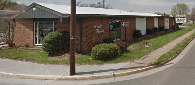
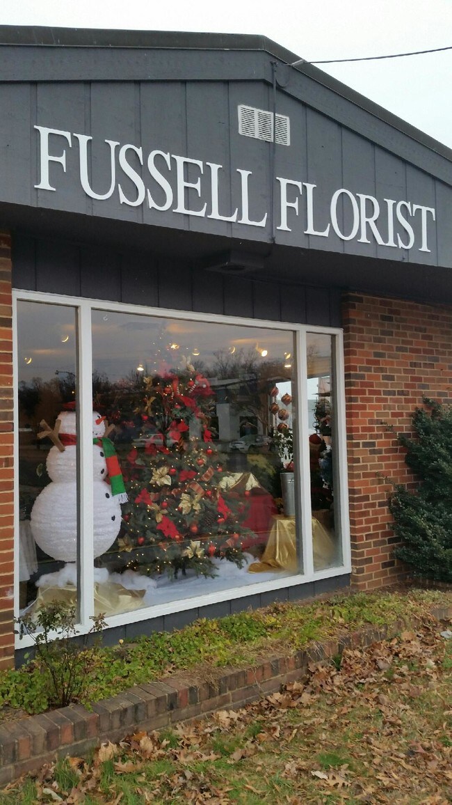
Property Record
202 E 2Nd St, Front Royal, VA 22630

Property Detail
202 E 2Nd St
20A8-1-4-33
L HILLIDGE SECOND ST
Storebuilding
Warren
C2
Virginia
AE The base floodplain where base flood elevations are provided. AE Zones are now used on new format FIRMs instead of A1-A30 Zones.
0.12 AC
2025
Warren County
2026
Washington, DC
020500
Washington-Arlington-Alexandria, DC-VA-MD-WV
4,891 SF
NEARBY LISTINGS FOR SALE OR LEASE
DEMOGRAPHICS near 202 E 2Nd St
1 mile
3 mile
5 mile
2025 Total Population
8,835
17,813
28,578
2030 Population
9,135
18,470
29,717
Pop Growth 2025-2030
+ 3.40%
+ 3.69%
+ 3.99%
Average Age
41
41
41
2025 Total Households
3,584
6,902
10,792
HH Growth 2025-2030
+ 3.49%
+ 3.77%
+ 4.07%
Median Household Inc
$63,130
$68,281
$74,437
Avg Household Size
2.40
2.50
2.50
2025 Avg HH Vehicles
2.00
2.00
2.00
Median Home Value
$296,087
$317,621
$341,663
Median Year Built
1962
1974
1979
Nearby Places
Map Layers
Map Styles
 Street
 Aerial
Layers
 Traffic
 Biking
Places
Listings with unknown addresses are not visible on the map
- Restaurants
- Banks
- Shops
- Fitness
- Groceries
SALE & LEASE HISTORY
LISTING DATE
SALE/LEASE

Nov 12, 2018
For Sale
Mar 21, 2019
For Sale
Nearby Properties
Address
Land Use
TOTAL SIZE
Lot Size
Zoning
Address
Land Use
TOTAL SIZE
Lot Size
Zoning
177,000 SF
31.20 AC
A1
Address
Land Use
TOTAL SIZE
Lot Size
Zoning
226,147 SF
56.43 AC
A
Address
Land Use
TOTAL SIZE
Lot Size
Zoning
219,825 SF
37.96 AC
RS
Address
Land Use
TOTAL SIZE
Lot Size
Zoning
2,352 SF
20 AC
RE
Address
Land Use
TOTAL SIZE
Lot Size
Zoning
215,659 SF
15.81 AC
R1
Address
Land Use
TOTAL SIZE
Lot Size
Zoning
162,566 SF
31.91 AC
R1
Address
Land Use
TOTAL SIZE
Lot Size
Zoning
123,668 SF
4.93 AC
R3
Address
Land Use
TOTAL SIZE
Lot Size
Zoning
85,956 SF
29.42 AC
R1
Address
Land Use
TOTAL SIZE
Lot Size
Zoning
1,836 SF
15 AC
R1
Address
Land Use
TOTAL SIZE
Lot Size
Zoning
126,828 SF
27.44 AC
C1
Address
Land Use
TOTAL SIZE
Lot Size
Zoning
219,065 SF
23.40 AC
C
Address
Land Use
TOTAL SIZE
Lot Size
Zoning
110,693 SF
30.65 AC
R3
Address
Land Use
TOTAL SIZE
Lot Size
Zoning
240.75 AC
I2
Address
Land Use
TOTAL SIZE
Lot Size
Zoning
91,950 SF
15 AC
R3
Address
Land Use
TOTAL SIZE
Lot Size
Zoning
73,000 SF
51.04 AC
RS
Address
Land Use
TOTAL SIZE
Lot Size
Zoning
1,109 SF
13.19 AC
R3
Address
Land Use
TOTAL SIZE
Lot Size
Zoning
147,298 SF
13.13 AC
C
Address
Land Use
TOTAL SIZE
Lot Size
Zoning
224 SF
2.78 AC
R3
Address
Land Use
TOTAL SIZE
Lot Size
Zoning
127,633 SF
11.37 AC
C
Address
Land Use
TOTAL SIZE
Lot Size
Zoning
61,410 SF
5.94 AC
C
Address
Land Use
TOTAL SIZE
Lot Size
Zoning
59,235 SF
22.25 AC
R1
Address
Land Use
TOTAL SIZE
Lot Size
Zoning
133,096 SF
10.07 AC
C1
Address
Land Use
TOTAL SIZE
Lot Size
Zoning
59,639 SF
3.67 AC
C2
Address
Land Use
TOTAL SIZE
Lot Size
Zoning
44,371 SF
12.69 AC
A
Address
Land Use
TOTAL SIZE
Lot Size
Zoning
39,212 SF
3.84 AC
C2
Address
Land Use
TOTAL SIZE
Lot Size
Zoning
34,590 SF
9.34 AC
R3
Address
Land Use
TOTAL SIZE
Lot Size
Zoning
37,745 SF
2.74 AC
C2
Address
Land Use
TOTAL SIZE
Lot Size
Zoning
28,800 SF
6.13 AC
R3
Address
Land Use
TOTAL SIZE
Lot Size
Zoning
50,184 SF
4.52 AC
C3
Address
Land Use
TOTAL SIZE
Lot Size
Zoning
53,764 SF
15.92 AC
I2
The World's #1 Commercial Real Estate Marketplace
Connect with us
© 2026 CoStar Group
The information above has been obtained from sources believed reliable. While we do not doubt its accuracy we have not verified it and make no guarantee, warranty or representation about it. It is your responsibility to independently confirm its accuracy and completeness. Any projections, opinions, assumptions, or estimates used are for example only and do not represent the current or future performance of the property. The value of this transaction to you depends on tax and other factors which should be evaluated by your tax, financial, and legal advisors. You and your advisors should conduct a careful, independent investigation of the property to determine to your satisfaction the suitability of the property for your needs.