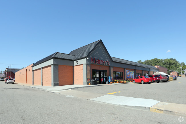
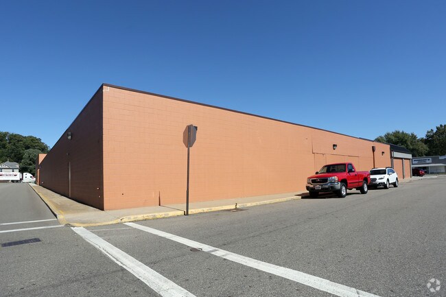
Property Record
202 E High St, Minerva, OH 44657

Property Detail
202 E High St
Canton-Massillon, OH
47,48,1061 WH EA
04201594
Stark
Supermarket
Ohio
0
1.07 AC
2025
Stark County
712900
Cleveland
41,015 SF
NEARBY LISTINGS FOR SALE OR LEASE
-
-
View all Minerva listings for sale on LoopNet.com
DEMOGRAPHICS near 202 E High St
1 mile
3 mile
5 mile
2024 Total Population
3,791
7,163
11,766
2029 Population
3,760
7,104
11,620
Pop Growth 2024-2029
(0.82%)
(0.82%)
(1.24%)
Average Age
42
42
43
2024 Total Households
1,581
2,947
4,816
HH Growth 2024-2029
(0.89%)
(0.88%)
(1.31%)
Median Household Inc
$54,946
$56,104
$56,512
Avg Household Size
2.30
2.40
2.40
2024 Avg HH Vehicles
2.00
2.00
2.00
Median Home Value
$150,191
$162,743
$170,221
Median Year Built
1958
1970
1969
Nearby Places
Map Layers
Map Styles
 Street
 Aerial
Transit
 Traffic
 Biking
Places
Listings with unknown addresses are not visible on the map
- Restaurants
- Banks
- Shops
- Fitness
- Groceries
PUBLIC TRANSPORTATION
AIRPORT
Akron-Canton Regional
Drive
Walk
Distance
Akron-Canton Regional
40 min
26.9 mi
Nearby Properties
Address
Land Use
TOTAL SIZE
Lot Size
Zoning
Address
Land Use
TOTAL SIZE
Lot Size
Zoning
122,724 SF
7.18 AC
Address
Land Use
TOTAL SIZE
Lot Size
Zoning
76,782 SF
4.11 AC
Address
Land Use
TOTAL SIZE
Lot Size
Zoning
140,605 SF
3.51 AC
Address
Land Use
TOTAL SIZE
Lot Size
Zoning
23,390 SF
16.63 AC
Address
Land Use
TOTAL SIZE
Lot Size
Zoning
25,392 SF
2.49 AC
Address
Land Use
TOTAL SIZE
Lot Size
Zoning
46,551 SF
0.88 AC
Address
Land Use
TOTAL SIZE
Lot Size
Zoning
296,470 SF
45.94 AC
Address
Land Use
TOTAL SIZE
Lot Size
Zoning
23,732 SF
12.70 AC
Address
Land Use
TOTAL SIZE
Lot Size
Zoning
23,908 SF
1.56 AC
Address
Land Use
TOTAL SIZE
Lot Size
Zoning
24,534 SF
5.41 AC
Address
Land Use
TOTAL SIZE
Lot Size
Zoning
8,008 SF
5.43 AC
Address
Land Use
TOTAL SIZE
Lot Size
Zoning
870 SF
9.87 AC
Address
Land Use
TOTAL SIZE
Lot Size
Zoning
92,361 SF
5.04 AC
Address
Land Use
TOTAL SIZE
Lot Size
Zoning
26,883 SF
0.44 AC
Address
Land Use
TOTAL SIZE
Lot Size
Zoning
49,846 SF
4.39 AC
Address
Land Use
TOTAL SIZE
Lot Size
Zoning
19,655 SF
0.78 AC
Address
Land Use
TOTAL SIZE
Lot Size
Zoning
24,021 SF
16.20 AC
Address
Land Use
TOTAL SIZE
Lot Size
Zoning
29,944 SF
3.99 AC
Address
Land Use
TOTAL SIZE
Lot Size
Zoning
11,144 SF
1.18 AC
Address
Land Use
TOTAL SIZE
Lot Size
Zoning
34,724 SF
3.85 AC
Address
Land Use
TOTAL SIZE
Lot Size
Zoning
31,500 SF
6.33 AC
Address
Land Use
TOTAL SIZE
Lot Size
Zoning
19,379 SF
2.77 AC
Address
Land Use
TOTAL SIZE
Lot Size
Zoning
5,232 SF
4.86 AC
Address
Land Use
TOTAL SIZE
Lot Size
Zoning
61,449 SF
1.86 AC
Address
Land Use
TOTAL SIZE
Lot Size
Zoning
18,235 SF
0.36 AC
Address
Land Use
TOTAL SIZE
Lot Size
Zoning
14,028 SF
1.02 AC
Address
Land Use
TOTAL SIZE
Lot Size
Zoning
11,384 SF
1.03 AC
Address
Land Use
TOTAL SIZE
Lot Size
Zoning
108,000 SF
65.08 AC
Address
Land Use
TOTAL SIZE
Lot Size
Zoning
10,554 SF
0.17 AC
The World's #1 Commercial Real Estate Marketplace
Connect with us
© 2026 CoStar Group
The information above has been obtained from sources believed reliable. While we do not doubt its accuracy we have not verified it and make no guarantee, warranty or representation about it. It is your responsibility to independently confirm its accuracy and completeness. Any projections, opinions, assumptions, or estimates used are for example only and do not represent the current or future performance of the property. The value of this transaction to you depends on tax and other factors which should be evaluated by your tax, financial, and legal advisors. You and your advisors should conduct a careful, independent investigation of the property to determine to your satisfaction the suitability of the property for your needs.