Property Record
202 E Oakridge Dr, Albany, GA 31705


Save to a Folder
{{folder.Name}}
{{folder.ListingIds.length}} Properties
{{folder.ListingIds.length}} Property
Create a New Folder
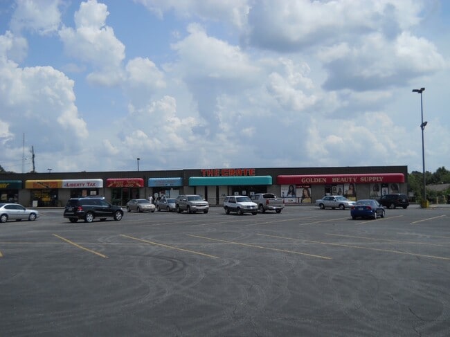
Property Detail
202 E Oakridge Dr
00227-00000-041
TRACT B & D
Stripcommercialcenter
Dougherty
C-2
Georgia
AE The base floodplain where base flood elevations are provided. AE Zones are now used on new format FIRMs instead of A1-A30 Zones.
2.19 AC
2025
Albany/Southwest
2025
Other Market Areas
010702
Albany, GA
11,505 SF
NEARBY LISTINGS FOR SALE OR LEASE
DEMOGRAPHICS near 202 E Oakridge Dr
1 mile
3 mile
5 mile
2025 Total Population
4,198
27,110
53,368
2030 Population
4,144
27,023
52,613
Pop Growth 2025-2030
(1.29%)
(0.32%)
(1.41%)
Average Age
35
37
38
2025 Total Households
1,437
10,765
21,728
HH Growth 2025-2030
(1.46%)
(0.34%)
(1.45%)
Median Household Inc
$34,022
$28,799
$36,692
Avg Household Size
2.40
2.30
2.30
2025 Avg HH Vehicles
1.00
1.00
1.00
Median Home Value
$72,780
$82,725
$99,910
Median Year Built
1967
1969
1969
Nearby Places
Map Layers
Map Styles
 Street
 Aerial
Layers
 Traffic
 Biking
Places
Listings with unknown addresses are not visible on the map
- Restaurants
- Banks
- Shops
- Fitness
- Groceries
PUBLIC TRANSPORTATION
AIRPORT
Southwest Georgia Regional
Drive
Walk
Distance
Southwest Georgia Regional
10 min
4.5 mi
Freight Ports
Port of Panama City
Drive
Walk
Distance
Port of Panama City
229 min
158.7 mi
Nearby Properties
Address
Land Use
TOTAL SIZE
Lot Size
Zoning
Address
Land Use
TOTAL SIZE
Lot Size
Zoning
Address
Land Use
TOTAL SIZE
Lot Size
Zoning
34,888 SF
164.47 AC
M-2
Address
Land Use
TOTAL SIZE
Lot Size
Zoning
1,445,486 SF
108.05 AC
M1
Address
Land Use
TOTAL SIZE
Lot Size
Zoning
51,008 SF
19.48 AC
C-5
Address
Land Use
TOTAL SIZE
Lot Size
Zoning
1.77 AC
C-2
Address
Land Use
TOTAL SIZE
Lot Size
Zoning
15.20 AC
C-2
Address
Land Use
TOTAL SIZE
Lot Size
Zoning
2.53 AC
C-2
Address
Land Use
TOTAL SIZE
Lot Size
Zoning
1.75 AC
C-2
Address
Land Use
TOTAL SIZE
Lot Size
Zoning
2,100 SF
9.92 AC
M1
Address
Land Use
TOTAL SIZE
Lot Size
Zoning
0.83 AC
C-2
Address
Land Use
TOTAL SIZE
Lot Size
Zoning
141,600 SF
45.43 AC
C-1
Address
Land Use
TOTAL SIZE
Lot Size
Zoning
288,982 SF
39.52 AC
M-1
Address
Land Use
TOTAL SIZE
Lot Size
Zoning
77,688 SF
2.93 AC
C-3
Address
Land Use
TOTAL SIZE
Lot Size
Zoning
70,596 SF
2.38 AC
C-2
Address
Land Use
TOTAL SIZE
Lot Size
Zoning
232,840 SF
49.88 AC
M-1
Address
Land Use
TOTAL SIZE
Lot Size
Zoning
9,000 SF
184.88 AC
M-2
Address
Land Use
TOTAL SIZE
Lot Size
Zoning
87,288 SF
1.22 AC
C-5
Address
Land Use
TOTAL SIZE
Lot Size
Zoning
0.54 AC
C-2
Address
Land Use
TOTAL SIZE
Lot Size
Zoning
9.37 AC
C-3
Address
Land Use
TOTAL SIZE
Lot Size
Zoning
204,625 SF
27.28 AC
M-1
Address
Land Use
TOTAL SIZE
Lot Size
Zoning
475,976 SF
51.30 AC
M-1
Address
Land Use
TOTAL SIZE
Lot Size
Zoning
23,040 SF
10.59 AC
C-R
Address
Land Use
TOTAL SIZE
Lot Size
Zoning
0.52 AC
C-2
Address
Land Use
TOTAL SIZE
Lot Size
Zoning
98,560 SF
19.64 AC
C-R
Address
Land Use
TOTAL SIZE
Lot Size
Zoning
13,958 SF
15 AC
M-1
Address
Land Use
TOTAL SIZE
Lot Size
Zoning
28,713 SF
9.96 AC
C-3
Address
Land Use
TOTAL SIZE
Lot Size
Zoning
30,336 SF
19.19 AC
C-R
Address
Land Use
TOTAL SIZE
Lot Size
Zoning
146,281 SF
17.87 AC
M-1
Address
Land Use
TOTAL SIZE
Lot Size
Zoning
10,608 SF
45.66 AC
M-1
Address
Land Use
TOTAL SIZE
Lot Size
Zoning
127,194 SF
15.01 AC
C-2
The World's #1 Commercial Real Estate Marketplace
Connect with us
© 2026 CoStar Group
The information above has been obtained from sources believed reliable. While we do not doubt its accuracy we have not verified it and make no guarantee, warranty or representation about it. It is your responsibility to independently confirm its accuracy and completeness. Any projections, opinions, assumptions, or estimates used are for example only and do not represent the current or future performance of the property. The value of this transaction to you depends on tax and other factors which should be evaluated by your tax, financial, and legal advisors. You and your advisors should conduct a careful, independent investigation of the property to determine to your satisfaction the suitability of the property for your needs.