Property Record
202 High Country Ln, Morganton, GA 30560
NEARBY LISTINGS FOR SALE OR LEASE
-
-
View all Morganton listings for sale on LoopNet.com
Property Detail
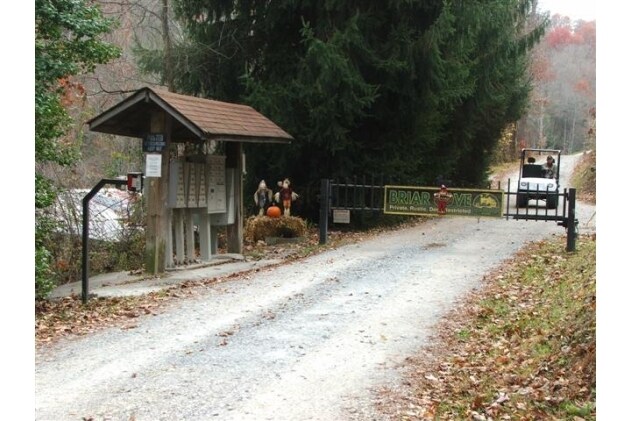
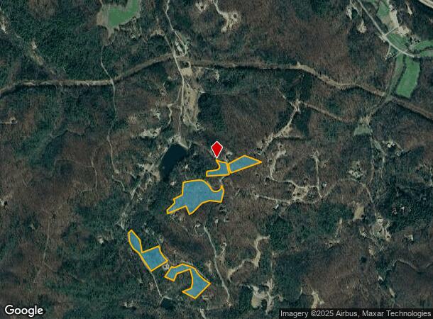
202 High Country Ln
0005-003A
Zone 5 Rural
Agriculturalland
8-1 LL300,301 DB1094-277* 20.99 ACRES
A
Fannin
13111C0210E
Georgia
2024
300
2025
20.99 AC
050500
Georgia Northeast
1,941 SF
Other Market Areas
DEMOGRAPHICS near 202 High Country Ln
1 Mile
3 Mile
5 Mile
2024 Total Population
219
2,444
6,812
2029 Population
240
2,747
7,740
Pop Growth 2024-2029
+ 9.59%
+ 12.40%
+ 13.62%
Average Age
52
49
49
2024 Total Households
103
1,049
2,939
HH Growth 2024-2029
+ 8.74%
+ 12.30%
+ 13.68%
Median Household Inc
$75,893
$56,148
$56,707
Avg Household Size
2.10
2.20
2.30
2024 Avg HH Vehicles
2.00
2.00
2.00
Median Home Value
$352,941
$264,999
$269,237
Median Year Built
2003
1998
1999
Nearby Places
Map Layers
Map Styles
 Street
 Aerial
- Restaurants
- Banks
- Shops
- Fitness
- Groceries
Nearby Properties
Address
Land Use
TOTAL SIZE
Lot Size
Zoning
Address
Land Use
TOTAL SIZE
Lot Size
Zoning
91,800 SF
6.37 AC
RESIDENTIA
Address
Land Use
TOTAL SIZE
Lot Size
Zoning
2,564 SF
4.42 AC
001
Address
Land Use
TOTAL SIZE
Lot Size
Zoning
15,000 SF
6.62 AC
001
Address
Land Use
TOTAL SIZE
Lot Size
Zoning
8,304 SF
46.11 AC
RURAL
Address
Land Use
TOTAL SIZE
Lot Size
Zoning
19,200 SF
9.01 AC
RESIDENTIA
Address
Land Use
TOTAL SIZE
Lot Size
Zoning
6,000 SF
6.63 AC
Address
Land Use
TOTAL SIZE
Lot Size
Zoning
141.27 AC
RURAL
Address
Land Use
TOTAL SIZE
Lot Size
Zoning
2,830 SF
3.11 AC
RESIDENTIA
Address
Land Use
TOTAL SIZE
Lot Size
Zoning
1,600 SF
17.18 AC
RURAL
Address
Land Use
TOTAL SIZE
Lot Size
Zoning
2,184 SF
0.90 AC
RESIDENTIA
Address
Land Use
TOTAL SIZE
Lot Size
Zoning
6,000 SF
2 AC
Address
Land Use
TOTAL SIZE
Lot Size
Zoning
2,292 SF
129.17 AC
RURAL
Address
Land Use
TOTAL SIZE
Lot Size
Zoning
226.22 AC
RURAL
Address
Land Use
TOTAL SIZE
Lot Size
Zoning
4,016 SF
1.43 AC
RESIDENTIA
Address
Land Use
TOTAL SIZE
Lot Size
Zoning
25.19 AC
001
Address
Land Use
TOTAL SIZE
Lot Size
Zoning
82.52 AC
001
Address
Land Use
TOTAL SIZE
Lot Size
Zoning
9,075 SF
1.17 AC
Address
Land Use
TOTAL SIZE
Lot Size
Zoning
2,009 SF
1.12 AC
RESIDENTIA
Address
Land Use
TOTAL SIZE
Lot Size
Zoning
1,276 SF
92.11 AC
RESIDENTIA
Address
Land Use
TOTAL SIZE
Lot Size
Zoning
1,424 SF
200 AC
RURAL
Address
Land Use
TOTAL SIZE
Lot Size
Zoning
67.18 AC
RESIDENTIA
Address
Land Use
TOTAL SIZE
Lot Size
Zoning
68.59 AC
RURAL
Address
Land Use
TOTAL SIZE
Lot Size
Zoning
96.62 AC
RURAL
Address
Land Use
TOTAL SIZE
Lot Size
Zoning
51.66 AC
RESIDENTIA
Address
Land Use
TOTAL SIZE
Lot Size
Zoning
1,092 SF
29.04 AC
RURAL
Address
Land Use
TOTAL SIZE
Lot Size
Zoning
131.28 AC
RURAL
Address
Land Use
TOTAL SIZE
Lot Size
Zoning
86.90 AC
RESIDENTIA
Address
Land Use
TOTAL SIZE
Lot Size
Zoning
81.90 AC
RURAL
Address
Land Use
TOTAL SIZE
Lot Size
Zoning
7,296 SF
5 AC
RESIDENTIA
The World's #1 Commercial Real Estate Marketplace
Connect with us
© 2025 CoStar Group
The information above has been obtained from sources believed reliable. While we do not doubt its accuracy we have not verified it and make no guarantee, warranty or representation about it. It is your responsibility to independently confirm its accuracy and completeness. Any projections, opinions, assumptions, or estimates used are for example only and do not represent the current or future performance of the property. The value of this transaction to you depends on tax and other factors which should be evaluated by your tax, financial, and legal advisors. You and your advisors should conduct a careful, independent investigation of the property to determine to your satisfaction the suitability of the property for your needs.