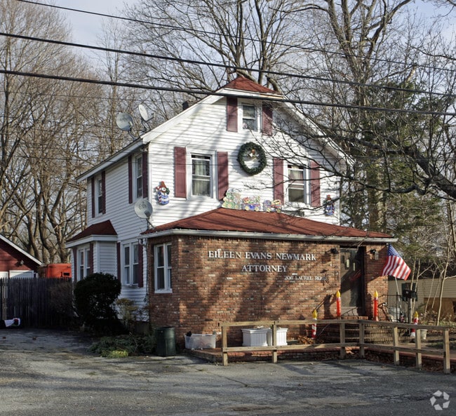
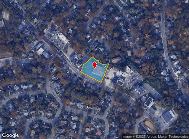
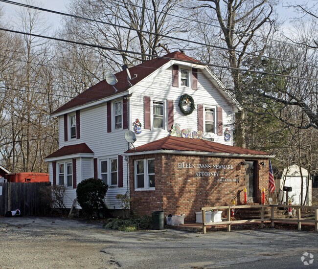
Property Record
202 Laurel Rd, East Northport, NY 11731
NEARBY LISTINGS FOR SALE OR LEASE
Property Detail
202 Laurel Rd
0400-058-00-02-00-077-006
Suffolk
Policefirecivildefense
New York
X
77
36103C0339H
0.85 AC
0
Western Suffolk
2024
Long Island (New York)
111601
Nassau County-Suffolk County, NY
DEMOGRAPHICS near 202 Laurel Rd
1 Mile
3 Mile
5 Mile
2024 Total Population
11,053
60,847
146,005
2029 Population
10,760
59,692
143,471
Pop Growth 2024-2029
(2.65%)
(1.90%)
(1.74%)
Average Age
42
43
43
2024 Total Households
3,955
21,147
49,678
HH Growth 2024-2029
(2.93%)
(2.18%)
(2.02%)
Median Household Inc
$133,352
$153,379
$148,757
Avg Household Size
2.70
2.80
2.80
2024 Avg HH Vehicles
2.00
2.00
2.00
Median Home Value
$651,802
$706,602
$685,003
Median Year Built
1957
1960
1962
Nearby Places
- Restaurants
- Banks
- Shops
- Fitness
- Groceries
PUBLIC TRANSPORTATION
COMMUTER RAIL
Northport Station (Port Jefferson Branch - Long Island Rail Road)
DRIVE
WALK
Distance
Northport Station (Port Jefferson Branch - Long Island Rail Road)
2 min
12 min
0.6 mi
Greenlawn Station (Port Jefferson Branch - Long Island Rail Road)
DRIVE
WALK
Distance
Greenlawn Station (Port Jefferson Branch - Long Island Rail Road)
7 min
3.4 mi
AIRPORT
Long Island MacArthur
DRIVE
WALK
Distance
Long Island MacArthur
28 min
16.3 mi
John F Kennedy International
DRIVE
WALK
Distance
John F Kennedy International
58 min
39.4 mi
Freight Ports
Port of New Haven
DRIVE
WALK
Distance
Port of New Haven
141 min
57.6 mi
Nearby Properties
Address
Land Use
TOTAL SIZE
Lot Size
Zoning
Address
Land Use
TOTAL SIZE
Lot Size
Zoning
243.60 AC
I6
Address
Land Use
TOTAL SIZE
Lot Size
Zoning
26.60 AC
Address
Land Use
TOTAL SIZE
Lot Size
Zoning
0.41 AC
VILLA
Address
Land Use
TOTAL SIZE
Lot Size
Zoning
0.80 AC
CR60
Address
Land Use
TOTAL SIZE
Lot Size
Zoning
300 AC
R80
Address
Land Use
TOTAL SIZE
Lot Size
Zoning
0.49 AC
VILLA
Address
Land Use
TOTAL SIZE
Lot Size
Zoning
2,764 SF
0.24 AC
HC
Address
Land Use
TOTAL SIZE
Lot Size
Zoning
1 AC
VILLA
Address
Land Use
TOTAL SIZE
Lot Size
Zoning
406.60 AC
R40
Address
Land Use
TOTAL SIZE
Lot Size
Zoning
43.30 AC
R40
Address
Land Use
TOTAL SIZE
Lot Size
Zoning
1,416 SF
0.86 AC
A
Address
Land Use
TOTAL SIZE
Lot Size
Zoning
0.57 AC
R20
Address
Land Use
TOTAL SIZE
Lot Size
Zoning
8.80 AC
R10
Address
Land Use
TOTAL SIZE
Lot Size
Zoning
6.50 AC
R40
Address
Land Use
TOTAL SIZE
Lot Size
Zoning
0.59 AC
R20
Address
Land Use
TOTAL SIZE
Lot Size
Zoning
42.20 AC
I1
Address
Land Use
TOTAL SIZE
Lot Size
Zoning
0.50 AC
R20
Address
Land Use
TOTAL SIZE
Lot Size
Zoning
30.80 AC
R40
Address
Land Use
TOTAL SIZE
Lot Size
Zoning
44.90 AC
R40
Address
Land Use
TOTAL SIZE
Lot Size
Zoning
10.14 AC
RRM
Address
Land Use
TOTAL SIZE
Lot Size
Zoning
0.46 AC
R20
Address
Land Use
TOTAL SIZE
Lot Size
Zoning
12 AC
RRM
Address
Land Use
TOTAL SIZE
Lot Size
Zoning
2.16 AC
CR200
Address
Land Use
TOTAL SIZE
Lot Size
Zoning
2.07 AC
CR200
Address
Land Use
TOTAL SIZE
Lot Size
Zoning
14.83 AC
R85
Address
Land Use
TOTAL SIZE
Lot Size
Zoning
16.54 AC
Address
Land Use
TOTAL SIZE
Lot Size
Zoning
1.94 AC
CR200
Address
Land Use
TOTAL SIZE
Lot Size
Zoning
15.80 AC
Address
Land Use
TOTAL SIZE
Lot Size
Zoning
35.04 AC
R40
Address
Land Use
TOTAL SIZE
Lot Size
Zoning
44.60 AC
R40
The World's #1 Commercial Real Estate Marketplace
Connect with us
© 2025 CoStar Group
The information above has been obtained from sources believed reliable. While we do not doubt its accuracy we have not verified it and make no guarantee, warranty or representation about it. It is your responsibility to independently confirm its accuracy and completeness. Any projections, opinions, assumptions, or estimates used are for example only and do not represent the current or future performance of the property. The value of this transaction to you depends on tax and other factors which should be evaluated by your tax, financial, and legal advisors. You and your advisors should conduct a careful, independent investigation of the property to determine to your satisfaction the suitability of the property for your needs.