No Photo
Property Record
202 N Dale Mabry Hwy, Tampa, FL 33609
NEARBY LISTINGS FOR SALE OR LEASE
Property Detail
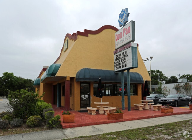
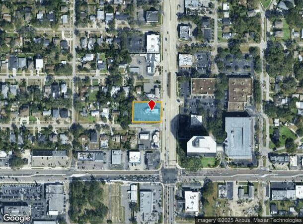
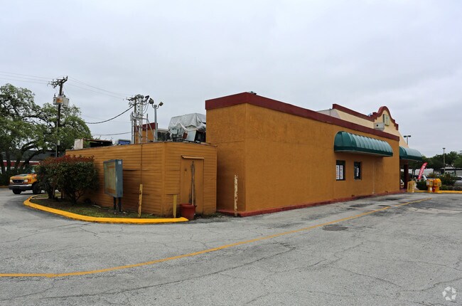
202 N Dale Mabry Hwy
Tampa-St. Petersburg-Clearwater, FL
North Bon Air
A-21-29-18-3LH-000000-00117.0
NORTH BON AIR E 45 FT OF LOT 117 LOT 118 119 AND LOT 120 LESS HWY AND ADDL RW
Restaurantbuilding
Hillsborough
X
Florida
12057C0334J
117
2024
0.62 AC
2024
Westshore
004700
Tampa/St Petersburg
3,499 SF
DEMOGRAPHICS near 202 N Dale Mabry Hwy
1 Mile
3 Mile
5 Mile
2024 Total Population
15,051
105,908
250,917
2029 Population
16,658
116,093
274,585
Pop Growth 2024-2029
+ 10.68%
+ 9.62%
+ 9.43%
Average Age
40
39
39
2024 Total Households
6,912
45,861
110,442
HH Growth 2024-2029
+ 10.92%
+ 10.13%
+ 9.83%
Median Household Inc
$73,019
$85,645
$69,865
Avg Household Size
2.10
2.10
2.20
2024 Avg HH Vehicles
2.00
2.00
2.00
Median Home Value
$440,595
$488,185
$406,737
Median Year Built
1982
1982
1981
Nearby Places
Map Layers
Map Styles
 Street
 Aerial
- Restaurants
- Banks
- Shops
- Fitness
- Groceries
PUBLIC TRANSPORTATION
COMMUTER RAIL
DRIVE
WALK
Distance
9 min
4.6 mi
AIRPORT
Tampa International
DRIVE
WALK
Distance
Tampa International
9 min
5.1 mi
St Pete-Clearwater International
DRIVE
WALK
Distance
St Pete-Clearwater International
21 min
13.5 mi
Freight Ports
Port of Tampa Bay
DRIVE
WALK
Distance
Port of Tampa Bay
16 min
7.6 mi
SALE & LEASE HISTORY
LISTING DATE
SALE/LEASE

Mar 10, 2020
For Lease
Mar 10, 2020
For Lease
Jun 19, 2020
For Sale
Nearby Properties
Address
Land Use
TOTAL SIZE
Lot Size
Zoning
Address
Land Use
TOTAL SIZE
Lot Size
Zoning
2,308,592 SF
1,915.65 AC
M-AP-1
Address
Land Use
TOTAL SIZE
Lot Size
Zoning
2,700,512 SF
87.53 AC
PD-A
Address
Land Use
TOTAL SIZE
Lot Size
Zoning
927,709 SF
74.68 AC
PD-A
Address
Land Use
TOTAL SIZE
Lot Size
Zoning
1,873,235 SF
20.98 AC
PD
Address
Land Use
TOTAL SIZE
Lot Size
Zoning
1,278,217 SF
0.02 AC
CI
Address
Land Use
TOTAL SIZE
Lot Size
Zoning
115,537 SF
0.95 AC
CBD-2
Address
Land Use
TOTAL SIZE
Lot Size
Zoning
810,926 SF
1.05 AC
CBD-2
Address
Land Use
TOTAL SIZE
Lot Size
Zoning
1,083,666 SF
26.73 AC
OP-1
Address
Land Use
TOTAL SIZE
Lot Size
Zoning
499,692 SF
4.40 AC
PD
Address
Land Use
TOTAL SIZE
Lot Size
Zoning
887,915 SF
0.76 AC
CBD-2
Address
Land Use
TOTAL SIZE
Lot Size
Zoning
142,972 SF
21.79 AC
M-AP-1
Address
Land Use
TOTAL SIZE
Lot Size
Zoning
625,694 SF
1 AC
CBD-2
Address
Land Use
TOTAL SIZE
Lot Size
Zoning
439,220 SF
1 AC
CBD-1
Address
Land Use
TOTAL SIZE
Lot Size
Zoning
124,768 SF
13.26 AC
CBD-2
Address
Land Use
TOTAL SIZE
Lot Size
Zoning
449,135 SF
16.72 AC
PD
Address
Land Use
TOTAL SIZE
Lot Size
Zoning
428,819 SF
5.24 AC
CBD-1
Address
Land Use
TOTAL SIZE
Lot Size
Zoning
532,661 SF
76.96 AC
CI
Address
Land Use
TOTAL SIZE
Lot Size
Zoning
476,090 SF
2.02 AC
CBD-1
Address
Land Use
TOTAL SIZE
Lot Size
Zoning
647,052 SF
3.85 AC
PD
Address
Land Use
TOTAL SIZE
Lot Size
Zoning
350,039 SF
2.40 AC
PD
Address
Land Use
TOTAL SIZE
Lot Size
Zoning
465,058 SF
0.99 AC
CBD-1
Address
Land Use
TOTAL SIZE
Lot Size
Zoning
399,394 SF
4.14 AC
PD-A
Address
Land Use
TOTAL SIZE
Lot Size
Zoning
601,434 SF
4.09 AC
CBD-2
Address
Land Use
TOTAL SIZE
Lot Size
Zoning
429,656 SF
6.97 AC
PD
Address
Land Use
TOTAL SIZE
Lot Size
Zoning
401,486 SF
13.22 AC
PD-A
Address
Land Use
TOTAL SIZE
Lot Size
Zoning
407,458 SF
1.48 AC
CBD-2
Address
Land Use
TOTAL SIZE
Lot Size
Zoning
387,234 SF
5.31 AC
OP-1
Address
Land Use
TOTAL SIZE
Lot Size
Zoning
777,707 SF
1 AC
CBD-2
Address
Land Use
TOTAL SIZE
Lot Size
Zoning
352,071 SF
21.42 AC
M-AP-2
Address
Land Use
TOTAL SIZE
Lot Size
Zoning
598,902 SF
36.33 AC
PD
The World's #1 Commercial Real Estate Marketplace
Connect with us
© 2025 CoStar Group
The information above has been obtained from sources believed reliable. While we do not doubt its accuracy we have not verified it and make no guarantee, warranty or representation about it. It is your responsibility to independently confirm its accuracy and completeness. Any projections, opinions, assumptions, or estimates used are for example only and do not represent the current or future performance of the property. The value of this transaction to you depends on tax and other factors which should be evaluated by your tax, financial, and legal advisors. You and your advisors should conduct a careful, independent investigation of the property to determine to your satisfaction the suitability of the property for your needs.