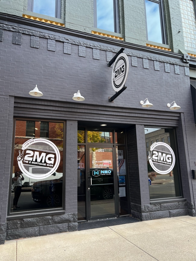
Property Record
202 N Main St, Kokomo, IN 46901
Current Lease Availabilities
NEARBY LISTINGS FOR SALE OR LEASE
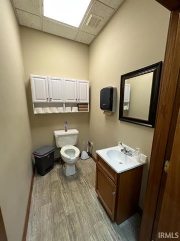
Property Detail
202 N Main St
Kokomo, IN
Original Plat
34-03-36-240-007.000-002
ORIGINAL PLAT MID 1/3 S2 LOTS 33 & 36
Officebuilding
Howard
X
Indiana
18067C0207C
33,36
2023
0.07 AC
2024
Lafayette/Kokomo
000200
Other Market Areas
8,184 SF
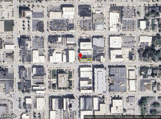
DEMOGRAPHICS near 202 N Main St
1 Mile
3 Mile
5 Mile
2024 Total Population
15,268
48,129
67,234
2029 Population
16,069
48,635
67,386
Pop Growth 2024-2029
+ 5.25%
+ 1.05%
+ 0.23%
Average Age
39
41
42
2024 Total Households
6,678
21,291
29,265
HH Growth 2024-2029
+ 5.53%
+ 0.96%
+ 0.19%
Median Household Inc
$41,001
$45,875
$52,545
Avg Household Size
2.20
2.20
2.20
2024 Avg HH Vehicles
2.00
2.00
2.00
Median Home Value
$79,562
$103,370
$131,819
Median Year Built
1949
1961
1966
Nearby Places
Map Layers
Map Styles
 Street
 Aerial
- Restaurants
- Banks
- Shops
- Fitness
- Groceries
Nearby Properties
Address
Land Use
TOTAL SIZE
Lot Size
Zoning
Address
Land Use
TOTAL SIZE
Lot Size
Zoning
1,415,366 SF
0.03 AC
Address
Land Use
TOTAL SIZE
Lot Size
Zoning
11,490,970 SF
0.02 AC
Address
Land Use
TOTAL SIZE
Lot Size
Zoning
3,633,252 SF
0.02 AC
Address
Land Use
TOTAL SIZE
Lot Size
Zoning
377,850 SF
87 SF
Address
Land Use
TOTAL SIZE
Lot Size
Zoning
399,910 SF
131 SF
Address
Land Use
TOTAL SIZE
Lot Size
Zoning
417,744 SF
174 SF
Address
Land Use
TOTAL SIZE
Lot Size
Zoning
414,424 SF
87 SF
Address
Land Use
TOTAL SIZE
Lot Size
Zoning
2,639,746 SF
0.02 AC
Address
Land Use
TOTAL SIZE
Lot Size
Zoning
165,418 SF
1.97 AC
Address
Land Use
TOTAL SIZE
Lot Size
Zoning
212,590 SF
87 SF
Address
Land Use
TOTAL SIZE
Lot Size
Zoning
74,096 SF
1.18 AC
Address
Land Use
TOTAL SIZE
Lot Size
Zoning
227,171 SF
87 SF
Address
Land Use
TOTAL SIZE
Lot Size
Zoning
64,326 SF
16.34 AC
Address
Land Use
TOTAL SIZE
Lot Size
Zoning
104,910 SF
44 SF
Address
Land Use
TOTAL SIZE
Lot Size
Zoning
240,144 SF
131 SF
Address
Land Use
TOTAL SIZE
Lot Size
Zoning
188,016 SF
44 SF
Address
Land Use
TOTAL SIZE
Lot Size
Zoning
116,821 SF
44 SF
Address
Land Use
TOTAL SIZE
Lot Size
Zoning
101,088 SF
44 SF
Address
Land Use
TOTAL SIZE
Lot Size
Zoning
0.01 AC
Address
Land Use
TOTAL SIZE
Lot Size
Zoning
188,114 SF
87 SF
Address
Land Use
TOTAL SIZE
Lot Size
Zoning
119,966 SF
44 SF
Address
Land Use
TOTAL SIZE
Lot Size
Zoning
428,684 SF
0.01 AC
Address
Land Use
TOTAL SIZE
Lot Size
Zoning
72,476 SF
3.87 AC
Address
Land Use
TOTAL SIZE
Lot Size
Zoning
109,429 SF
44 SF
Address
Land Use
TOTAL SIZE
Lot Size
Zoning
66,400 SF
44 SF
Address
Land Use
TOTAL SIZE
Lot Size
Zoning
158,656 SF
44 SF
Address
Land Use
TOTAL SIZE
Lot Size
Zoning
89,717 SF
87 SF
Address
Land Use
TOTAL SIZE
Lot Size
Zoning
4,976 SF
131 SF
Address
Land Use
TOTAL SIZE
Lot Size
Zoning
133,817 SF
87 SF
Address
Land Use
TOTAL SIZE
Lot Size
Zoning
239,259 SF
87 SF
The World's #1 Commercial Real Estate Marketplace
Connect with us
© 2025 CoStar Group
The information above has been obtained from sources believed reliable. While we do not doubt its accuracy we have not verified it and make no guarantee, warranty or representation about it. It is your responsibility to independently confirm its accuracy and completeness. Any projections, opinions, assumptions, or estimates used are for example only and do not represent the current or future performance of the property. The value of this transaction to you depends on tax and other factors which should be evaluated by your tax, financial, and legal advisors. You and your advisors should conduct a careful, independent investigation of the property to determine to your satisfaction the suitability of the property for your needs.