Property Record
202 Pearson Ln, Azle, TX 76020

Save to a Folder
{{folder.Name}}
{{folder.ListingIds.length}} Properties
{{folder.ListingIds.length}} Property
Create a New Folder
Property Detail
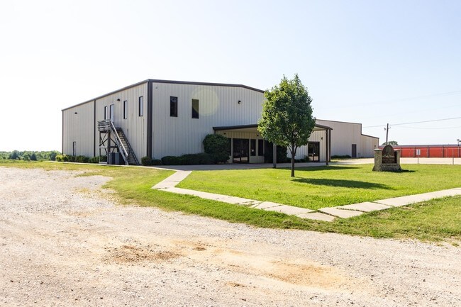
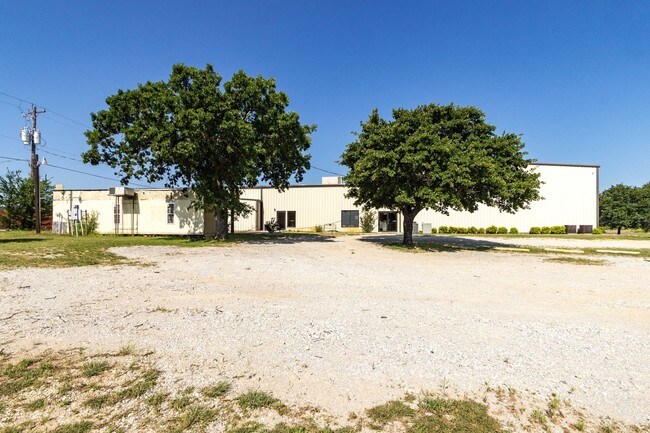
202 Pearson Ln
R000050889
ACRES: 1.483 ABST: 1155, TR:, BLK:, SURV: G. W. ROBBINS
Taxexempt
Parker
B and X Area of moderate flood hazard, usually the area between the limits of the 100-year and 500-year floods.
Texas
0
1.48 AC
2025
Parker County
140412
Dallas/Ft Worth
7,319 SF
Dallas-Fort Worth-Arlington, TX
NEARBY LISTINGS FOR SALE OR LEASE
DEMOGRAPHICS near 202 Pearson Ln
1 mile
3 mile
5 mile
2025 Total Population
1,391
18,573
45,329
2030 Population
1,628
21,141
51,087
Pop Growth 2025-2030
+ 17.04%
+ 13.83%
+ 12.70%
Average Age
40
40
41
2025 Total Households
504
6,776
16,599
HH Growth 2025-2030
+ 16.27%
+ 13.21%
+ 12.21%
Median Household Inc
$85,845
$84,300
$87,056
Avg Household Size
2.60
2.70
2.70
2025 Avg HH Vehicles
2.00
2.00
2.00
Median Home Value
$320,454
$298,379
$327,589
Median Year Built
1994
1994
1995
Nearby Places
Map Layers
Map Styles
 Street
 Aerial
Layers
 Traffic
 Biking
Places
Listings with unknown addresses are not visible on the map
- Restaurants
- Banks
- Shops
- Fitness
- Groceries
PUBLIC TRANSPORTATION
AIRPORT
Dallas-Fort Worth International
Drive
Walk
Distance
Dallas-Fort Worth International
52 min
40.6 mi
SALE & LEASE HISTORY
LISTING DATE
SALE/LEASE

Sep 24, 2016
For Sale
Jan 05, 2017
For Sale
Nearby Properties
Address
Land Use
TOTAL SIZE
Lot Size
Zoning
Address
Land Use
TOTAL SIZE
Lot Size
Zoning
208,984 SF
14.42 AC
Address
Land Use
TOTAL SIZE
Lot Size
Zoning
262,793 SF
67.85 AC
Address
Land Use
TOTAL SIZE
Lot Size
Zoning
185,807 SF
14.03 AC
Address
Land Use
TOTAL SIZE
Lot Size
Zoning
28,901 SF
14.03 AC
Address
Land Use
TOTAL SIZE
Lot Size
Zoning
62,068 SF
18.93 AC
Address
Land Use
TOTAL SIZE
Lot Size
Zoning
119.88 AC
Address
Land Use
TOTAL SIZE
Lot Size
Zoning
36,452 SF
10 AC
Address
Land Use
TOTAL SIZE
Lot Size
Zoning
105,385 SF
20 AC
Address
Land Use
TOTAL SIZE
Lot Size
Zoning
50,103 SF
11.48 AC
Address
Land Use
TOTAL SIZE
Lot Size
Zoning
32,334 SF
3.52 AC
Address
Land Use
TOTAL SIZE
Lot Size
Zoning
69,227 SF
19.02 AC
Address
Land Use
TOTAL SIZE
Lot Size
Zoning
62,538 SF
9.19 AC
Address
Land Use
TOTAL SIZE
Lot Size
Zoning
21,141 SF
4.14 AC
Address
Land Use
TOTAL SIZE
Lot Size
Zoning
71,740 SF
1.75 AC
Address
Land Use
TOTAL SIZE
Lot Size
Zoning
42,008 SF
4.13 AC
Address
Land Use
TOTAL SIZE
Lot Size
Zoning
56,296 SF
4.83 AC
Address
Land Use
TOTAL SIZE
Lot Size
Zoning
59.11 AC
Address
Land Use
TOTAL SIZE
Lot Size
Zoning
42,206 SF
2.67 AC
Address
Land Use
TOTAL SIZE
Lot Size
Zoning
18,200 SF
4.39 AC
Address
Land Use
TOTAL SIZE
Lot Size
Zoning
36,760 SF
2.79 AC
Address
Land Use
TOTAL SIZE
Lot Size
Zoning
15,520 SF
5.46 AC
Address
Land Use
TOTAL SIZE
Lot Size
Zoning
56,317 SF
4.10 AC
Address
Land Use
TOTAL SIZE
Lot Size
Zoning
56.08 AC
Address
Land Use
TOTAL SIZE
Lot Size
Zoning
30,824 SF
2.70 AC
Address
Land Use
TOTAL SIZE
Lot Size
Zoning
54,292 SF
6.26 AC
Address
Land Use
TOTAL SIZE
Lot Size
Zoning
27,800 SF
9 AC
Address
Land Use
TOTAL SIZE
Lot Size
Zoning
25,232 SF
1.84 AC
Address
Land Use
TOTAL SIZE
Lot Size
Zoning
28,540 SF
2.22 AC
Address
Land Use
TOTAL SIZE
Lot Size
Zoning
14,981 SF
1.67 AC
Address
Land Use
TOTAL SIZE
Lot Size
Zoning
13,816 SF
1.55 AC
The World's #1 Commercial Real Estate Marketplace
Connect with us
© 2026 CoStar Group
The information above has been obtained from sources believed reliable. While we do not doubt its accuracy we have not verified it and make no guarantee, warranty or representation about it. It is your responsibility to independently confirm its accuracy and completeness. Any projections, opinions, assumptions, or estimates used are for example only and do not represent the current or future performance of the property. The value of this transaction to you depends on tax and other factors which should be evaluated by your tax, financial, and legal advisors. You and your advisors should conduct a careful, independent investigation of the property to determine to your satisfaction the suitability of the property for your needs.