Property Record
S Bennetts Bridge Rd, Greer, SC 29651
NEARBY LISTINGS FOR SALE OR LEASE
Property Detail
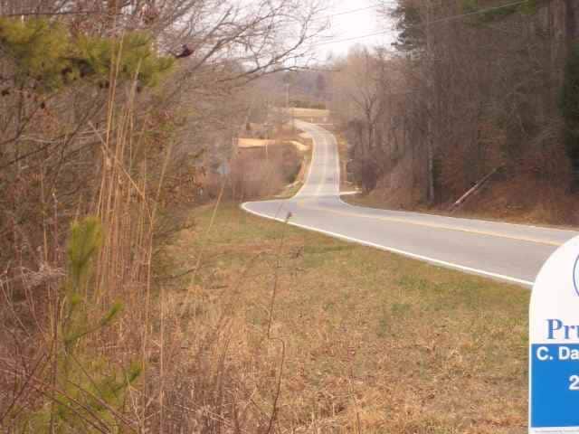
S Bennetts Bridge Rd
Greenville-Anderson-Mauldin, SC
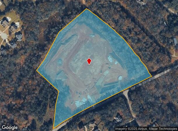
Survey For Blackstream Development
0549.01-01-012.00
Greenville
Sfr
South Carolina
AE
20.06 AC
45045C0429E
Mauldin/Fountain
4,377 SF
Greenville/Spartanburg
DEMOGRAPHICS near S Bennetts Bridge Rd
1 Mile
3 Mile
5 Mile
2024 Total Population
1,632
30,721
73,277
2029 Population
1,816
34,053
81,198
Pop Growth 2024-2029
+ 11.27%
+ 10.85%
+ 10.81%
Average Age
38
38
40
2024 Total Households
537
10,305
26,724
HH Growth 2024-2029
+ 11.36%
+ 10.99%
+ 10.95%
Median Household Inc
$129,687
$116,768
$104,181
Avg Household Size
3.00
2.90
2.70
2024 Avg HH Vehicles
2.00
2.00
2.00
Median Home Value
$350,000
$310,107
$300,070
Median Year Built
2006
2004
2001
Nearby Places
Map Layers
Map Styles
 Street
 Aerial
- Restaurants
- Banks
- Shops
- Fitness
- Groceries
PUBLIC TRANSPORTATION
AIRPORT
Greenville Spartanburg International
DRIVE
WALK
Distance
Greenville Spartanburg International
16 min
7.0 mi
Freight Ports
North Charleston Terminal
DRIVE
WALK
Distance
North Charleston Terminal
229 min
200.6 mi
Nearby Properties
Address
Land Use
TOTAL SIZE
Lot Size
Zoning
Address
Land Use
TOTAL SIZE
Lot Size
Zoning
301 AC
RS
Address
Land Use
TOTAL SIZE
Lot Size
Zoning
1,345 SF
115.58 AC
Address
Land Use
TOTAL SIZE
Lot Size
Zoning
2.97 AC
S1
Address
Land Use
TOTAL SIZE
Lot Size
Zoning
26.29 AC
RS
Address
Land Use
TOTAL SIZE
Lot Size
Zoning
3,507 SF
8.78 AC
I1
Address
Land Use
TOTAL SIZE
Lot Size
Zoning
49.81 AC
Address
Land Use
TOTAL SIZE
Lot Size
Zoning
34.33 AC
RS
Address
Land Use
TOTAL SIZE
Lot Size
Zoning
28.30 AC
RS
Address
Land Use
TOTAL SIZE
Lot Size
Zoning
25.94 AC
RS
Address
Land Use
TOTAL SIZE
Lot Size
Zoning
1.70 AC
I1
Address
Land Use
TOTAL SIZE
Lot Size
Zoning
14,306 SF
3.64 AC
RS
Address
Land Use
TOTAL SIZE
Lot Size
Zoning
3.09 AC
RS
Address
Land Use
TOTAL SIZE
Lot Size
Zoning
9.69 AC
C2
Address
Land Use
TOTAL SIZE
Lot Size
Zoning
1,324 SF
9.80 AC
RS
Address
Land Use
TOTAL SIZE
Lot Size
Zoning
7.89 AC
C1
Address
Land Use
TOTAL SIZE
Lot Size
Zoning
1,846 SF
8.88 AC
C1
Address
Land Use
TOTAL SIZE
Lot Size
Zoning
11 AC
RS
Address
Land Use
TOTAL SIZE
Lot Size
Zoning
1,602 SF
2.53 AC
POD
Address
Land Use
TOTAL SIZE
Lot Size
Zoning
6,874 SF
1.79 AC
Address
Land Use
TOTAL SIZE
Lot Size
Zoning
3.40 AC
RS
Address
Land Use
TOTAL SIZE
Lot Size
Zoning
4,769 SF
0.60 AC
Address
Land Use
TOTAL SIZE
Lot Size
Zoning
4,060 SF
0.60 AC
Address
Land Use
TOTAL SIZE
Lot Size
Zoning
7.53 AC
RS
Address
Land Use
TOTAL SIZE
Lot Size
Zoning
4,164 SF
0.22 AC
Address
Land Use
TOTAL SIZE
Lot Size
Zoning
6,622 SF
1.44 AC
Address
Land Use
TOTAL SIZE
Lot Size
Zoning
6.74 AC
I1
Address
Land Use
TOTAL SIZE
Lot Size
Zoning
1,534 SF
6.18 AC
C1
Address
Land Use
TOTAL SIZE
Lot Size
Zoning
4,304 SF
0.65 AC
Address
Land Use
TOTAL SIZE
Lot Size
Zoning
2,672 SF
99.03 AC
Address
Land Use
TOTAL SIZE
Lot Size
Zoning
18.76 AC
RS
The World's #1 Commercial Real Estate Marketplace
Connect with us
© 2026 CoStar Group
The information above has been obtained from sources believed reliable. While we do not doubt its accuracy we have not verified it and make no guarantee, warranty or representation about it. It is your responsibility to independently confirm its accuracy and completeness. Any projections, opinions, assumptions, or estimates used are for example only and do not represent the current or future performance of the property. The value of this transaction to you depends on tax and other factors which should be evaluated by your tax, financial, and legal advisors. You and your advisors should conduct a careful, independent investigation of the property to determine to your satisfaction the suitability of the property for your needs.