Property Record
202 S Sylvania Ave, Sturtevant, WI 53177
NEARBY LISTINGS FOR SALE OR LEASE
-
-
View all Sturtevant listings for sale on LoopNet.com
Property Detail
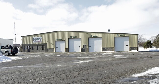
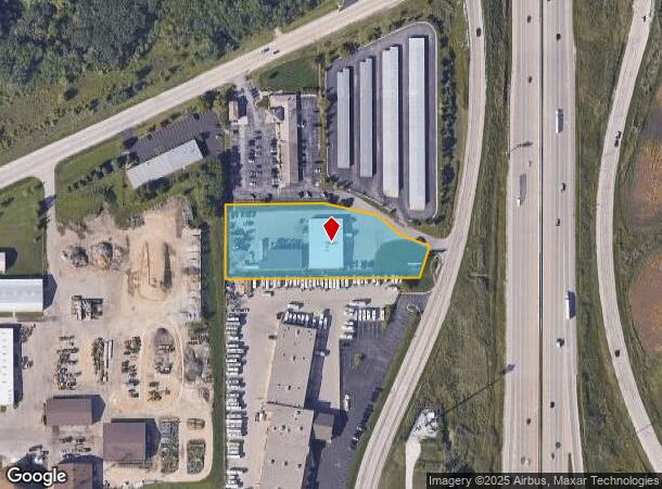
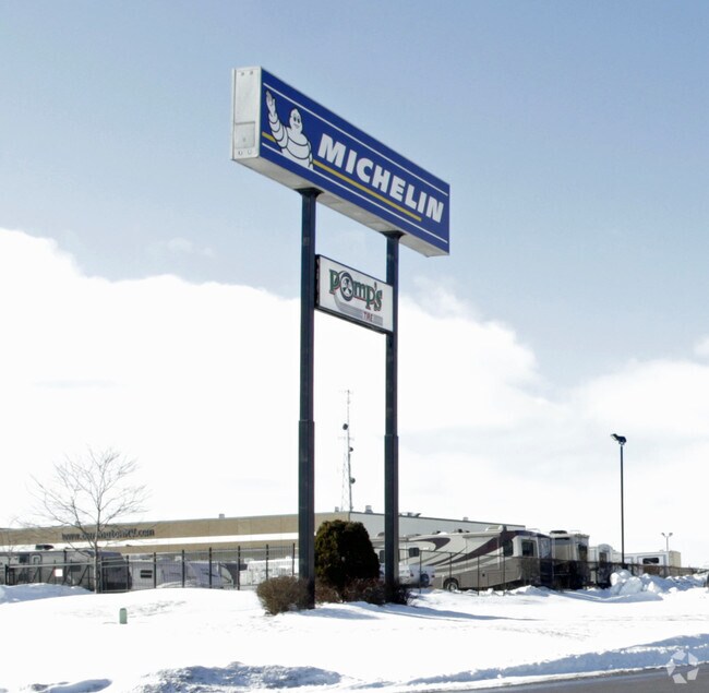
202 S Sylvania Ave
194-032112024010
PT SE1/4 COM S1/4 COR N820 NE2189 S454 TO POB SE150 SE75 SE122 TO W LN FRONTAGE RD SLY68 S558 N196E260 TO POB SUB TO EASMNT E
Commercialnec
Racine
X
Wisconsin
55101C0202D
2.12 AC
2024
Racine East
2024
Milwaukee/Madison
001703
Racine, WI
DEMOGRAPHICS near 202 S Sylvania Ave
1 Mile
3 Mile
5 Mile
2024 Total Population
361
3,965
24,367
2029 Population
352
3,935
24,139
Pop Growth 2024-2029
(2.49%)
(0.76%)
(0.94%)
Average Age
42
44
43
2024 Total Households
129
1,358
9,438
HH Growth 2024-2029
(3.10%)
(0.15%)
(0.73%)
Median Household Inc
$119,230
$91,975
$86,795
Avg Household Size
2.80
2.40
2.40
2024 Avg HH Vehicles
3.00
2.00
2.00
Median Home Value
$366,666
$306,896
$277,022
Median Year Built
1968
1977
1984
Nearby Places
Map Layers
Map Styles
 Street
 Aerial
- Restaurants
- Banks
- Shops
- Fitness
- Groceries
PUBLIC TRANSPORTATION
COMMUTER RAIL
Sturtevant Amtrak Station (Hiawatha Service - Amtrak)
DRIVE
WALK
Distance
Sturtevant Amtrak Station (Hiawatha Service - Amtrak)
6 min
3.1 mi
AIRPORT
General Mitchell International
DRIVE
WALK
Distance
General Mitchell International
23 min
17.8 mi
Freight Ports
Port Milwaukee
DRIVE
WALK
Distance
Port Milwaukee
28 min
21.7 mi
Nearby Properties
Address
Land Use
TOTAL SIZE
Lot Size
Zoning
Address
Land Use
TOTAL SIZE
Lot Size
Zoning
Address
Land Use
TOTAL SIZE
Lot Size
Zoning
241.29 AC
Address
Land Use
TOTAL SIZE
Lot Size
Zoning
Address
Land Use
TOTAL SIZE
Lot Size
Zoning
23.10 AC
Address
Land Use
TOTAL SIZE
Lot Size
Zoning
37.55 AC
Address
Land Use
TOTAL SIZE
Lot Size
Zoning
26.79 AC
Address
Land Use
TOTAL SIZE
Lot Size
Zoning
Address
Land Use
TOTAL SIZE
Lot Size
Zoning
Address
Land Use
TOTAL SIZE
Lot Size
Zoning
23.21 AC
Address
Land Use
TOTAL SIZE
Lot Size
Zoning
140.07 AC
Address
Land Use
TOTAL SIZE
Lot Size
Zoning
Address
Land Use
TOTAL SIZE
Lot Size
Zoning
30.45 AC
002
Address
Land Use
TOTAL SIZE
Lot Size
Zoning
13.04 AC
Address
Land Use
TOTAL SIZE
Lot Size
Zoning
18.33 AC
Address
Land Use
TOTAL SIZE
Lot Size
Zoning
10.72 AC
Address
Land Use
TOTAL SIZE
Lot Size
Zoning
20.61 AC
Address
Land Use
TOTAL SIZE
Lot Size
Zoning
5.74 AC
Address
Land Use
TOTAL SIZE
Lot Size
Zoning
Address
Land Use
TOTAL SIZE
Lot Size
Zoning
31.50 AC
Address
Land Use
TOTAL SIZE
Lot Size
Zoning
22.93 AC
Address
Land Use
TOTAL SIZE
Lot Size
Zoning
32.99 AC
002
Address
Land Use
TOTAL SIZE
Lot Size
Zoning
Address
Land Use
TOTAL SIZE
Lot Size
Zoning
Address
Land Use
TOTAL SIZE
Lot Size
Zoning
16.97 AC
Address
Land Use
TOTAL SIZE
Lot Size
Zoning
14.34 AC
Address
Land Use
TOTAL SIZE
Lot Size
Zoning
Address
Land Use
TOTAL SIZE
Lot Size
Zoning
16.91 AC
Address
Land Use
TOTAL SIZE
Lot Size
Zoning
Address
Land Use
TOTAL SIZE
Lot Size
Zoning
Address
Land Use
TOTAL SIZE
Lot Size
Zoning
The World's #1 Commercial Real Estate Marketplace
Connect with us
© 2025 CoStar Group
The information above has been obtained from sources believed reliable. While we do not doubt its accuracy we have not verified it and make no guarantee, warranty or representation about it. It is your responsibility to independently confirm its accuracy and completeness. Any projections, opinions, assumptions, or estimates used are for example only and do not represent the current or future performance of the property. The value of this transaction to you depends on tax and other factors which should be evaluated by your tax, financial, and legal advisors. You and your advisors should conduct a careful, independent investigation of the property to determine to your satisfaction the suitability of the property for your needs.