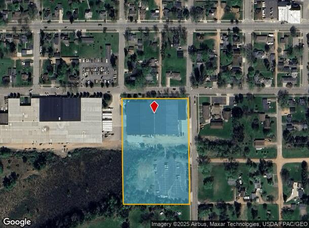
Property Record
202 S Thomas St, Merrill, WI 54452


NEARBY LISTINGS FOR SALE OR LEASE
Property Detail
202 S Thomas St
Merrill, WI
Mathews And Cotters Add'n
251-3106-151-0147
LT 1 CSM 2249 V12 P172 D0481625
Centrallyassessed
Lincoln
X
Wisconsin
55069C0536D
1
2024
4.81 AC
2024
Wisconsin North Area
960800
Other Market Areas
DEMOGRAPHICS near 202 S Thomas St
1 Mile
3 Mile
5 Mile
2024 Total Population
4,688
12,221
15,118
2029 Population
4,748
12,426
15,315
Pop Growth 2024-2029
+ 1.28%
+ 1.68%
+ 1.30%
Average Age
42
43
44
2024 Total Households
2,081
5,393
6,591
HH Growth 2024-2029
+ 1.20%
+ 1.71%
+ 1.35%
Median Household Inc
$61,265
$55,579
$58,068
Avg Household Size
2.20
2.20
2.20
2024 Avg HH Vehicles
2.00
2.00
2.00
Median Home Value
$104,700
$112,883
$130,947
Median Year Built
1976
1971
1975
Nearby Places
Map Layers
Map Styles
 Street
 Aerial
- Restaurants
- Banks
- Shops
- Fitness
- Groceries
PUBLIC TRANSPORTATION
AIRPORT
Central Wisconsin
DRIVE
WALK
Distance
Central Wisconsin
50 min
40.1 mi
Freight Ports
Port Milwaukee
DRIVE
WALK
Distance
Port Milwaukee
243 min
208.4 mi
Nearby Properties
Address
Land Use
TOTAL SIZE
Lot Size
Zoning
Address
Land Use
TOTAL SIZE
Lot Size
Zoning
19,238 SF
5.43 AC
Address
Land Use
TOTAL SIZE
Lot Size
Zoning
13,248 SF
6.05 AC
Address
Land Use
TOTAL SIZE
Lot Size
Zoning
13,248 SF
6.05 AC
Address
Land Use
TOTAL SIZE
Lot Size
Zoning
21.74 AC
Address
Land Use
TOTAL SIZE
Lot Size
Zoning
10.78 AC
Address
Land Use
TOTAL SIZE
Lot Size
Zoning
4.68 AC
Address
Land Use
TOTAL SIZE
Lot Size
Zoning
14,460 SF
5.85 AC
Address
Land Use
TOTAL SIZE
Lot Size
Zoning
14,256 SF
6.87 AC
Address
Land Use
TOTAL SIZE
Lot Size
Zoning
14,356 SF
5.55 AC
Address
Land Use
TOTAL SIZE
Lot Size
Zoning
10.13 AC
Address
Land Use
TOTAL SIZE
Lot Size
Zoning
11.12 AC
Address
Land Use
TOTAL SIZE
Lot Size
Zoning
15.68 AC
Address
Land Use
TOTAL SIZE
Lot Size
Zoning
8.68 AC
Address
Land Use
TOTAL SIZE
Lot Size
Zoning
3.42 AC
Address
Land Use
TOTAL SIZE
Lot Size
Zoning
1.70 AC
Address
Land Use
TOTAL SIZE
Lot Size
Zoning
8.86 AC
Address
Land Use
TOTAL SIZE
Lot Size
Zoning
7.02 AC
Address
Land Use
TOTAL SIZE
Lot Size
Zoning
2.72 AC
Address
Land Use
TOTAL SIZE
Lot Size
Zoning
9.51 AC
Address
Land Use
TOTAL SIZE
Lot Size
Zoning
5.38 AC
Address
Land Use
TOTAL SIZE
Lot Size
Zoning
14.12 AC
Address
Land Use
TOTAL SIZE
Lot Size
Zoning
5,212 SF
1.48 AC
Address
Land Use
TOTAL SIZE
Lot Size
Zoning
2.38 AC
Address
Land Use
TOTAL SIZE
Lot Size
Zoning
Address
Land Use
TOTAL SIZE
Lot Size
Zoning
6.92 AC
Address
Land Use
TOTAL SIZE
Lot Size
Zoning
6.51 AC
Address
Land Use
TOTAL SIZE
Lot Size
Zoning
0.28 AC
Address
Land Use
TOTAL SIZE
Lot Size
Zoning
2.19 AC
Address
Land Use
TOTAL SIZE
Lot Size
Zoning
4.57 AC
Address
Land Use
TOTAL SIZE
Lot Size
Zoning
15.13 AC
The World's #1 Commercial Real Estate Marketplace
Connect with us
© 2026 CoStar Group
The information above has been obtained from sources believed reliable. While we do not doubt its accuracy we have not verified it and make no guarantee, warranty or representation about it. It is your responsibility to independently confirm its accuracy and completeness. Any projections, opinions, assumptions, or estimates used are for example only and do not represent the current or future performance of the property. The value of this transaction to you depends on tax and other factors which should be evaluated by your tax, financial, and legal advisors. You and your advisors should conduct a careful, independent investigation of the property to determine to your satisfaction the suitability of the property for your needs.