Property Record
202 Tamiami Trl, Port Charlotte, FL 33953


NEARBY LISTINGS FOR SALE OR LEASE
Property Detail
202 Tamiami Trl
402103126001
Acreage
Vehiclerentalsvehiclesales
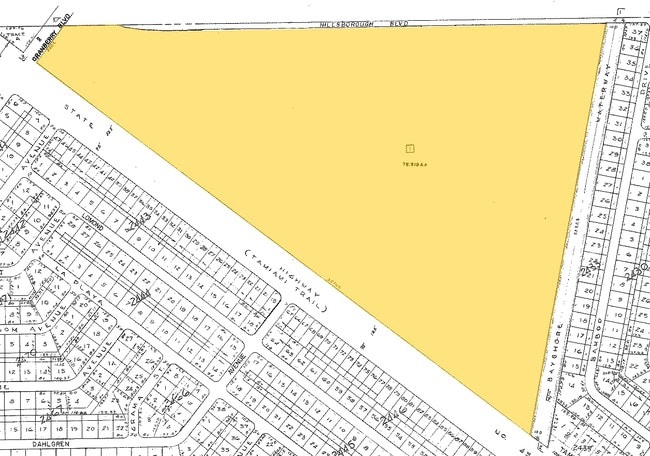
03 40 21 P1 40.53 AC M/L COMMENCE AT THE POINT OF INTERSECTION OF THE NORTHEASTERLY RIGHT-OF-WAY LINE OF U.S. HIGHWAY NO. 41 WITH THE SOUTHEASTERLY RIGHT-OF-WAY OF CRANBERRY BOULEVARD; THENCE S51-51-48E ALONG THE NORTHEASTERLY RIGHT-OF-WAY OF U.S. HI
AE
Charlotte
12015C0040G
Florida
2024
40.53 AC
2025
Charlotte County
020402
Southwest Florida
47,450 SF
Punta Gorda, FL
DEMOGRAPHICS near 202 Tamiami Trl
1 Mile
3 Mile
5 Mile
2024 Total Population
4,291
31,793
86,757
2029 Population
4,986
36,672
100,593
Pop Growth 2024-2029
+ 16.20%
+ 15.35%
+ 15.95%
Average Age
45
47
47
2024 Total Households
1,682
13,154
36,099
HH Growth 2024-2029
+ 16.41%
+ 15.41%
+ 16.16%
Median Household Inc
$57,983
$61,669
$61,833
Avg Household Size
2.50
2.40
2.30
2024 Avg HH Vehicles
2.00
2.00
2.00
Median Home Value
$258,080
$243,219
$237,386
Median Year Built
1999
2001
1999
Nearby Places
Map Layers
Map Styles
 Street
 Aerial
- Restaurants
- Banks
- Shops
- Fitness
- Groceries
PUBLIC TRANSPORTATION
AIRPORT
Punta Gorda
DRIVE
WALK
Distance
Punta Gorda
31 min
16.8 mi
Freight Ports
Port Manatee
DRIVE
WALK
Distance
Port Manatee
73 min
55.5 mi
Nearby Properties
Address
Land Use
TOTAL SIZE
Lot Size
Zoning
Address
Land Use
TOTAL SIZE
Lot Size
Zoning
316,994 SF
40.88 AC
V
Address
Land Use
TOTAL SIZE
Lot Size
Zoning
103,886 SF
21.48 AC
PD
Address
Land Use
TOTAL SIZE
Lot Size
Zoning
218,356 SF
17.14 AC
AC2
Address
Land Use
TOTAL SIZE
Lot Size
Zoning
267,412 SF
23.26 AC
AC1
Address
Land Use
TOTAL SIZE
Lot Size
Zoning
132,969 SF
80.28 AC
PKR
Address
Land Use
TOTAL SIZE
Lot Size
Zoning
302,632 SF
15.71 AC
AC2
Address
Land Use
TOTAL SIZE
Lot Size
Zoning
131,053 SF
14.40 AC
PD
Address
Land Use
TOTAL SIZE
Lot Size
Zoning
205,624 SF
21.37 AC
AC1
Address
Land Use
TOTAL SIZE
Lot Size
Zoning
114,985 SF
29.77 AC
GU
Address
Land Use
TOTAL SIZE
Lot Size
Zoning
79,944 SF
15.64 AC
AC1
Address
Land Use
TOTAL SIZE
Lot Size
Zoning
94,423 SF
12.87 AC
V
Address
Land Use
TOTAL SIZE
Lot Size
Zoning
196,163 SF
15.60 AC
AC1
Address
Land Use
TOTAL SIZE
Lot Size
Zoning
142,364 SF
13.87 AC
AC1
Address
Land Use
TOTAL SIZE
Lot Size
Zoning
95.20 AC
PD
Address
Land Use
TOTAL SIZE
Lot Size
Zoning
37,567 SF
36.76 AC
PKR
Address
Land Use
TOTAL SIZE
Lot Size
Zoning
65,103 SF
10.16 AC
AC2
Address
Land Use
TOTAL SIZE
Lot Size
Zoning
85,529 SF
11.41 AC
AC1
Address
Land Use
TOTAL SIZE
Lot Size
Zoning
105,046 SF
12.69 AC
AC1
Address
Land Use
TOTAL SIZE
Lot Size
Zoning
115,678 SF
8.58 AC
R3
Address
Land Use
TOTAL SIZE
Lot Size
Zoning
48,392 SF
3.89 AC
PD
Address
Land Use
TOTAL SIZE
Lot Size
Zoning
42,923 SF
403.06 AC
R1
Address
Land Use
TOTAL SIZE
Lot Size
Zoning
30,242 SF
7.40 AC
CG
Address
Land Use
TOTAL SIZE
Lot Size
Zoning
63,016 SF
2.56 AC
AC1
Address
Land Use
TOTAL SIZE
Lot Size
Zoning
43,387 SF
5.09 AC
AC2
Address
Land Use
TOTAL SIZE
Lot Size
Zoning
40,467 SF
2.89 AC
CG
Address
Land Use
TOTAL SIZE
Lot Size
Zoning
22.07 AC
PD
Address
Land Use
TOTAL SIZE
Lot Size
Zoning
12,670 SF
17.20 AC
CG
Address
Land Use
TOTAL SIZE
Lot Size
Zoning
31,470 SF
20.05 AC
PD
Address
Land Use
TOTAL SIZE
Lot Size
Zoning
29,760 SF
118.84 AC
PD
The World's #1 Commercial Real Estate Marketplace
Connect with us
© 2026 CoStar Group
The information above has been obtained from sources believed reliable. While we do not doubt its accuracy we have not verified it and make no guarantee, warranty or representation about it. It is your responsibility to independently confirm its accuracy and completeness. Any projections, opinions, assumptions, or estimates used are for example only and do not represent the current or future performance of the property. The value of this transaction to you depends on tax and other factors which should be evaluated by your tax, financial, and legal advisors. You and your advisors should conduct a careful, independent investigation of the property to determine to your satisfaction the suitability of the property for your needs.