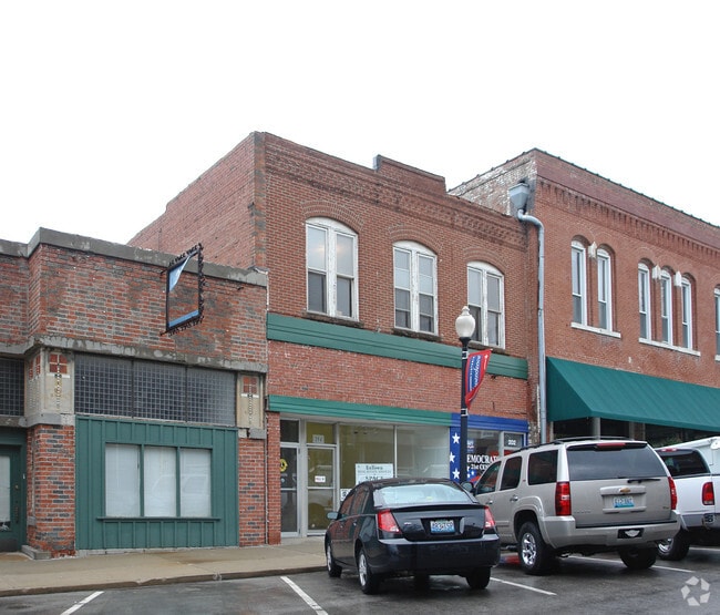
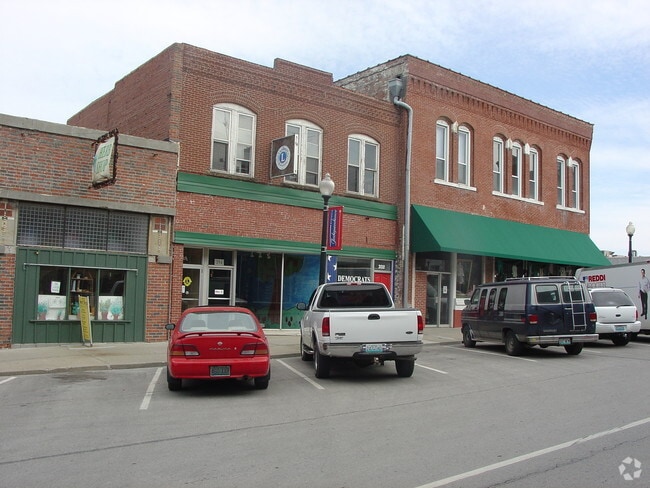
Property Record
202 W Maple Ave, Independence, MO 64050

Property Detail
202 W Maple Ave
Kansas City, MO-KS
INDEPENDENCE OLD TOWN BEG SW COR LOT 18 TH N 148.5 TH E 20 TH S 112.5 TH E 9 TH S 36 TH W 29 TO POB
26-230-04-10-00-0-00-000
Jackson
Storebuilding
Missouri
B and X Area of moderate flood hazard, usually the area between the limits of the 100-year and 500-year floods.
18
2024
0.07 AC
2025
East Jackson County
011601
Kansas City
5,490 SF
NEARBY LISTINGS FOR SALE OR LEASE
DEMOGRAPHICS near 202 W Maple Ave
1 mile
3 mile
5 mile
2025 Total Population
11,655
71,509
139,688
2030 Population
11,842
72,028
140,653
Pop Growth 2025-2030
+ 1.60%
+ 0.73%
+ 0.69%
Average Age
41
40
40
2025 Total Households
5,086
29,873
57,254
HH Growth 2025-2030
+ 1.59%
+ 0.67%
+ 0.66%
Median Household Inc
$41,333
$54,862
$58,936
Avg Household Size
2.20
2.30
2.30
2025 Avg HH Vehicles
1.00
2.00
2.00
Median Home Value
$146,759
$154,951
$169,207
Median Year Built
1950
1960
1966
Nearby Places
Map Layers
Map Styles
 Street
 Aerial
Transit
 Traffic
 Biking
Places
Listings with unknown addresses are not visible on the map
- Restaurants
- Banks
- Shops
- Fitness
- Groceries
PUBLIC TRANSPORTATION
COMMUTER RAIL
Independence Amtrak Station (Lincoln Service Missouri River Runner - Amtrak, Missouri River Runner - Amtrak)
Drive
Walk
Distance
Independence Amtrak Station (Lincoln Service Missouri River Runner - Amtrak, Missouri River Runner - Amtrak)
3 min
19 min
1.0 mi
AIRPORT
Kansas City International
Drive
Walk
Distance
Kansas City International
41 min
30.3 mi
Freight Ports
Tulsa Port Of Catoosa
Drive
Walk
Distance
Tulsa Port Of Catoosa
279 min
246.7 mi
SALE & LEASE HISTORY
LISTING DATE
SALE/LEASE

Jul 05, 2017
For Lease
Jan 06, 2017
For Lease
Nearby Properties
Address
Land Use
TOTAL SIZE
Lot Size
Zoning
Address
Land Use
TOTAL SIZE
Lot Size
Zoning
519,315 SF
28.47 AC
Address
Land Use
TOTAL SIZE
Lot Size
Zoning
250,196 SF
39.50 AC
Address
Land Use
TOTAL SIZE
Lot Size
Zoning
455,100 SF
42.02 AC
Address
Land Use
TOTAL SIZE
Lot Size
Zoning
123,305 SF
15.51 AC
Address
Land Use
TOTAL SIZE
Lot Size
Zoning
64,318 SF
32.40 AC
Address
Land Use
TOTAL SIZE
Lot Size
Zoning
213,615 SF
15.50 AC
Address
Land Use
TOTAL SIZE
Lot Size
Zoning
74,801 SF
8.93 AC
Address
Land Use
TOTAL SIZE
Lot Size
Zoning
157,666 SF
18.54 AC
Address
Land Use
TOTAL SIZE
Lot Size
Zoning
139,713 SF
15.70 AC
Address
Land Use
TOTAL SIZE
Lot Size
Zoning
157,429 SF
36.60 AC
Address
Land Use
TOTAL SIZE
Lot Size
Zoning
13,227 SF
287 AC
Address
Land Use
TOTAL SIZE
Lot Size
Zoning
111,445 SF
8 AC
Address
Land Use
TOTAL SIZE
Lot Size
Zoning
48,664 SF
8.44 AC
Address
Land Use
TOTAL SIZE
Lot Size
Zoning
71,339 SF
0.68 AC
Address
Land Use
TOTAL SIZE
Lot Size
Zoning
113,667 SF
6.31 AC
Address
Land Use
TOTAL SIZE
Lot Size
Zoning
190,810 SF
26.90 AC
Address
Land Use
TOTAL SIZE
Lot Size
Zoning
55,985 SF
20.93 AC
Address
Land Use
TOTAL SIZE
Lot Size
Zoning
36,883 SF
14.60 AC
Address
Land Use
TOTAL SIZE
Lot Size
Zoning
286,490 SF
37.30 AC
Address
Land Use
TOTAL SIZE
Lot Size
Zoning
66,168 SF
44.98 AC
Address
Land Use
TOTAL SIZE
Lot Size
Zoning
45,870 SF
2.01 AC
Address
Land Use
TOTAL SIZE
Lot Size
Zoning
104,740 SF
7.25 AC
Address
Land Use
TOTAL SIZE
Lot Size
Zoning
153,774 SF
Address
Land Use
TOTAL SIZE
Lot Size
Zoning
39,120 SF
1.87 AC
Address
Land Use
TOTAL SIZE
Lot Size
Zoning
101,268 SF
13.09 AC
Address
Land Use
TOTAL SIZE
Lot Size
Zoning
48,330 SF
12.31 AC
Address
Land Use
TOTAL SIZE
Lot Size
Zoning
246,652 SF
5.07 AC
Address
Land Use
TOTAL SIZE
Lot Size
Zoning
50,900 SF
13.80 AC
Address
Land Use
TOTAL SIZE
Lot Size
Zoning
58,946 SF
0.98 AC
Address
Land Use
TOTAL SIZE
Lot Size
Zoning
67,282 SF
4 AC
The World's #1 Commercial Real Estate Marketplace
Connect with us
© 2026 CoStar Group
The information above has been obtained from sources believed reliable. While we do not doubt its accuracy we have not verified it and make no guarantee, warranty or representation about it. It is your responsibility to independently confirm its accuracy and completeness. Any projections, opinions, assumptions, or estimates used are for example only and do not represent the current or future performance of the property. The value of this transaction to you depends on tax and other factors which should be evaluated by your tax, financial, and legal advisors. You and your advisors should conduct a careful, independent investigation of the property to determine to your satisfaction the suitability of the property for your needs.