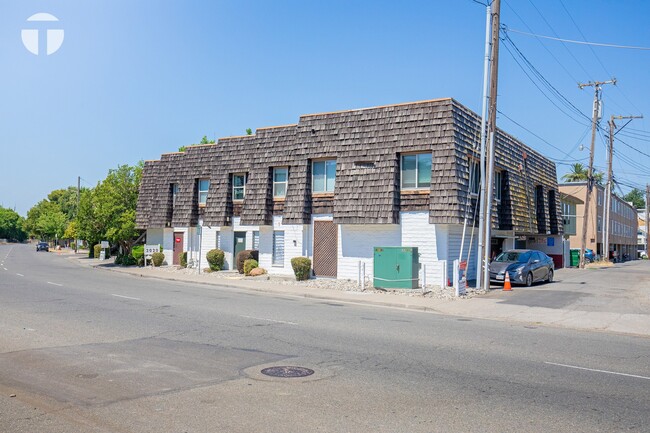
Property Record
2020 29Th St, Sacramento, CA 95817


NEARBY LISTINGS FOR SALE OR LEASE
Property Detail
2020 29Th St
Sacramento--Roseville--Arden-Arcade, CA
A10 123
010-0123-021
PTN OF LOT 5 OF BLK BOUNDED BY T AND U WITH 28 AND 29TH STREETS SD PTN LYING NWLY FR LINE DESC AS FOLLOWS BEG AT PT LOC S 35%16'05 W 398.66 FTFROM INTER-SEC OF C/L OF T ST WITH C/L OF 29TH ST TH FROM POB N 49%19'18 E 60.97 FT TH CURVE TOLEF
Officebuilding
Sacramento
X
California
06067C0190H
5
2024
0.19 AC
2025
Midtown
001900
Sacramento
6,372 SF
DEMOGRAPHICS near 2020 29Th St
1 Mile
3 Mile
5 Mile
2024 Total Population
25,981
156,661
421,608
2029 Population
26,333
158,703
426,084
Pop Growth 2024-2029
+ 1.35%
+ 1.30%
+ 1.06%
Average Age
39
39
38
2024 Total Households
13,618
68,591
164,453
HH Growth 2024-2029
+ 1.47%
+ 1.51%
+ 1.19%
Median Household Inc
$73,628
$77,711
$67,268
Avg Household Size
1.80
2.10
2.40
2024 Avg HH Vehicles
1.00
2.00
2.00
Median Home Value
$646,076
$625,105
$458,515
Median Year Built
1952
1955
1967
Nearby Places
Map Layers
Map Styles
 Street
 Aerial
- Restaurants
- Banks
- Shops
- Fitness
- Groceries
PUBLIC TRANSPORTATION
TRANSIT/SUBWAY
29th Street (Gold Line - Sacramento Regional Transit District Light Rail (The RT))
DRIVE
WALK
Distance
29th Street (Gold Line - Sacramento Regional Transit District Light Rail (The RT))
3 min
6 min
0.3 mi
23rd Street (Gold Line - Sacramento Regional Transit District Light Rail (The RT))
DRIVE
WALK
Distance
23rd Street (Gold Line - Sacramento Regional Transit District Light Rail (The RT))
3 min
14 min
0.7 mi
Broadway (Blue Line - Sacramento Regional Transit District Light Rail (The RT))
DRIVE
WALK
Distance
Broadway (Blue Line - Sacramento Regional Transit District Light Rail (The RT))
2 min
19 min
1.0 mi
COMMUTER RAIL
DRIVE
WALK
Distance
7 min
3.1 mi
AIRPORT
Sacramento International
DRIVE
WALK
Distance
Sacramento International
21 min
13.8 mi
Freight Ports
Port of Stockton
DRIVE
WALK
Distance
Port of Stockton
57 min
46.8 mi
SALE & LEASE HISTORY
LISTING DATE
SALE/LEASE

Nov 14, 2022
For Sale
Jul 18, 2025
For Sale
Jul 12, 2021
For Sale
Apr 26, 2024
For Lease
Nearby Properties
Address
Land Use
TOTAL SIZE
Lot Size
Zoning
Address
Land Use
TOTAL SIZE
Lot Size
Zoning
1,095,507 SF
1.39 AC
H-SPD C-2-
Address
Land Use
TOTAL SIZE
Lot Size
Zoning
5.64 AC
C-3-SPD
Address
Land Use
TOTAL SIZE
Lot Size
Zoning
10.28 AC
H
Address
Land Use
TOTAL SIZE
Lot Size
Zoning
299,943 SF
4.95 AC
H
Address
Land Use
TOTAL SIZE
Lot Size
Zoning
487,483 SF
1.12 AC
C-3-SPD
Address
Land Use
TOTAL SIZE
Lot Size
Zoning
1.33 AC
R-1
Address
Land Use
TOTAL SIZE
Lot Size
Zoning
756,831 SF
1.39 AC
C-2-SPD
Address
Land Use
TOTAL SIZE
Lot Size
Zoning
399,626 SF
2.41 AC
C-3-SPD
Address
Land Use
TOTAL SIZE
Lot Size
Zoning
1.15 AC
R-1
Address
Land Use
TOTAL SIZE
Lot Size
Zoning
366,730 SF
0.89 AC
C-3-SPD
Address
Land Use
TOTAL SIZE
Lot Size
Zoning
200,616 SF
2.54 AC
C-2-SPD
Address
Land Use
TOTAL SIZE
Lot Size
Zoning
594,942 SF
2.39 AC
C-3-SPD
Address
Land Use
TOTAL SIZE
Lot Size
Zoning
31,163 SF
1.57 AC
C-2-TO-SPD
Address
Land Use
TOTAL SIZE
Lot Size
Zoning
676,447 SF
1.43 AC
C-3-SPD
Address
Land Use
TOTAL SIZE
Lot Size
Zoning
193,521 SF
0.60 AC
C-3-SPD
Address
Land Use
TOTAL SIZE
Lot Size
Zoning
339,329 SF
6.40 AC
R-5-PUD-SP
Address
Land Use
TOTAL SIZE
Lot Size
Zoning
213,557 SF
2.33 AC
C-3-SPD
Address
Land Use
TOTAL SIZE
Lot Size
Zoning
0.65 AC
C-4-SPD
Address
Land Use
TOTAL SIZE
Lot Size
Zoning
467,970 SF
4.59 AC
W-F
Address
Land Use
TOTAL SIZE
Lot Size
Zoning
410,420 SF
0.95 AC
C-3-SPD
Address
Land Use
TOTAL SIZE
Lot Size
Zoning
320,072 SF
2.65 AC
C-2
Address
Land Use
TOTAL SIZE
Lot Size
Zoning
R-4-PUD C-
Address
Land Use
TOTAL SIZE
Lot Size
Zoning
0.13 AC
WF
Address
Land Use
TOTAL SIZE
Lot Size
Zoning
26,712 SF
1.90 AC
R-5-PUD-SP
Address
Land Use
TOTAL SIZE
Lot Size
Zoning
26,712 SF
1.85 AC
R-5-PUD-SP
Address
Land Use
TOTAL SIZE
Lot Size
Zoning
2.88 AC
C-3-SPD
Address
Land Use
TOTAL SIZE
Lot Size
Zoning
508,916 SF
0.71 AC
C-3-SPD
Address
Land Use
TOTAL SIZE
Lot Size
Zoning
246,417 SF
1.19 AC
C-3-SPD
Address
Land Use
TOTAL SIZE
Lot Size
Zoning
405,074 SF
2.39 AC
C-3-SPD
Address
Land Use
TOTAL SIZE
Lot Size
Zoning
119,055 SF
1.18 AC
C-2-SPD
The World's #1 Commercial Real Estate Marketplace
Connect with us
© 2025 CoStar Group
The information above has been obtained from sources believed reliable. While we do not doubt its accuracy we have not verified it and make no guarantee, warranty or representation about it. It is your responsibility to independently confirm its accuracy and completeness. Any projections, opinions, assumptions, or estimates used are for example only and do not represent the current or future performance of the property. The value of this transaction to you depends on tax and other factors which should be evaluated by your tax, financial, and legal advisors. You and your advisors should conduct a careful, independent investigation of the property to determine to your satisfaction the suitability of the property for your needs.