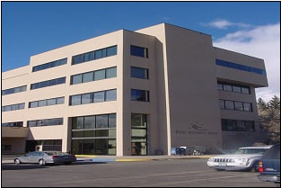
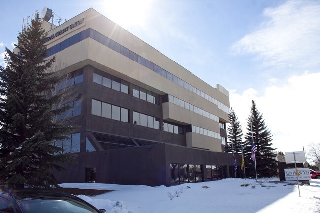
Property Record
2020 E Grand Ave, Laramie, WY 82070
NEARBY LISTINGS FOR SALE OR LEASE
Property Detail
2020 E Grand Ave
Laramie, WY
16 N 73 W 34 TR IN NESESW
05-1673-34-3-00-052.00
Albany
Officebuilding
Wyoming
2024
1.86 AC
2025
I-80 Corridor/Cheyenne
963600
Other Market Areas
51,466 SF
DEMOGRAPHICS near 2020 E Grand Ave
1 Mile
3 Mile
5 Mile
2024 Total Population
13,235
32,424
34,875
2029 Population
13,810
33,887
36,468
Pop Growth 2024-2029
+ 4.34%
+ 4.51%
+ 4.57%
Average Age
31
34
34
2024 Total Households
5,195
13,942
14,966
HH Growth 2024-2029
+ 5.04%
+ 4.87%
+ 4.91%
Median Household Inc
$36,274
$44,845
$47,019
Avg Household Size
2.10
2.10
2.10
2024 Avg HH Vehicles
2.00
2.00
2.00
Median Home Value
$283,783
$276,987
$275,741
Median Year Built
1978
1977
1978
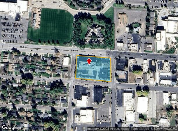
Nearby Places
Map Layers
Map Styles
 Street
 Aerial
- Restaurants
- Banks
- Shops
- Fitness
- Groceries
SALE & LEASE HISTORY
LISTING DATE
SALE/LEASE

Sep 25, 2016
For Lease
Sep 25, 2016
For Lease
Sep 25, 2016
For Lease
Feb 06, 2019
For Sale
Apr 24, 2019
For Sale
Nearby Properties
Address
Land Use
TOTAL SIZE
Lot Size
Zoning
Address
Land Use
TOTAL SIZE
Lot Size
Zoning
184,618 SF
0.62 AC
Address
Land Use
TOTAL SIZE
Lot Size
Zoning
279,138 SF
20.10 AC
Address
Land Use
TOTAL SIZE
Lot Size
Zoning
105,992 SF
5.12 AC
Address
Land Use
TOTAL SIZE
Lot Size
Zoning
83,770 SF
15.19 AC
Address
Land Use
TOTAL SIZE
Lot Size
Zoning
368,130 SF
36.08 AC
Address
Land Use
TOTAL SIZE
Lot Size
Zoning
129,760 SF
4.15 AC
Address
Land Use
TOTAL SIZE
Lot Size
Zoning
173,512 SF
6.36 AC
Address
Land Use
TOTAL SIZE
Lot Size
Zoning
164,069 SF
9.62 AC
Address
Land Use
TOTAL SIZE
Lot Size
Zoning
167,415 SF
12.68 AC
Address
Land Use
TOTAL SIZE
Lot Size
Zoning
55,547 SF
5.48 AC
Address
Land Use
TOTAL SIZE
Lot Size
Zoning
190,796 SF
11.18 AC
Address
Land Use
TOTAL SIZE
Lot Size
Zoning
131,020 SF
8.54 AC
Address
Land Use
TOTAL SIZE
Lot Size
Zoning
48,116 SF
5.63 AC
Address
Land Use
TOTAL SIZE
Lot Size
Zoning
67,335 SF
4.18 AC
Address
Land Use
TOTAL SIZE
Lot Size
Zoning
24,164 SF
2.56 AC
Address
Land Use
TOTAL SIZE
Lot Size
Zoning
85,866 SF
35.47 AC
Address
Land Use
TOTAL SIZE
Lot Size
Zoning
31,255 SF
5.12 AC
Address
Land Use
TOTAL SIZE
Lot Size
Zoning
57,539 SF
1.70 AC
Address
Land Use
TOTAL SIZE
Lot Size
Zoning
147,598 SF
10.25 AC
Address
Land Use
TOTAL SIZE
Lot Size
Zoning
57,916 SF
40.14 AC
Address
Land Use
TOTAL SIZE
Lot Size
Zoning
44,728 SF
2.50 AC
Address
Land Use
TOTAL SIZE
Lot Size
Zoning
333,540 SF
22.20 AC
Address
Land Use
TOTAL SIZE
Lot Size
Zoning
49,410 SF
2.44 AC
Address
Land Use
TOTAL SIZE
Lot Size
Zoning
43,200 SF
2.22 AC
Address
Land Use
TOTAL SIZE
Lot Size
Zoning
61,240 SF
1.32 AC
Address
Land Use
TOTAL SIZE
Lot Size
Zoning
109,672 SF
3.13 AC
Address
Land Use
TOTAL SIZE
Lot Size
Zoning
2,401 SF
27.27 AC
Address
Land Use
TOTAL SIZE
Lot Size
Zoning
58,752 SF
1.35 AC
Address
Land Use
TOTAL SIZE
Lot Size
Zoning
64,632 SF
5.89 AC
Address
Land Use
TOTAL SIZE
Lot Size
Zoning
19,888 SF
0.79 AC
The World's #1 Commercial Real Estate Marketplace
Connect with us
© 2026 CoStar Group
The information above has been obtained from sources believed reliable. While we do not doubt its accuracy we have not verified it and make no guarantee, warranty or representation about it. It is your responsibility to independently confirm its accuracy and completeness. Any projections, opinions, assumptions, or estimates used are for example only and do not represent the current or future performance of the property. The value of this transaction to you depends on tax and other factors which should be evaluated by your tax, financial, and legal advisors. You and your advisors should conduct a careful, independent investigation of the property to determine to your satisfaction the suitability of the property for your needs.