Property Record
2020 Esplanade, Chico, CA 95926
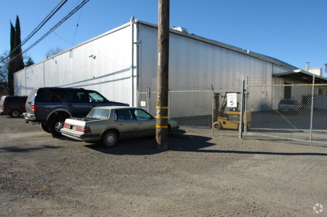

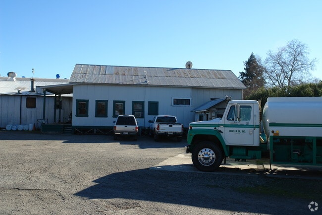
This Property Is For Sale
Property Detail
2020 Esplanade
Chico, CA
2020 ESPLANANDE
003-340-014-000
Butte
Industrialgeneral
California
AE The base floodplain where base flood elevations are provided. AE Zones are now used on new format FIRMs instead of A1-A30 Zones.
5
2024
9.16 AC
2025
Redding/Chico
000700
Other Market Areas
230,638 SF
NEARBY LISTINGS FOR SALE OR LEASE
DEMOGRAPHICS near 2020 Esplanade
1 mile
3 mile
5 mile
2025 Total Population
14,943
87,569
102,639
2030 Population
14,450
85,832
100,727
Pop Growth 2025-2030
(3.30%)
(1.98%)
(1.86%)
Average Age
36
36
37
2025 Total Households
6,328
35,562
41,806
HH Growth 2025-2030
(3.54%)
(2.18%)
(2.05%)
Median Household Inc
$56,121
$65,440
$68,133
Avg Household Size
2.10
2.30
2.30
2025 Avg HH Vehicles
2.00
2.00
2.00
Median Home Value
$436,059
$466,364
$479,102
Median Year Built
1973
1980
1982
Nearby Places
Map Layers
Map Styles
 Street
 Aerial
Transit
 Traffic
 Biking
Places
Listings with unknown addresses are not visible on the map
- Restaurants
- Banks
- Shops
- Fitness
- Groceries
PUBLIC TRANSPORTATION
COMMUTER RAIL
Chico Amtrak (Coast Starlight - Amtrak)
Drive
Walk
Distance
Chico Amtrak (Coast Starlight - Amtrak)
5 min
2.2 mi
Freight Ports
Port of Stockton
Drive
Walk
Distance
Port of Stockton
162 min
133.8 mi
Nearby Properties
Address
Land Use
TOTAL SIZE
Lot Size
Zoning
Address
Land Use
TOTAL SIZE
Lot Size
Zoning
150,000 SF
2.31 AC
Address
Land Use
TOTAL SIZE
Lot Size
Zoning
135,668 SF
3.43 AC
PQ
Address
Land Use
TOTAL SIZE
Lot Size
Zoning
194,612 SF
4.72 AC
R3
Address
Land Use
TOTAL SIZE
Lot Size
Zoning
12.63 AC
R1
Address
Land Use
TOTAL SIZE
Lot Size
Zoning
8.55 AC
R3
Address
Land Use
TOTAL SIZE
Lot Size
Zoning
90,859 SF
5.60 AC
PQ
Address
Land Use
TOTAL SIZE
Lot Size
Zoning
84,280 SF
1.60 AC
R4
Address
Land Use
TOTAL SIZE
Lot Size
Zoning
190,996 SF
7.94 AC
R3
Address
Land Use
TOTAL SIZE
Lot Size
Zoning
8,008 SF
8.79 AC
Address
Land Use
TOTAL SIZE
Lot Size
Zoning
9,784 SF
3.97 AC
R1
Address
Land Use
TOTAL SIZE
Lot Size
Zoning
126,476 SF
6.75 AC
R3
Address
Land Use
TOTAL SIZE
Lot Size
Zoning
133,120 SF
5.37 AC
R3
Address
Land Use
TOTAL SIZE
Lot Size
Zoning
61,571 SF
6.47 AC
Address
Land Use
TOTAL SIZE
Lot Size
Zoning
158,426 SF
16.19 AC
M1
Address
Land Use
TOTAL SIZE
Lot Size
Zoning
1.58 AC
Address
Land Use
TOTAL SIZE
Lot Size
Zoning
247,613 SF
10.77 AC
CR
Address
Land Use
TOTAL SIZE
Lot Size
Zoning
160,354 SF
11.39 AC
00
Address
Land Use
TOTAL SIZE
Lot Size
Zoning
175,392 SF
14.83 AC
Address
Land Use
TOTAL SIZE
Lot Size
Zoning
16,020 SF
12.01 AC
Address
Land Use
TOTAL SIZE
Lot Size
Zoning
83,886 SF
4.55 AC
Address
Land Use
TOTAL SIZE
Lot Size
Zoning
142,712 SF
7.24 AC
Address
Land Use
TOTAL SIZE
Lot Size
Zoning
132,768 SF
9.65 AC
R3
Address
Land Use
TOTAL SIZE
Lot Size
Zoning
44,492 SF
2.05 AC
R3
Address
Land Use
TOTAL SIZE
Lot Size
Zoning
92,292 SF
5.14 AC
Address
Land Use
TOTAL SIZE
Lot Size
Zoning
137,980 SF
15 AC
Address
Land Use
TOTAL SIZE
Lot Size
Zoning
3.30 AC
CR
Address
Land Use
TOTAL SIZE
Lot Size
Zoning
123,494 SF
6.84 AC
R3
Address
Land Use
TOTAL SIZE
Lot Size
Zoning
24.26 AC
Address
Land Use
TOTAL SIZE
Lot Size
Zoning
115,792 SF
5.69 AC
R3
Address
Land Use
TOTAL SIZE
Lot Size
Zoning
2,248 SF
7.90 AC
R3
The World's #1 Commercial Real Estate Marketplace
Connect with us
© 2026 CoStar Group
The information above has been obtained from sources believed reliable. While we do not doubt its accuracy we have not verified it and make no guarantee, warranty or representation about it. It is your responsibility to independently confirm its accuracy and completeness. Any projections, opinions, assumptions, or estimates used are for example only and do not represent the current or future performance of the property. The value of this transaction to you depends on tax and other factors which should be evaluated by your tax, financial, and legal advisors. You and your advisors should conduct a careful, independent investigation of the property to determine to your satisfaction the suitability of the property for your needs.