Property Record
2020 S Bascom Ave, Idaho Falls, ID 83402
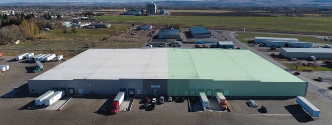


Property Detail
2020 S Bascom Ave
Idaho Falls, ID
LOTS 5-6, BLOCK 1, HEYREND INDUSTRIAL PARK NE1/4 & NW1/4, SEC 2, T 1N, R 37
RPO4090001005A
BONNEVILLE
Manufacturinglight
Idaho
R2
5-6
2025
6.51 AC
2025
Idaho South Area
971302
Other Market Areas
144,781 SF
NEARBY LISTINGS FOR SALE OR LEASE
DEMOGRAPHICS near 2020 S Bascom Ave
1 mile
3 mile
5 mile
2025 Total Population
213
21,229
73,710
2030 Population
227
22,549
77,810
Pop Growth 2025-2030
+ 6.57%
+ 6.22%
+ 5.56%
Average Age
39
39
38
2025 Total Households
76
7,377
27,199
HH Growth 2025-2030
+ 6.58%
+ 6.28%
+ 5.63%
Median Household Inc
$84,722
$93,055
$68,855
Avg Household Size
2.80
2.80
2.60
2025 Avg HH Vehicles
2.00
2.00
2.00
Median Home Value
$445,238
$426,726
$362,655
Median Year Built
2010
1996
1981
Nearby Places
Map Layers
Map Styles
 Street
 Aerial
Transit
 Traffic
 Biking
Places
Listings with unknown addresses are not visible on the map
- Restaurants
- Banks
- Shops
- Fitness
- Groceries
PUBLIC TRANSPORTATION
AIRPORT
Idaho Falls Regional
Drive
Walk
Distance
Idaho Falls Regional
11 min
5.9 mi
Freight Ports
Port of Portland
Drive
Walk
Distance
Port of Portland
737 min
707.2 mi
SALE & LEASE HISTORY
LISTING DATE
SALE/LEASE

Oct 26, 2023
For Lease
Mar 13, 2025
For Lease
Nearby Properties
Address
Land Use
TOTAL SIZE
Lot Size
Zoning
Address
Land Use
TOTAL SIZE
Lot Size
Zoning
57,420 SF
8.59 AC
Address
Land Use
TOTAL SIZE
Lot Size
Zoning
37,287 SF
9.46 AC
Address
Land Use
TOTAL SIZE
Lot Size
Zoning
4,118 SF
25.18 AC
R2
Address
Land Use
TOTAL SIZE
Lot Size
Zoning
1 SF
35.35 AC
R2
Address
Land Use
TOTAL SIZE
Lot Size
Zoning
111,649 SF
8.60 AC
Address
Land Use
TOTAL SIZE
Lot Size
Zoning
108,128 SF
14.53 AC
Address
Land Use
TOTAL SIZE
Lot Size
Zoning
1,908 SF
5.77 AC
Address
Land Use
TOTAL SIZE
Lot Size
Zoning
27,084 SF
3.69 AC
Address
Land Use
TOTAL SIZE
Lot Size
Zoning
89,263 SF
3.92 AC
Address
Land Use
TOTAL SIZE
Lot Size
Zoning
25,629 SF
14.42 AC
Address
Land Use
TOTAL SIZE
Lot Size
Zoning
61,715 SF
4.12 AC
Address
Land Use
TOTAL SIZE
Lot Size
Zoning
54,748 SF
12.73 AC
Address
Land Use
TOTAL SIZE
Lot Size
Zoning
140,670 SF
8.59 AC
Address
Land Use
TOTAL SIZE
Lot Size
Zoning
89,980 SF
12.71 AC
Address
Land Use
TOTAL SIZE
Lot Size
Zoning
140,670 SF
7.22 AC
Address
Land Use
TOTAL SIZE
Lot Size
Zoning
3,520 SF
7.42 AC
Address
Land Use
TOTAL SIZE
Lot Size
Zoning
43,783 SF
2.20 AC
R2
Address
Land Use
TOTAL SIZE
Lot Size
Zoning
166,200 SF
6.75 AC
Address
Land Use
TOTAL SIZE
Lot Size
Zoning
58,902 SF
2.17 AC
Address
Land Use
TOTAL SIZE
Lot Size
Zoning
37,223 SF
5.96 AC
R2
Address
Land Use
TOTAL SIZE
Lot Size
Zoning
35,235 SF
4.90 AC
Address
Land Use
TOTAL SIZE
Lot Size
Zoning
49,782 SF
1.96 AC
R2
Address
Land Use
TOTAL SIZE
Lot Size
Zoning
24,411 SF
4.87 AC
Address
Land Use
TOTAL SIZE
Lot Size
Zoning
13,826 SF
19.84 AC
Address
Land Use
TOTAL SIZE
Lot Size
Zoning
52,980 SF
2.63 AC
R2
Address
Land Use
TOTAL SIZE
Lot Size
Zoning
39,776 SF
1.48 AC
Address
Land Use
TOTAL SIZE
Lot Size
Zoning
153,581 SF
6.01 AC
R2
Address
Land Use
TOTAL SIZE
Lot Size
Zoning
169,162 SF
8.42 AC
R2
Address
Land Use
TOTAL SIZE
Lot Size
Zoning
99,450 SF
5.75 AC
Address
Land Use
TOTAL SIZE
Lot Size
Zoning
30,641 SF
10.54 AC
The World's #1 Commercial Real Estate Marketplace
Connect with us
© 2026 CoStar Group
The information above has been obtained from sources believed reliable. While we do not doubt its accuracy we have not verified it and make no guarantee, warranty or representation about it. It is your responsibility to independently confirm its accuracy and completeness. Any projections, opinions, assumptions, or estimates used are for example only and do not represent the current or future performance of the property. The value of this transaction to you depends on tax and other factors which should be evaluated by your tax, financial, and legal advisors. You and your advisors should conduct a careful, independent investigation of the property to determine to your satisfaction the suitability of the property for your needs.