Property Record
2020 Old Mill Rd, Rocky Mount, NC 27803


NEARBY LISTINGS FOR SALE OR LEASE
Property Detail
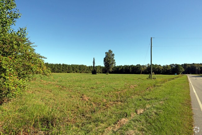
2020 Old Mill Rd
3739-12-95-8865
Property Of Dale C Bone
Religious
6 97 AC, STONE SPLIT OUT OF 373912960695 AC 2H STONE
X
Nash
3720374900K
North Carolina
0
6.97 AC
2025
Rocky Mount/Wilson
010302
Other Market Areas
9,600 SF
Rocky Mount, NC
DEMOGRAPHICS near 2020 Old Mill Rd
1 Mile
3 Mile
5 Mile
2024 Total Population
2,341
26,476
57,509
2029 Population
2,389
27,437
58,962
Pop Growth 2024-2029
+ 2.05%
+ 3.63%
+ 2.53%
Average Age
44
42
41
2024 Total Households
1,001
11,316
24,468
HH Growth 2024-2029
+ 2.00%
+ 3.54%
+ 2.52%
Median Household Inc
$58,011
$49,823
$46,726
Avg Household Size
2.30
2.30
2.30
2024 Avg HH Vehicles
2.00
2.00
2.00
Median Home Value
$151,357
$148,802
$144,135
Median Year Built
1984
1977
1980
Nearby Places
Map Layers
Map Styles
 Street
 Aerial
- Restaurants
- Banks
- Shops
- Fitness
- Groceries
PUBLIC TRANSPORTATION
COMMUTER RAIL
Rocky Mount (Carolinian - Amtrak, Palmetto - Amtrak, Silver Meteor - Amtrak, Silver Star - Amtrak)
DRIVE
WALK
Distance
Rocky Mount (Carolinian - Amtrak, Palmetto - Amtrak, Silver Meteor - Amtrak, Silver Star - Amtrak)
9 min
3.9 mi
Freight Ports
Port of Morehead City
DRIVE
WALK
Distance
Port of Morehead City
185 min
136.1 mi
Nearby Properties
Address
Land Use
TOTAL SIZE
Lot Size
Zoning
Address
Land Use
TOTAL SIZE
Lot Size
Zoning
130,639 SF
60.52 AC
A1M
Address
Land Use
TOTAL SIZE
Lot Size
Zoning
10,632 SF
16.61 AC
R6
Address
Land Use
TOTAL SIZE
Lot Size
Zoning
79,027 SF
33.37 AC
R10
Address
Land Use
TOTAL SIZE
Lot Size
Zoning
98,831 SF
5.40 AC
I
Address
Land Use
TOTAL SIZE
Lot Size
Zoning
29,504 SF
18.61 AC
Address
Land Use
TOTAL SIZE
Lot Size
Zoning
73,338 SF
2.81 AC
B5CU
Address
Land Use
TOTAL SIZE
Lot Size
Zoning
32,051 SF
18.50 AC
R6
Address
Land Use
TOTAL SIZE
Lot Size
Zoning
15,650 SF
32.25 AC
R10
Address
Land Use
TOTAL SIZE
Lot Size
Zoning
118,800 SF
5.51 AC
I
Address
Land Use
TOTAL SIZE
Lot Size
Zoning
6,253 SF
16.22 AC
A1
Address
Land Use
TOTAL SIZE
Lot Size
Zoning
135,400 SF
21.45 AC
B2
Address
Land Use
TOTAL SIZE
Lot Size
Zoning
47,410 SF
2.58 AC
B5CU
Address
Land Use
TOTAL SIZE
Lot Size
Zoning
129,264 SF
31.28 AC
B3
Address
Land Use
TOTAL SIZE
Lot Size
Zoning
63,276 SF
3.07 AC
I
Address
Land Use
TOTAL SIZE
Lot Size
Zoning
61,944 SF
2.51 AC
B5
Address
Land Use
TOTAL SIZE
Lot Size
Zoning
9,736 SF
11.94 AC
R6
Address
Land Use
TOTAL SIZE
Lot Size
Zoning
26,401 SF
7.50 AC
R10
Address
Land Use
TOTAL SIZE
Lot Size
Zoning
3,360 SF
6.27 AC
R10
Address
Land Use
TOTAL SIZE
Lot Size
Zoning
50,305 SF
2.20 AC
B5
Address
Land Use
TOTAL SIZE
Lot Size
Zoning
46,533 SF
11.52 AC
B3
Address
Land Use
TOTAL SIZE
Lot Size
Zoning
21,500 SF
16.11 AC
Address
Land Use
TOTAL SIZE
Lot Size
Zoning
19,532 SF
15.58 AC
R10
Address
Land Use
TOTAL SIZE
Lot Size
Zoning
29,187 SF
29.05 AC
R10
Address
Land Use
TOTAL SIZE
Lot Size
Zoning
29,787 SF
2.86 AC
B5CU
Address
Land Use
TOTAL SIZE
Lot Size
Zoning
52,789 SF
21.90 AC
I2
Address
Land Use
TOTAL SIZE
Lot Size
Zoning
40,812 SF
0.42 AC
R10
Address
Land Use
TOTAL SIZE
Lot Size
Zoning
32,583 SF
12.62 AC
I2
Address
Land Use
TOTAL SIZE
Lot Size
Zoning
41,629 SF
2.50 AC
I
Address
Land Use
TOTAL SIZE
Lot Size
Zoning
109,400 SF
12.91 AC
B2
Address
Land Use
TOTAL SIZE
Lot Size
Zoning
1,298 SF
10.51 AC
R6
The World's #1 Commercial Real Estate Marketplace
Connect with us
© 2025 CoStar Group
The information above has been obtained from sources believed reliable. While we do not doubt its accuracy we have not verified it and make no guarantee, warranty or representation about it. It is your responsibility to independently confirm its accuracy and completeness. Any projections, opinions, assumptions, or estimates used are for example only and do not represent the current or future performance of the property. The value of this transaction to you depends on tax and other factors which should be evaluated by your tax, financial, and legal advisors. You and your advisors should conduct a careful, independent investigation of the property to determine to your satisfaction the suitability of the property for your needs.