Property Record
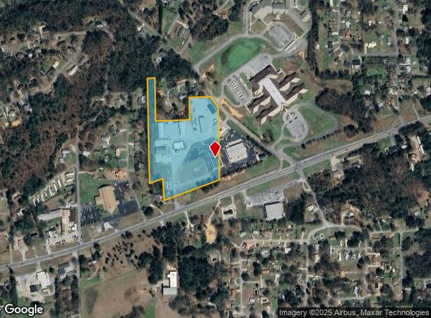
2020 Us Highway 78 W, Oxford, AL 36203

NEARBY LISTINGS FOR SALE OR LEASE
Property Detail
2020 Us Highway 78 W
22-07-35-0-003-043.000
SEC 35 TSP 16S RNG 07E A PARCEL IN SW 1/4 OF NW 1/4 SEC DES C AS BEG ON N LINE OF U S HWY 78 1395 FT E OF W SEC LINE TH SW 52
Warehouse
Calhoun
X
Alabama
01121C0135E
11.10 AC
0
Gadsden/Anniston Area
2025
Other Market Areas
001103
Anniston-Oxford-Jacksonville, AL
4,800 SF
DEMOGRAPHICS near 2020 Us Highway 78 W
1 Mile
3 Mile
5 Mile
2024 Total Population
2,580
10,303
32,452
2029 Population
2,515
10,065
31,884
Pop Growth 2024-2029
(2.52%)
(2.31%)
(1.75%)
Average Age
39
40
40
2024 Total Households
963
3,899
12,794
HH Growth 2024-2029
(2.60%)
(2.46%)
(1.87%)
Median Household Inc
$50,417
$53,299
$49,359
Avg Household Size
2.60
2.50
2.40
2024 Avg HH Vehicles
2.00
2.00
2.00
Median Home Value
$146,867
$147,327
$136,493
Median Year Built
1979
1979
1978
Nearby Places
- Restaurants
- Banks
- Shops
- Fitness
- Groceries
PUBLIC TRANSPORTATION
COMMUTER RAIL
Anniston Amtrak Station (Crescent - Amtrak)
DRIVE
WALK
Distance
Anniston Amtrak Station (Crescent - Amtrak)
10 min
5.8 mi
Freight Ports
Port of Panama City
DRIVE
WALK
Distance
Port of Panama City
359 min
288.2 mi
SALE & LEASE HISTORY
LISTING DATE
SALE/LEASE

Apr 23, 2018
For Lease
Nearby Properties
Address
Land Use
TOTAL SIZE
Lot Size
Zoning
Address
Land Use
TOTAL SIZE
Lot Size
Zoning
128,399 SF
17 AC
Address
Land Use
TOTAL SIZE
Lot Size
Zoning
7,752 SF
182 AC
Address
Land Use
TOTAL SIZE
Lot Size
Zoning
1,972 SF
22.80 AC
Address
Land Use
TOTAL SIZE
Lot Size
Zoning
87,750 SF
25 AC
Address
Land Use
TOTAL SIZE
Lot Size
Zoning
201,670 SF
27.50 AC
Address
Land Use
TOTAL SIZE
Lot Size
Zoning
12,695 SF
0.75 AC
Address
Land Use
TOTAL SIZE
Lot Size
Zoning
128,064 SF
7.70 AC
Address
Land Use
TOTAL SIZE
Lot Size
Zoning
3.50 AC
Address
Land Use
TOTAL SIZE
Lot Size
Zoning
85,305 SF
1.11 AC
Address
Land Use
TOTAL SIZE
Lot Size
Zoning
15,080 SF
24 AC
Address
Land Use
TOTAL SIZE
Lot Size
Zoning
81,250 SF
18 AC
Address
Land Use
TOTAL SIZE
Lot Size
Zoning
171,881 SF
29 AC
Address
Land Use
TOTAL SIZE
Lot Size
Zoning
19,016 SF
4 AC
Address
Land Use
TOTAL SIZE
Lot Size
Zoning
81,920 SF
10 AC
Address
Land Use
TOTAL SIZE
Lot Size
Zoning
34,350 SF
2.60 AC
Address
Land Use
TOTAL SIZE
Lot Size
Zoning
20,446 SF
4.80 AC
Address
Land Use
TOTAL SIZE
Lot Size
Zoning
42,781 SF
3.30 AC
Address
Land Use
TOTAL SIZE
Lot Size
Zoning
17,500 SF
4 AC
Address
Land Use
TOTAL SIZE
Lot Size
Zoning
105,252 SF
7.60 AC
Address
Land Use
TOTAL SIZE
Lot Size
Zoning
18,834 SF
2.37 AC
Address
Land Use
TOTAL SIZE
Lot Size
Zoning
1.11 AC
Address
Land Use
TOTAL SIZE
Lot Size
Zoning
1.25 AC
Address
Land Use
TOTAL SIZE
Lot Size
Zoning
45,686 SF
7.40 AC
Address
Land Use
TOTAL SIZE
Lot Size
Zoning
22,000 SF
8.60 AC
Address
Land Use
TOTAL SIZE
Lot Size
Zoning
Address
Land Use
TOTAL SIZE
Lot Size
Zoning
39,000 SF
2.20 AC
Address
Land Use
TOTAL SIZE
Lot Size
Zoning
15,906 SF
8.50 AC
Address
Land Use
TOTAL SIZE
Lot Size
Zoning
2,958 SF
2 AC
Address
Land Use
TOTAL SIZE
Lot Size
Zoning
33,070 SF
1.80 AC
Address
Land Use
TOTAL SIZE
Lot Size
Zoning
38,336 SF
2.08 AC
The World's #1 Commercial Real Estate Marketplace
Connect with us
© 2025 CoStar Group
The information above has been obtained from sources believed reliable. While we do not doubt its accuracy we have not verified it and make no guarantee, warranty or representation about it. It is your responsibility to independently confirm its accuracy and completeness. Any projections, opinions, assumptions, or estimates used are for example only and do not represent the current or future performance of the property. The value of this transaction to you depends on tax and other factors which should be evaluated by your tax, financial, and legal advisors. You and your advisors should conduct a careful, independent investigation of the property to determine to your satisfaction the suitability of the property for your needs.