Property Record
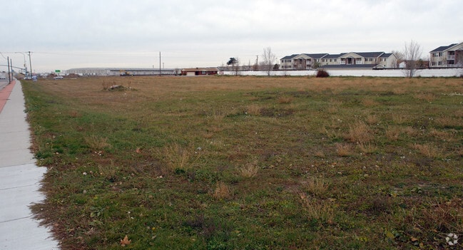
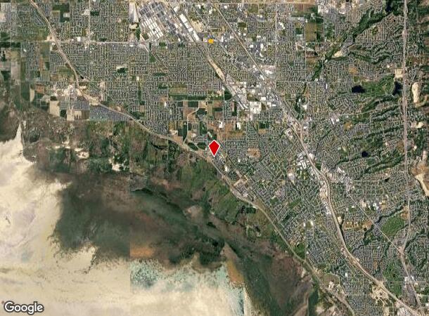
2020 W Antelope Dr, Layton, UT 84041
NEARBY LISTINGS FOR SALE OR LEASE
Property Detail
2020 W Antelope Dr
09-022-0176
BEG AT A PT ALG THE N'LY R/W LINE OF ANTELOPE DRIVE, WH IS N 74^30'19" E 216.36 FT FR THE SW COR OF SEC 7-T4N-R1W, SLB&M; TH N 00^06'05" E 293.35 FT; TH E 356.94 FT; TH S 200.00 FT; TH N 89^47'00" E 3
Vehiclerentalsvehiclesales
Davis
X
Utah
49011C0210E
2.48 AC
2025
Davis/Weber Counties
2025
Salt Lake City
126002
Ogden-Clearfield, UT
13,379 SF
DEMOGRAPHICS near 2020 W Antelope Dr
1 Mile
3 Mile
5 Mile
2024 Total Population
17,905
97,112
203,178
2029 Population
19,076
103,520
215,943
Pop Growth 2024-2029
+ 6.54%
+ 6.60%
+ 6.28%
Average Age
33
33
34
2024 Total Households
6,233
30,578
62,188
HH Growth 2024-2029
+ 7.17%
+ 6.68%
+ 6.36%
Median Household Inc
$62,502
$76,343
$89,139
Avg Household Size
2.80
3.10
3.20
2024 Avg HH Vehicles
2.00
2.00
2.00
Median Home Value
$337,564
$375,537
$402,524
Median Year Built
1995
1995
1995
Nearby Places
Map Layers
Map Styles
 Street
 Aerial
- Restaurants
- Banks
- Shops
- Fitness
- Groceries
PUBLIC TRANSPORTATION
COMMUTER RAIL
Layton (FrontRunner North - Utah Transit Authority (UTA))
DRIVE
WALK
Distance
Layton (FrontRunner North - Utah Transit Authority (UTA))
6 min
2.7 mi
Clearfield (FrontRunner North - Utah Transit Authority (UTA))
DRIVE
WALK
Distance
Clearfield (FrontRunner North - Utah Transit Authority (UTA))
10 min
4.0 mi
AIRPORT
Salt Lake City International
DRIVE
WALK
Distance
Salt Lake City International
36 min
27.2 mi
Freight Ports
Port of Stockton
DRIVE
WALK
Distance
Port of Stockton
737 min
717.6 mi
Nearby Properties
Address
Land Use
TOTAL SIZE
Lot Size
Zoning
Address
Land Use
TOTAL SIZE
Lot Size
Zoning
346,223 SF
36.29 AC
BRP
Address
Land Use
TOTAL SIZE
Lot Size
Zoning
217,412 SF
13.23 AC
RS
Address
Land Use
TOTAL SIZE
Lot Size
Zoning
102,978 SF
6.42 AC
Address
Land Use
TOTAL SIZE
Lot Size
Zoning
100,348 SF
21.75 AC
R18
Address
Land Use
TOTAL SIZE
Lot Size
Zoning
79,285 SF
0.01 AC
BRP
Address
Land Use
TOTAL SIZE
Lot Size
Zoning
1,484 SF
10.34 AC
Address
Land Use
TOTAL SIZE
Lot Size
Zoning
94,532 SF
7.07 AC
Address
Land Use
TOTAL SIZE
Lot Size
Zoning
4,281 SF
16.55 AC
RM1
Address
Land Use
TOTAL SIZE
Lot Size
Zoning
147,675 SF
11.25 AC
C-H
Address
Land Use
TOTAL SIZE
Lot Size
Zoning
455,336 SF
22.93 AC
Address
Land Use
TOTAL SIZE
Lot Size
Zoning
111,724 SF
10.72 AC
RA
Address
Land Use
TOTAL SIZE
Lot Size
Zoning
67,536 SF
13.16 AC
LI
Address
Land Use
TOTAL SIZE
Lot Size
Zoning
2,373 SF
6.63 AC
RM2PRUD
Address
Land Use
TOTAL SIZE
Lot Size
Zoning
104,342 SF
18.54 AC
M2
Address
Land Use
TOTAL SIZE
Lot Size
Zoning
218,896 SF
2.76 AC
MUTOD
Address
Land Use
TOTAL SIZE
Lot Size
Zoning
119,988 SF
10.63 AC
LI
Address
Land Use
TOTAL SIZE
Lot Size
Zoning
72,750 SF
13.09 AC
A1
Address
Land Use
TOTAL SIZE
Lot Size
Zoning
72,750 SF
12.82 AC
BRP
Address
Land Use
TOTAL SIZE
Lot Size
Zoning
220,887 SF
12.17 AC
CH
Address
Land Use
TOTAL SIZE
Lot Size
Zoning
132,251 SF
7.94 AC
Address
Land Use
TOTAL SIZE
Lot Size
Zoning
72,750 SF
11.54 AC
RS
Address
Land Use
TOTAL SIZE
Lot Size
Zoning
77,091 SF
11.09 AC
A
Address
Land Use
TOTAL SIZE
Lot Size
Zoning
300,026 SF
4.39 AC
Address
Land Use
TOTAL SIZE
Lot Size
Zoning
26,856 SF
5.92 AC
RM2
Address
Land Use
TOTAL SIZE
Lot Size
Zoning
72,301 SF
11.98 AC
A1
Address
Land Use
TOTAL SIZE
Lot Size
Zoning
399,469 SF
7.88 AC
M2
Address
Land Use
TOTAL SIZE
Lot Size
Zoning
83,616 SF
7.48 AC
Address
Land Use
TOTAL SIZE
Lot Size
Zoning
41,075 SF
5.29 AC
Address
Land Use
TOTAL SIZE
Lot Size
Zoning
87,198 SF
0.01 AC
BRP
Address
Land Use
TOTAL SIZE
Lot Size
Zoning
3,640 SF
6.45 AC
R18
The World's #1 Commercial Real Estate Marketplace
Connect with us
© 2025 CoStar Group
The information above has been obtained from sources believed reliable. While we do not doubt its accuracy we have not verified it and make no guarantee, warranty or representation about it. It is your responsibility to independently confirm its accuracy and completeness. Any projections, opinions, assumptions, or estimates used are for example only and do not represent the current or future performance of the property. The value of this transaction to you depends on tax and other factors which should be evaluated by your tax, financial, and legal advisors. You and your advisors should conduct a careful, independent investigation of the property to determine to your satisfaction the suitability of the property for your needs.