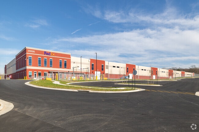
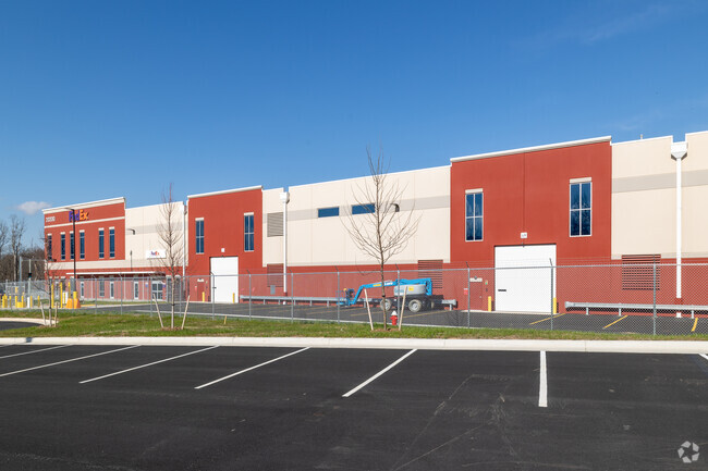
Property Record
20200 Sycolin Rd, Leesburg, VA 20175
NEARBY LISTINGS FOR SALE OR LEASE
Property Detail
20200 Sycolin Rd
Washington, DC
Scannell Properties
Washington-Arlington-Alexandria, DC-VA-MD-WV
SYCOLIN/ SCANNELL PROPERTIES LOT 1 202311200046403/4P ST.DEDD 202301110001158/59P ST.DEDD, 202207200042441/2P
193-36-7800
Loudoun
Commercialnec
Virginia
2025
1
2025
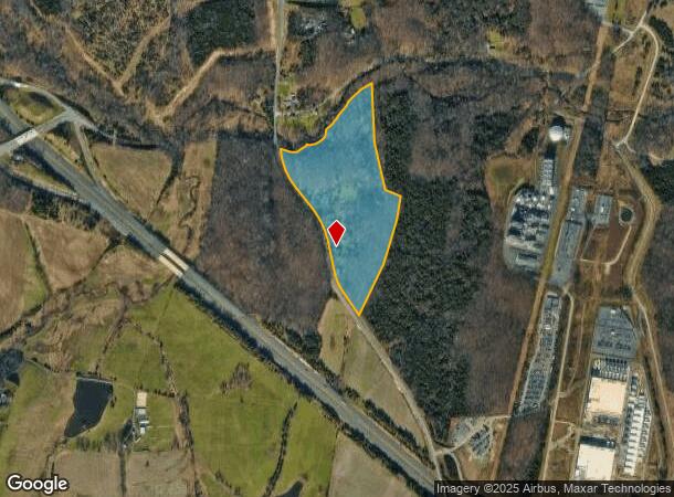
36.09 AC
611004
Leesburg
198,300 SF
DEMOGRAPHICS near 20200 Sycolin Rd
1 Mile
3 Mile
5 Mile
2024 Total Population
48
38,827
160,669
2029 Population
51
41,720
173,218
Pop Growth 2024-2029
+ 6.25%
+ 7.45%
+ 7.81%
Average Age
36
37
38
2024 Total Households
14
12,489
54,005
HH Growth 2024-2029
+ 7.14%
+ 7.59%
+ 7.97%
Median Household Inc
$214,286
$177,574
$154,270
Avg Household Size
3.40
3.10
2.90
2024 Avg HH Vehicles
3.00
2.00
2.00
Median Home Value
$750,000
$706,811
$682,159
Median Year Built
2004
2002
2000
Nearby Places
Map Layers
Map Styles
 Street
 Aerial
- Restaurants
- Banks
- Shops
- Fitness
- Groceries
PUBLIC TRANSPORTATION
AIRPORT
Washington Dulles International
DRIVE
WALK
Distance
Washington Dulles International
22 min
13.5 mi
Freight Ports
Port of Baltimore
DRIVE
WALK
Distance
Port of Baltimore
95 min
70.4 mi
Nearby Properties
Address
Land Use
TOTAL SIZE
Lot Size
Zoning
Address
Land Use
TOTAL SIZE
Lot Size
Zoning
793,474 SF
311.38 AC
PDIP
Address
Land Use
TOTAL SIZE
Lot Size
Zoning
250,459 SF
OP
Address
Land Use
TOTAL SIZE
Lot Size
Zoning
356,841 SF
119.07 AC
PDGI
Address
Land Use
TOTAL SIZE
Lot Size
Zoning
108.01 AC
PDOP
Address
Land Use
TOTAL SIZE
Lot Size
Zoning
553,617 SF
592.60 AC
PDSA
Address
Land Use
TOTAL SIZE
Lot Size
Zoning
340,152 SF
119.26 AC
TR10
Address
Land Use
TOTAL SIZE
Lot Size
Zoning
420,787 SF
LB:B4
Address
Land Use
TOTAL SIZE
Lot Size
Zoning
37.61 AC
IP
Address
Land Use
TOTAL SIZE
Lot Size
Zoning
300,570 SF
OP
Address
Land Use
TOTAL SIZE
Lot Size
Zoning
260,741 SF
37.30 AC
PDH4
Address
Land Use
TOTAL SIZE
Lot Size
Zoning
413,099 SF
10.12 AC
PDIP
Address
Land Use
TOTAL SIZE
Lot Size
Zoning
388,150 SF
PDIP
Address
Land Use
TOTAL SIZE
Lot Size
Zoning
261,445 SF
17.95 AC
LB:I1
Address
Land Use
TOTAL SIZE
Lot Size
Zoning
245,886 SF
52.32 AC
LB:RE
Address
Land Use
TOTAL SIZE
Lot Size
Zoning
90,051 SF
181.22 AC
PDRV
Address
Land Use
TOTAL SIZE
Lot Size
Zoning
247,082 SF
57.50 AC
PDH4
Address
Land Use
TOTAL SIZE
Lot Size
Zoning
294,934 SF
7.11 AC
PDIP
Address
Land Use
TOTAL SIZE
Lot Size
Zoning
131,283 SF
27.84 AC
LB:B3
Address
Land Use
TOTAL SIZE
Lot Size
Zoning
141,978 SF
15.92 AC
PDCCCC
Address
Land Use
TOTAL SIZE
Lot Size
Zoning
148,448 SF
9.71 AC
LB:PEC
Address
Land Use
TOTAL SIZE
Lot Size
Zoning
172,593 SF
14.74 AC
PDH3
Address
Land Use
TOTAL SIZE
Lot Size
Zoning
196,665 SF
18.96 AC
LB:PRN
Address
Land Use
TOTAL SIZE
Lot Size
Zoning
129,600 SF
7.48 AC
PDH4
Address
Land Use
TOTAL SIZE
Lot Size
Zoning
57.61 AC
PDH3
Address
Land Use
TOTAL SIZE
Lot Size
Zoning
31.69 AC
GI
Address
Land Use
TOTAL SIZE
Lot Size
Zoning
18.85 AC
PDH4
Address
Land Use
TOTAL SIZE
Lot Size
Zoning
106.59 AC
PDGI
Address
Land Use
TOTAL SIZE
Lot Size
Zoning
81,360 SF
67.81 AC
PDRV
The World's #1 Commercial Real Estate Marketplace
Connect with us
© 2025 CoStar Group
The information above has been obtained from sources believed reliable. While we do not doubt its accuracy we have not verified it and make no guarantee, warranty or representation about it. It is your responsibility to independently confirm its accuracy and completeness. Any projections, opinions, assumptions, or estimates used are for example only and do not represent the current or future performance of the property. The value of this transaction to you depends on tax and other factors which should be evaluated by your tax, financial, and legal advisors. You and your advisors should conduct a careful, independent investigation of the property to determine to your satisfaction the suitability of the property for your needs.