Property Record
202002 E Schuster Rd, Kennewick, WA 99337
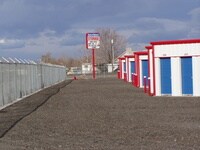

Property Detail
202002 E Schuster Rd
108801000004000
SECTION 8 TOWNSHIP 8 NORTH RANGE 30: PORTION OF THE NORTH ONE/HALF OF THE SOUTHEAST QUARTER OF THE NORTHEAST QUARTER DEFINED AS FOLLOWS: COMMENCING AT THE NORTHEAST CORNER OF THE SOUTHEAST QUARTER OF THE NORTHEAST QUARTER: THENCE NORTH 89 DEGREES
Commercialnec
Benton
BENTON COU
Washington
2025
1.75 AC
2025
Yakima/Kennewick
011501
Other Market Areas
27,845 SF
Kennewick-Richland, WA
NEARBY LISTINGS FOR SALE OR LEASE
DEMOGRAPHICS near 202002 E Schuster Rd
1 mile
3 mile
5 mile
2025 Total Population
1,342
38,657
103,806
2030 Population
1,398
40,288
107,683
Pop Growth 2025-2030
+ 4.17%
+ 4.22%
+ 3.73%
Average Age
39
35
36
2025 Total Households
448
12,405
34,066
HH Growth 2025-2030
+ 4.24%
+ 4.26%
+ 3.80%
Median Household Inc
$91,749
$59,947
$65,955
Avg Household Size
2.90
3.00
3.00
2025 Avg HH Vehicles
3.00
2.00
2.00
Median Home Value
$372,641
$335,421
$347,440
Median Year Built
1989
1974
1975
Nearby Places
Map Layers
Map Styles
 Street
 Aerial
Layers
 Traffic
 Biking
Places
Listings with unknown addresses are not visible on the map
- Restaurants
- Banks
- Shops
- Fitness
- Groceries
PUBLIC TRANSPORTATION
COMMUTER RAIL
Drive
Walk
Distance
10 min
4.5 mi
AIRPORT
Tri-Cities
Drive
Walk
Distance
Tri-Cities
14 min
7.4 mi
Nearby Properties
Address
Land Use
TOTAL SIZE
Lot Size
Zoning
Address
Land Use
TOTAL SIZE
Lot Size
Zoning
1,078,419 SF
114.48 AC
Address
Land Use
TOTAL SIZE
Lot Size
Zoning
1,049,518 SF
104.40 AC
Address
Land Use
TOTAL SIZE
Lot Size
Zoning
2,863,808 SF
28.33 AC
Address
Land Use
TOTAL SIZE
Lot Size
Zoning
377,541 SF
24.58 AC
Address
Land Use
TOTAL SIZE
Lot Size
Zoning
294,855 SF
35.04 AC
KENNEWICK
Address
Land Use
TOTAL SIZE
Lot Size
Zoning
140,275 SF
6.36 AC
Address
Land Use
TOTAL SIZE
Lot Size
Zoning
123.27 AC
Address
Land Use
TOTAL SIZE
Lot Size
Zoning
113,585 SF
15.43 AC
Address
Land Use
TOTAL SIZE
Lot Size
Zoning
55,809 SF
10.79 AC
Address
Land Use
TOTAL SIZE
Lot Size
Zoning
110,740 SF
18.15 AC
Address
Land Use
TOTAL SIZE
Lot Size
Zoning
70,416 SF
2.73 AC
Address
Land Use
TOTAL SIZE
Lot Size
Zoning
584,810 SF
Address
Land Use
TOTAL SIZE
Lot Size
Zoning
47,064 SF
13.70 AC
KENNEWICK
Address
Land Use
TOTAL SIZE
Lot Size
Zoning
107,280 SF
14.53 AC
Address
Land Use
TOTAL SIZE
Lot Size
Zoning
20,919 SF
58.49 AC
KENNEWICK
Address
Land Use
TOTAL SIZE
Lot Size
Zoning
101,720 SF
4.92 AC
33
Address
Land Use
TOTAL SIZE
Lot Size
Zoning
125,508 SF
3.49 AC
Address
Land Use
TOTAL SIZE
Lot Size
Zoning
147,847 SF
8.47 AC
Address
Land Use
TOTAL SIZE
Lot Size
Zoning
30,640 SF
2.27 AC
Address
Land Use
TOTAL SIZE
Lot Size
Zoning
113,292 SF
1.47 AC
Address
Land Use
TOTAL SIZE
Lot Size
Zoning
75,870 SF
5.32 AC
33
Address
Land Use
TOTAL SIZE
Lot Size
Zoning
89,884 SF
7.49 AC
33
Address
Land Use
TOTAL SIZE
Lot Size
Zoning
68,630 SF
13.42 AC
Address
Land Use
TOTAL SIZE
Lot Size
Zoning
69,082 SF
5.24 AC
35
Address
Land Use
TOTAL SIZE
Lot Size
Zoning
47,239 SF
3.34 AC
Address
Land Use
TOTAL SIZE
Lot Size
Zoning
75,002 SF
3.56 AC
33
Address
Land Use
TOTAL SIZE
Lot Size
Zoning
55,733 SF
16.50 AC
Address
Land Use
TOTAL SIZE
Lot Size
Zoning
66,912 SF
5.05 AC
35
Address
Land Use
TOTAL SIZE
Lot Size
Zoning
50,310 SF
0.32 AC
The World's #1 Commercial Real Estate Marketplace
Connect with us
© 2026 CoStar Group
The information above has been obtained from sources believed reliable. While we do not doubt its accuracy we have not verified it and make no guarantee, warranty or representation about it. It is your responsibility to independently confirm its accuracy and completeness. Any projections, opinions, assumptions, or estimates used are for example only and do not represent the current or future performance of the property. The value of this transaction to you depends on tax and other factors which should be evaluated by your tax, financial, and legal advisors. You and your advisors should conduct a careful, independent investigation of the property to determine to your satisfaction the suitability of the property for your needs.