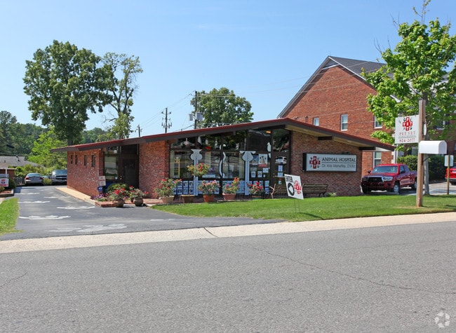
Property Record
2021 Kentucky Ave, Vestavia Hills, AL 35216
NEARBY LISTINGS FOR SALE OR LEASE
Property Detail
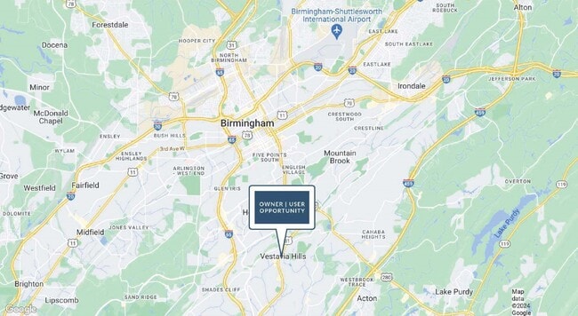
2021 Kentucky Ave
Birmingham-Hoover, AL
South Bham Hts Re 28-30-2
28-00-30-2-002-002.000
LOT A SOUTH BHAM HEIGHTS RESUR OF LOTS 1-2 & 3 BLK 13 57/22
Policefirecivildefense
Jefferson
X
Alabama
01073C0558J
a
2023
0.26 AC
2024
Vestavia Hills
012905
Birmingham
1,930 SF
DEMOGRAPHICS near 2021 Kentucky Ave
1 Mile
3 Mile
5 Mile
2024 Total Population
6,635
63,029
175,213
2029 Population
6,445
61,437
172,846
Pop Growth 2024-2029
(2.86%)
(2.53%)
(1.35%)
Average Age
40
37
38
2024 Total Households
2,548
24,775
76,921
HH Growth 2024-2029
(2.90%)
(2.69%)
(1.27%)
Median Household Inc
$115,836
$87,005
$66,271
Avg Household Size
2.50
2.30
2.10
2024 Avg HH Vehicles
2.00
2.00
2.00
Median Home Value
$477,940
$427,027
$361,931
Median Year Built
1969
1974
1976
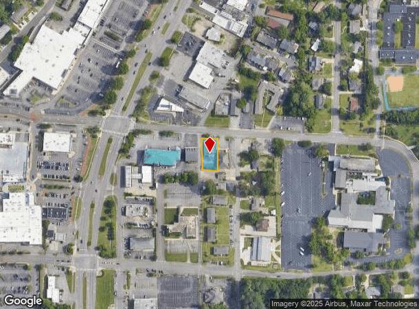
Nearby Places
Map Layers
Map Styles
 Street
 Aerial
- Restaurants
- Banks
- Shops
- Fitness
- Groceries
PUBLIC TRANSPORTATION
COMMUTER RAIL
DRIVE
WALK
Distance
10 min
6.4 mi
AIRPORT
Birmingham-Shuttlesworth International
DRIVE
WALK
Distance
Birmingham-Shuttlesworth International
17 min
10.2 mi
SALE & LEASE HISTORY
LISTING DATE
SALE/LEASE

Oct 04, 2024
For Sale
Nearby Properties
Address
Land Use
TOTAL SIZE
Lot Size
Zoning
Address
Land Use
TOTAL SIZE
Lot Size
Zoning
978,879 SF
43.50 AC
I3
Address
Land Use
TOTAL SIZE
Lot Size
Zoning
261,311 SF
20.85 AC
C1
Address
Land Use
TOTAL SIZE
Lot Size
Zoning
31,980 SF
99.92 AC
I3/P
Address
Land Use
TOTAL SIZE
Lot Size
Zoning
200,927 SF
19 AC
PMUD
Address
Land Use
TOTAL SIZE
Lot Size
Zoning
81,807 SF
6.30 AC
C1
Address
Land Use
TOTAL SIZE
Lot Size
Zoning
186,070 SF
16.60 AC
QB2
Address
Land Use
TOTAL SIZE
Lot Size
Zoning
51,699 SF
1.31 AC
PCD-
Address
Land Use
TOTAL SIZE
Lot Size
Zoning
329,064 SF
9 AC
I3
Address
Land Use
TOTAL SIZE
Lot Size
Zoning
62,543 SF
1.78 AC
R-D
Address
Land Use
TOTAL SIZE
Lot Size
Zoning
69,981 SF
4.90 AC
B2
Address
Land Use
TOTAL SIZE
Lot Size
Zoning
33,209 SF
3.11 AC
C4B
Address
Land Use
TOTAL SIZE
Lot Size
Zoning
282,421 SF
24.33 AC
R7
Address
Land Use
TOTAL SIZE
Lot Size
Zoning
92,332 SF
8.40 AC
Address
Land Use
TOTAL SIZE
Lot Size
Zoning
331,413 SF
14.46 AC
R6
Address
Land Use
TOTAL SIZE
Lot Size
Zoning
65,685 SF
9.50 AC
B2
Address
Land Use
TOTAL SIZE
Lot Size
Zoning
265,418 SF
26.55 AC
R2
Address
Land Use
TOTAL SIZE
Lot Size
Zoning
62,516 SF
1.37 AC
I3
Address
Land Use
TOTAL SIZE
Lot Size
Zoning
133,396 SF
19 AC
QR6
Address
Land Use
TOTAL SIZE
Lot Size
Zoning
58,463 SF
11 AC
C1
Address
Land Use
TOTAL SIZE
Lot Size
Zoning
38,963 SF
0.24 AC
C4B
Address
Land Use
TOTAL SIZE
Lot Size
Zoning
403,758 SF
22.36 AC
R3
Address
Land Use
TOTAL SIZE
Lot Size
Zoning
97,764 SF
14.20 AC
C1
Address
Land Use
TOTAL SIZE
Lot Size
Zoning
141,583 SF
18 AC
I3
Address
Land Use
TOTAL SIZE
Lot Size
Zoning
66,829 SF
3.44 AC
R-5
Address
Land Use
TOTAL SIZE
Lot Size
Zoning
447,428 SF
12.99 AC
PCD-
Address
Land Use
TOTAL SIZE
Lot Size
Zoning
170,850 SF
9.31 AC
INST
Address
Land Use
TOTAL SIZE
Lot Size
Zoning
285,719 SF
18 AC
R-4
Address
Land Use
TOTAL SIZE
Lot Size
Zoning
97,875 SF
4.60 AC
R5
Address
Land Use
TOTAL SIZE
Lot Size
Zoning
313,404 SF
19 AC
PMUD
The World's #1 Commercial Real Estate Marketplace
Connect with us
© 2025 CoStar Group
The information above has been obtained from sources believed reliable. While we do not doubt its accuracy we have not verified it and make no guarantee, warranty or representation about it. It is your responsibility to independently confirm its accuracy and completeness. Any projections, opinions, assumptions, or estimates used are for example only and do not represent the current or future performance of the property. The value of this transaction to you depends on tax and other factors which should be evaluated by your tax, financial, and legal advisors. You and your advisors should conduct a careful, independent investigation of the property to determine to your satisfaction the suitability of the property for your needs.