Property Record
2047 West St, River Grove, IL 60171


NEARBY LISTINGS FOR SALE OR LEASE
Property Detail
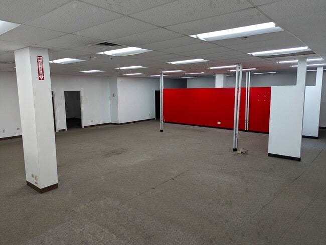
2047 West St
Industrialgeneral
Cook
X
Illinois
17031C0386J
3.17 AC
2023
West Cook North
2024
Chicago
811100
Chicago-Naperville-Elgin, IL-IN-WI
55,953 SF
12-34-208-011-0000
DEMOGRAPHICS near 2047 West St
1 Mile
3 Mile
5 Mile
2024 Total Population
11,824
188,239
532,707
2029 Population
11,424
181,496
510,494
Pop Growth 2024-2029
(3.38%)
(3.58%)
(4.17%)
Average Age
39
40
40
2024 Total Households
4,126
66,252
194,192
HH Growth 2024-2029
(3.73%)
(3.90%)
(4.37%)
Median Household Inc
$67,572
$71,259
$71,209
Avg Household Size
2.80
2.70
2.60
2024 Avg HH Vehicles
2.00
2.00
2.00
Median Home Value
$252,382
$264,845
$283,846
Median Year Built
1954
1954
1952
Nearby Places
Map Layers
Map Styles
 Street
 Aerial
- Restaurants
- Banks
- Shops
- Fitness
- Groceries
PUBLIC TRANSPORTATION
COMMUTER RAIL
River Grove Station (Milwaukee District West Line - Northeast Illinois Regional Commuter Railroad (Metra), North Central Service - Northeast Illinois Regional Commuter Railroad (Metra))
DRIVE
WALK
Distance
River Grove Station (Milwaukee District West Line - Northeast Illinois Regional Commuter Railroad (Metra), North Central Service - Northeast Illinois Regional Commuter Railroad (Metra))
7 min
2.0 mi
Franklin Park-Belmont Ave Station (Ncs) (North Central Service - Northeast Illinois Regional Commuter Railroad (Metra))
DRIVE
WALK
Distance
Franklin Park-Belmont Ave Station (Ncs) (North Central Service - Northeast Illinois Regional Commuter Railroad (Metra))
8 min
2.6 mi
AIRPORT
Chicago O'Hare International
DRIVE
WALK
Distance
Chicago O'Hare International
18 min
7.9 mi
Chicago Midway International
DRIVE
WALK
Distance
Chicago Midway International
27 min
14.3 mi
Freight Ports
Port Milwaukee
DRIVE
WALK
Distance
Port Milwaukee
102 min
81.1 mi
SALE & LEASE HISTORY
LISTING DATE
SALE/LEASE

Feb 28, 2023
For Lease
Nearby Properties
Address
Land Use
TOTAL SIZE
Lot Size
Zoning
Address
Land Use
TOTAL SIZE
Lot Size
Zoning
86.63 AC
Address
Land Use
TOTAL SIZE
Lot Size
Zoning
422,063 SF
18.88 AC
Address
Land Use
TOTAL SIZE
Lot Size
Zoning
396,650 SF
19.12 AC
Address
Land Use
TOTAL SIZE
Lot Size
Zoning
595,800 SF
9.40 AC
Address
Land Use
TOTAL SIZE
Lot Size
Zoning
Address
Land Use
TOTAL SIZE
Lot Size
Zoning
516,605 SF
16.29 AC
Address
Land Use
TOTAL SIZE
Lot Size
Zoning
194,219 SF
17.26 AC
Address
Land Use
TOTAL SIZE
Lot Size
Zoning
548,206 SF
21.13 AC
Address
Land Use
TOTAL SIZE
Lot Size
Zoning
276,458 SF
16.14 AC
Address
Land Use
TOTAL SIZE
Lot Size
Zoning
Address
Land Use
TOTAL SIZE
Lot Size
Zoning
479,130 SF
15.80 AC
Address
Land Use
TOTAL SIZE
Lot Size
Zoning
531,227 SF
18.32 AC
Address
Land Use
TOTAL SIZE
Lot Size
Zoning
348,133 SF
2.69 AC
Address
Land Use
TOTAL SIZE
Lot Size
Zoning
141,800 SF
3.77 AC
Address
Land Use
TOTAL SIZE
Lot Size
Zoning
325,045 SF
13.79 AC
Address
Land Use
TOTAL SIZE
Lot Size
Zoning
609,109 SF
12.10 AC
Address
Land Use
TOTAL SIZE
Lot Size
Zoning
1.65 AC
Address
Land Use
TOTAL SIZE
Lot Size
Zoning
89,919 SF
2.87 AC
Address
Land Use
TOTAL SIZE
Lot Size
Zoning
152,533 SF
12.64 AC
Address
Land Use
TOTAL SIZE
Lot Size
Zoning
790,000 SF
31.71 AC
Address
Land Use
TOTAL SIZE
Lot Size
Zoning
Address
Land Use
TOTAL SIZE
Lot Size
Zoning
62,844 SF
3.24 AC
Address
Land Use
TOTAL SIZE
Lot Size
Zoning
Address
Land Use
TOTAL SIZE
Lot Size
Zoning
5.38 AC
Address
Land Use
TOTAL SIZE
Lot Size
Zoning
432,777 SF
22.29 AC
Address
Land Use
TOTAL SIZE
Lot Size
Zoning
15.48 AC
Address
Land Use
TOTAL SIZE
Lot Size
Zoning
Address
Land Use
TOTAL SIZE
Lot Size
Zoning
126,955 SF
13.70 AC
PD 541
Address
Land Use
TOTAL SIZE
Lot Size
Zoning
318,305 SF
12.71 AC
Address
Land Use
TOTAL SIZE
Lot Size
Zoning
150,893 SF
The World's #1 Commercial Real Estate Marketplace
Connect with us
© 2025 CoStar Group
The information above has been obtained from sources believed reliable. While we do not doubt its accuracy we have not verified it and make no guarantee, warranty or representation about it. It is your responsibility to independently confirm its accuracy and completeness. Any projections, opinions, assumptions, or estimates used are for example only and do not represent the current or future performance of the property. The value of this transaction to you depends on tax and other factors which should be evaluated by your tax, financial, and legal advisors. You and your advisors should conduct a careful, independent investigation of the property to determine to your satisfaction the suitability of the property for your needs.