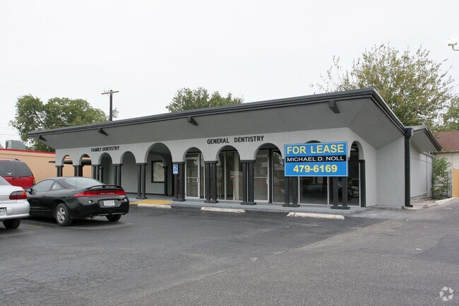
Property Record
2022 Pleasanton Rd, San Antonio, TX 78221


NEARBY LISTINGS FOR SALE OR LEASE
Property Detail
2022 Pleasanton Rd
San Antonio-New Braunfels, TX
Harlandale Acre Bl 7837 4
07837-002-0140
NCB 7837 BLK 2 LOT N 91.7 OF W 120 FT OF 14
Medicalbuilding
Bexar
X
Texas
48029C0560F
14
2024
0.27 AC
2025
South
150900
San Antonio
3,584 SF
DEMOGRAPHICS near 2022 Pleasanton Rd
1 mile
3 mile
5 mile
2024 Total Population
16,099
112,835
274,845
2029 Population
16,934
119,604
293,275
Pop Growth 2024-2029
+ 5.19%
+ 6.00%
+ 6.71%
Average Age
38
38
37
2024 Total Households
5,388
37,920
94,505
HH Growth 2024-2029
+ 5.33%
+ 6.21%
+ 7.03%
Median Household Inc
$42,562
$41,255
$40,952
Avg Household Size
2.90
2.90
2.80
2024 Avg HH Vehicles
2.00
2.00
2.00
Median Home Value
$121,827
$117,453
$124,983
Median Year Built
1955
1958
1963
Nearby Places
Map Layers
Map Styles
 Street
 Aerial
Transit
 Traffic
 Biking
Places
Listings with unknown addresses are not visible on the map
- Restaurants
- Banks
- Shops
- Fitness
- Groceries
PUBLIC TRANSPORTATION
COMMUTER RAIL
Drive
Walk
Distance
11 min
5.8 mi
AIRPORT
San Antonio International
Drive
Walk
Distance
San Antonio International
20 min
13.2 mi
Nearby Properties
Address
Land Use
TOTAL SIZE
Lot Size
Zoning
Address
Land Use
TOTAL SIZE
Lot Size
Zoning
Address
Land Use
TOTAL SIZE
Lot Size
Zoning
548,048 SF
27.53 AC
Address
Land Use
TOTAL SIZE
Lot Size
Zoning
291,374 SF
13.49 AC
Address
Land Use
TOTAL SIZE
Lot Size
Zoning
12,504,292 SF
32.18 AC
Address
Land Use
TOTAL SIZE
Lot Size
Zoning
447,169 SF
46.74 AC
Address
Land Use
TOTAL SIZE
Lot Size
Zoning
163.70 AC
Address
Land Use
TOTAL SIZE
Lot Size
Zoning
63,850 SF
33.42 AC
Address
Land Use
TOTAL SIZE
Lot Size
Zoning
145,389 SF
18.70 AC
Address
Land Use
TOTAL SIZE
Lot Size
Zoning
306,922 SF
32.07 AC
Address
Land Use
TOTAL SIZE
Lot Size
Zoning
71,607 SF
10.46 AC
Address
Land Use
TOTAL SIZE
Lot Size
Zoning
218,003 SF
12.33 AC
Address
Land Use
TOTAL SIZE
Lot Size
Zoning
87,686 SF
32.01 AC
Address
Land Use
TOTAL SIZE
Lot Size
Zoning
11,553 SF
67.15 AC
Address
Land Use
TOTAL SIZE
Lot Size
Zoning
231,592 SF
47.96 AC
Address
Land Use
TOTAL SIZE
Lot Size
Zoning
20.58 AC
Address
Land Use
TOTAL SIZE
Lot Size
Zoning
45,363 SF
4.29 AC
Address
Land Use
TOTAL SIZE
Lot Size
Zoning
56,875 SF
10.04 AC
Address
Land Use
TOTAL SIZE
Lot Size
Zoning
143,067 SF
11.69 AC
Address
Land Use
TOTAL SIZE
Lot Size
Zoning
166,270 SF
13.95 AC
Address
Land Use
TOTAL SIZE
Lot Size
Zoning
38,671 SF
5.20 AC
Address
Land Use
TOTAL SIZE
Lot Size
Zoning
141,606 SF
13.74 AC
Address
Land Use
TOTAL SIZE
Lot Size
Zoning
67,184 SF
60.16 AC
Address
Land Use
TOTAL SIZE
Lot Size
Zoning
203,232 SF
24.20 AC
Address
Land Use
TOTAL SIZE
Lot Size
Zoning
360,000 SF
0.01 AC
Address
Land Use
TOTAL SIZE
Lot Size
Zoning
109,591 SF
5.65 AC
Address
Land Use
TOTAL SIZE
Lot Size
Zoning
89,949 SF
7.14 AC
Address
Land Use
TOTAL SIZE
Lot Size
Zoning
47.74 AC
Address
Land Use
TOTAL SIZE
Lot Size
Zoning
154,556 SF
7.52 AC
Address
Land Use
TOTAL SIZE
Lot Size
Zoning
144,137 SF
10.44 AC
Address
Land Use
TOTAL SIZE
Lot Size
Zoning
258,170 SF
17.89 AC
The World's #1 Commercial Real Estate Marketplace
Connect with us
© 2026 CoStar Group
The information above has been obtained from sources believed reliable. While we do not doubt its accuracy we have not verified it and make no guarantee, warranty or representation about it. It is your responsibility to independently confirm its accuracy and completeness. Any projections, opinions, assumptions, or estimates used are for example only and do not represent the current or future performance of the property. The value of this transaction to you depends on tax and other factors which should be evaluated by your tax, financial, and legal advisors. You and your advisors should conduct a careful, independent investigation of the property to determine to your satisfaction the suitability of the property for your needs.