Property Record
20222 Plymouth Rd, Detroit, MI 48228


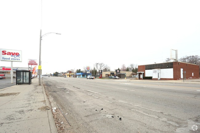

This Property Is For Sale
NEARBY LISTINGS FOR SALE OR LEASE
Property Detail
20222 Plymouth Rd
22-0056009
Maples Park
Financialbuilding
N PLYMOUTH E 15 FT 54 53 THRU 48 MAPLES PARK SUB L53 P9 PLATS, W C R 22/285 140 X 100
X
Wayne
26163C0255E
Michigan
2025
0.32 AC
2025
Detroit W of Woodward
547000
Detroit
3,196 SF
Detroit-Warren-Dearborn, MI
DEMOGRAPHICS near 20222 Plymouth Rd
1 Mile
3 Mile
5 Mile
2024 Total Population
11,892
139,676
388,684
2029 Population
11,739
137,185
378,946
Pop Growth 2024-2029
(1.29%)
(1.78%)
(2.51%)
Average Age
36
37
38
2024 Total Households
4,665
51,993
144,293
HH Growth 2024-2029
(1.50%)
(1.87%)
(2.50%)
Median Household Inc
$36,627
$39,644
$44,662
Avg Household Size
2.50
2.60
2.60
2024 Avg HH Vehicles
1.00
1.00
1.00
Median Home Value
$55,693
$88,308
$121,528
Median Year Built
1953
1951
1952
Nearby Places
Map Layers
Map Styles
 Street
 Aerial
- Restaurants
- Banks
- Shops
- Fitness
- Groceries
PUBLIC TRANSPORTATION
AIRPORT
Detroit Metro Wayne County
DRIVE
WALK
Distance
Detroit Metro Wayne County
31 min
19.2 mi
Windsor International
DRIVE
WALK
Distance
Windsor International
41 min
23.1 mi
Nearby Properties
Address
Land Use
TOTAL SIZE
Lot Size
Zoning
Address
Land Use
TOTAL SIZE
Lot Size
Zoning
1,211,148 SF
69.13 AC
M4
Address
Land Use
TOTAL SIZE
Lot Size
Zoning
783,976 SF
52.57 AC
M4
Address
Land Use
TOTAL SIZE
Lot Size
Zoning
335,133 SF
22.08 AC
Address
Land Use
TOTAL SIZE
Lot Size
Zoning
85.45 AC
Address
Land Use
TOTAL SIZE
Lot Size
Zoning
261,917 SF
9.31 AC
PD
Address
Land Use
TOTAL SIZE
Lot Size
Zoning
192,813 SF
28.92 AC
TR
Address
Land Use
TOTAL SIZE
Lot Size
Zoning
202,736 SF
20 AC
PD
Address
Land Use
TOTAL SIZE
Lot Size
Zoning
835,383 SF
36.85 AC
Address
Land Use
TOTAL SIZE
Lot Size
Zoning
300,936 SF
18.40 AC
M4
Address
Land Use
TOTAL SIZE
Lot Size
Zoning
72,326 SF
0.74 AC
BB
Address
Land Use
TOTAL SIZE
Lot Size
Zoning
158,354 SF
43.70 AC
M4
Address
Land Use
TOTAL SIZE
Lot Size
Zoning
95,908 SF
1.12 AC
BB
Address
Land Use
TOTAL SIZE
Lot Size
Zoning
207,081 SF
8.80 AC
B5
Address
Land Use
TOTAL SIZE
Lot Size
Zoning
167,562 SF
9.25 AC
R5
Address
Land Use
TOTAL SIZE
Lot Size
Zoning
82,196 SF
3.49 AC
BB
Address
Land Use
TOTAL SIZE
Lot Size
Zoning
179,412 SF
2.17 AC
Address
Land Use
TOTAL SIZE
Lot Size
Zoning
129,975 SF
6.89 AC
R5
Address
Land Use
TOTAL SIZE
Lot Size
Zoning
104,567 SF
2.14 AC
PD
Address
Land Use
TOTAL SIZE
Lot Size
Zoning
63,924 SF
0.60 AC
BB
Address
Land Use
TOTAL SIZE
Lot Size
Zoning
152,424 SF
5.02 AC
Address
Land Use
TOTAL SIZE
Lot Size
Zoning
114,337 SF
3.94 AC
RE
Address
Land Use
TOTAL SIZE
Lot Size
Zoning
186.50 AC
IND
Address
Land Use
TOTAL SIZE
Lot Size
Zoning
331,590 SF
18.50 AC
M4
Address
Land Use
TOTAL SIZE
Lot Size
Zoning
79,831 SF
7.60 AC
B3
Address
Land Use
TOTAL SIZE
Lot Size
Zoning
97,114 SF
2.10 AC
R1
Address
Land Use
TOTAL SIZE
Lot Size
Zoning
207,088 SF
14.25 AC
R-1
Address
Land Use
TOTAL SIZE
Lot Size
Zoning
124,976 SF
5.56 AC
PD
Address
Land Use
TOTAL SIZE
Lot Size
Zoning
362,981 SF
18.08 AC
M4
Address
Land Use
TOTAL SIZE
Lot Size
Zoning
106,597 SF
4.71 AC
PD
Address
Land Use
TOTAL SIZE
Lot Size
Zoning
68,198 SF
4.22 AC
B4
The World's #1 Commercial Real Estate Marketplace
Connect with us
© 2026 CoStar Group
The information above has been obtained from sources believed reliable. While we do not doubt its accuracy we have not verified it and make no guarantee, warranty or representation about it. It is your responsibility to independently confirm its accuracy and completeness. Any projections, opinions, assumptions, or estimates used are for example only and do not represent the current or future performance of the property. The value of this transaction to you depends on tax and other factors which should be evaluated by your tax, financial, and legal advisors. You and your advisors should conduct a careful, independent investigation of the property to determine to your satisfaction the suitability of the property for your needs.