Property Record
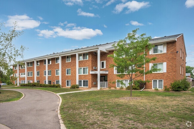
2023 Bradley St, Saint Paul, MN 55117

NEARBY LISTINGS FOR SALE OR LEASE
Property Detail
2023 Bradley St
Minneapolis-St. Paul-Bloomington, MN-WI
Edgerton Highlands
17-29-22-24-0005
EDGERTON HIGHLANDS LOT 1 BLK 2
Apartment
Ramsey
X
Minnesota
27003C0450E
1
2024
1.18 AC
2025
Roseville
042202
Minneapolis/St Paul
25,296 SF
DEMOGRAPHICS near 2023 Bradley St
1 Mile
3 Mile
5 Mile
2024 Total Population
9,288
113,014
307,779
2029 Population
9,009
109,152
299,449
Pop Growth 2024-2029
(3.00%)
(3.42%)
(2.71%)
Average Age
38
36
38
2024 Total Households
3,436
40,001
118,723
HH Growth 2024-2029
(3.23%)
(3.62%)
(2.76%)
Median Household Inc
$67,331
$63,902
$66,621
Avg Household Size
2.60
2.70
2.40
2024 Avg HH Vehicles
2.00
2.00
2.00
Median Home Value
$260,964
$249,584
$263,514
Median Year Built
1971
1965
1965
Nearby Places
Map Layers
Map Styles
 Street
 Aerial
- Restaurants
- Banks
- Shops
- Fitness
- Groceries
PUBLIC TRANSPORTATION
COMMUTER RAIL
St. Paul-Minneapolis (Empire Builder - Amtrak)
DRIVE
WALK
Distance
St. Paul-Minneapolis (Empire Builder - Amtrak)
9 min
4.4 mi
AIRPORT
Minneapolis-St Paul International/Wold-Chamberlain
DRIVE
WALK
Distance
Minneapolis-St Paul International/Wold-Chamberlain
23 min
13.8 mi
Freight Ports
Port Milwaukee
DRIVE
WALK
Distance
Port Milwaukee
368 min
332.8 mi
Nearby Properties
Address
Land Use
TOTAL SIZE
Lot Size
Zoning
Address
Land Use
TOTAL SIZE
Lot Size
Zoning
404,491 SF
27.01 AC
Address
Land Use
TOTAL SIZE
Lot Size
Zoning
267,576 SF
18.95 AC
Address
Land Use
TOTAL SIZE
Lot Size
Zoning
3,050 SF
58.60 AC
Address
Land Use
TOTAL SIZE
Lot Size
Zoning
160,800 SF
5.05 AC
Address
Land Use
TOTAL SIZE
Lot Size
Zoning
4,800 SF
20.36 AC
Address
Land Use
TOTAL SIZE
Lot Size
Zoning
47,670 SF
179 AC
Address
Land Use
TOTAL SIZE
Lot Size
Zoning
13.10 AC
Address
Land Use
TOTAL SIZE
Lot Size
Zoning
Address
Land Use
TOTAL SIZE
Lot Size
Zoning
273,937 SF
16.75 AC
Address
Land Use
TOTAL SIZE
Lot Size
Zoning
53,851 SF
22.74 AC
Address
Land Use
TOTAL SIZE
Lot Size
Zoning
180,756 SF
40.63 AC
Address
Land Use
TOTAL SIZE
Lot Size
Zoning
202,958 SF
4.87 AC
Address
Land Use
TOTAL SIZE
Lot Size
Zoning
233,419 SF
5.67 AC
Address
Land Use
TOTAL SIZE
Lot Size
Zoning
90,293 SF
9.33 AC
Address
Land Use
TOTAL SIZE
Lot Size
Zoning
138,407 SF
15.67 AC
Address
Land Use
TOTAL SIZE
Lot Size
Zoning
313,546 SF
7.33 AC
Address
Land Use
TOTAL SIZE
Lot Size
Zoning
272,002 SF
8.16 AC
Address
Land Use
TOTAL SIZE
Lot Size
Zoning
129,854 SF
5.08 AC
Address
Land Use
TOTAL SIZE
Lot Size
Zoning
297,750 SF
11.54 AC
Address
Land Use
TOTAL SIZE
Lot Size
Zoning
129,290 SF
5.13 AC
Address
Land Use
TOTAL SIZE
Lot Size
Zoning
278,392 SF
8.04 AC
Address
Land Use
TOTAL SIZE
Lot Size
Zoning
Address
Land Use
TOTAL SIZE
Lot Size
Zoning
35.93 AC
W7PUBLC
Address
Land Use
TOTAL SIZE
Lot Size
Zoning
2,779 SF
95.22 AC
Address
Land Use
TOTAL SIZE
Lot Size
Zoning
49,691 SF
10.94 AC
Address
Land Use
TOTAL SIZE
Lot Size
Zoning
157,404 SF
40.84 AC
Address
Land Use
TOTAL SIZE
Lot Size
Zoning
17.16 AC
Address
Land Use
TOTAL SIZE
Lot Size
Zoning
90,080 SF
12.81 AC
Address
Land Use
TOTAL SIZE
Lot Size
Zoning
118,442 SF
12.83 AC
Address
Land Use
TOTAL SIZE
Lot Size
Zoning
127,207 SF
3.49 AC
The World's #1 Commercial Real Estate Marketplace
Connect with us
© 2025 CoStar Group
The information above has been obtained from sources believed reliable. While we do not doubt its accuracy we have not verified it and make no guarantee, warranty or representation about it. It is your responsibility to independently confirm its accuracy and completeness. Any projections, opinions, assumptions, or estimates used are for example only and do not represent the current or future performance of the property. The value of this transaction to you depends on tax and other factors which should be evaluated by your tax, financial, and legal advisors. You and your advisors should conduct a careful, independent investigation of the property to determine to your satisfaction the suitability of the property for your needs.