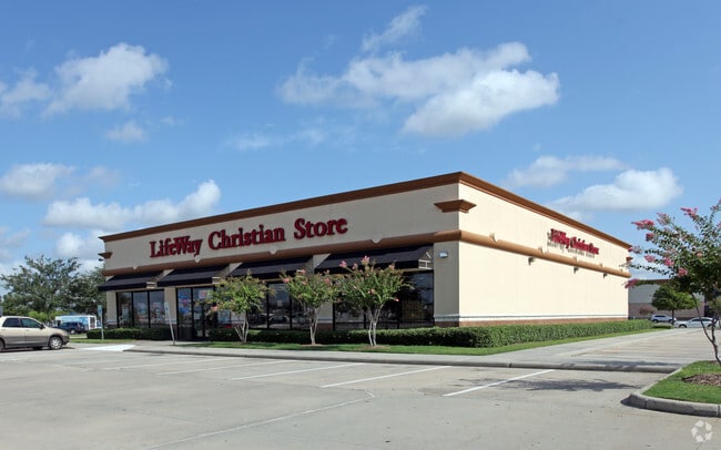
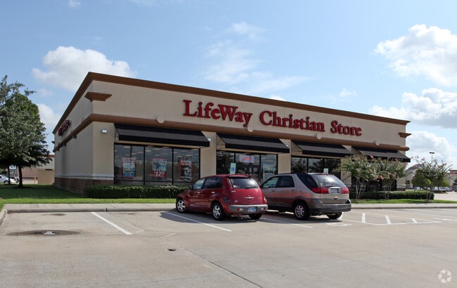
Property Record
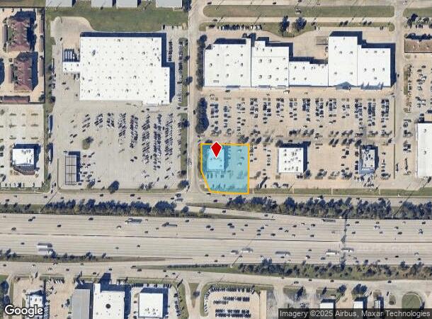
20230 Katy Fwy, Katy, TX 77449

NEARBY LISTINGS FOR SALE OR LEASE
Property Detail
20230 Katy Fwy
1206720010007
Home Depot Plaza Sec 2
Regionalshoppingcenterormallwithanchorstore
RES A4 BLK 1 HOME DEPOT PLAZA SEC 2
X
Harris
48201C0615M
Texas
2024
1.15 AC
2025
Far Katy North
542402
Houston
8,000 SF
Houston-The Woodlands-Sugar Land, TX
DEMOGRAPHICS near 20230 Katy Fwy
1 Mile
3 Mile
5 Mile
2024 Total Population
13,972
123,675
267,153
2029 Population
14,146
125,438
279,592
Pop Growth 2024-2029
+ 1.25%
+ 1.43%
+ 4.66%
Average Age
37
37
36
2024 Total Households
4,785
42,429
89,108
HH Growth 2024-2029
+ 1.11%
+ 1.44%
+ 4.68%
Median Household Inc
$62,867
$81,765
$87,022
Avg Household Size
2.90
2.90
3.00
2024 Avg HH Vehicles
2.00
2.00
2.00
Median Home Value
$214,129
$241,672
$254,142
Median Year Built
1987
1995
2002
Nearby Places
Map Layers
Map Styles
 Street
 Aerial
- Restaurants
- Banks
- Shops
- Fitness
- Groceries
PUBLIC TRANSPORTATION
AIRPORT
William P Hobby
DRIVE
WALK
Distance
William P Hobby
49 min
37.8 mi
George Bush Intcntl/Houston
DRIVE
WALK
Distance
George Bush Intcntl/Houston
42 min
38.0 mi
Nearby Properties
Address
Land Use
TOTAL SIZE
Lot Size
Zoning
Address
Land Use
TOTAL SIZE
Lot Size
Zoning
695,923 SF
6.63 AC
Address
Land Use
TOTAL SIZE
Lot Size
Zoning
681,561 SF
7.98 AC
Address
Land Use
TOTAL SIZE
Lot Size
Zoning
614,847 SF
42 AC
Address
Land Use
TOTAL SIZE
Lot Size
Zoning
451,973 SF
19.47 AC
Address
Land Use
TOTAL SIZE
Lot Size
Zoning
439,347 SF
13.50 AC
Address
Land Use
TOTAL SIZE
Lot Size
Zoning
417,092 SF
17.58 AC
Address
Land Use
TOTAL SIZE
Lot Size
Zoning
891,129 SF
44.39 AC
Address
Land Use
TOTAL SIZE
Lot Size
Zoning
375,486 SF
12.36 AC
Address
Land Use
TOTAL SIZE
Lot Size
Zoning
341,844 SF
16.71 AC
Address
Land Use
TOTAL SIZE
Lot Size
Zoning
343,605 SF
11.90 AC
Address
Land Use
TOTAL SIZE
Lot Size
Zoning
319,717 SF
10.45 AC
Address
Land Use
TOTAL SIZE
Lot Size
Zoning
319,341 SF
14.88 AC
Address
Land Use
TOTAL SIZE
Lot Size
Zoning
492,836 SF
30.20 AC
Address
Land Use
TOTAL SIZE
Lot Size
Zoning
272,033 SF
12.74 AC
Address
Land Use
TOTAL SIZE
Lot Size
Zoning
278,684 SF
13 AC
Address
Land Use
TOTAL SIZE
Lot Size
Zoning
384,260 SF
18 AC
Address
Land Use
TOTAL SIZE
Lot Size
Zoning
276,470 SF
8.88 AC
Address
Land Use
TOTAL SIZE
Lot Size
Zoning
266,532 SF
6.45 AC
Address
Land Use
TOTAL SIZE
Lot Size
Zoning
235,837 SF
7.99 AC
Address
Land Use
TOTAL SIZE
Lot Size
Zoning
326,912 SF
13.78 AC
Address
Land Use
TOTAL SIZE
Lot Size
Zoning
284,321 SF
10.54 AC
Address
Land Use
TOTAL SIZE
Lot Size
Zoning
351,505 SF
13.38 AC
Address
Land Use
TOTAL SIZE
Lot Size
Zoning
307,596 SF
9.62 AC
Address
Land Use
TOTAL SIZE
Lot Size
Zoning
214,347 SF
30.70 AC
Address
Land Use
TOTAL SIZE
Lot Size
Zoning
334,724 SF
21.23 AC
Address
Land Use
TOTAL SIZE
Lot Size
Zoning
489,188 SF
5.99 AC
Address
Land Use
TOTAL SIZE
Lot Size
Zoning
290,607 SF
14.50 AC
Address
Land Use
TOTAL SIZE
Lot Size
Zoning
420,671 SF
23.29 AC
Address
Land Use
TOTAL SIZE
Lot Size
Zoning
375,895 SF
14 AC
Address
Land Use
TOTAL SIZE
Lot Size
Zoning
363,880 SF
17.32 AC
The World's #1 Commercial Real Estate Marketplace
Connect with us
© 2025 CoStar Group
The information above has been obtained from sources believed reliable. While we do not doubt its accuracy we have not verified it and make no guarantee, warranty or representation about it. It is your responsibility to independently confirm its accuracy and completeness. Any projections, opinions, assumptions, or estimates used are for example only and do not represent the current or future performance of the property. The value of this transaction to you depends on tax and other factors which should be evaluated by your tax, financial, and legal advisors. You and your advisors should conduct a careful, independent investigation of the property to determine to your satisfaction the suitability of the property for your needs.