Property Record
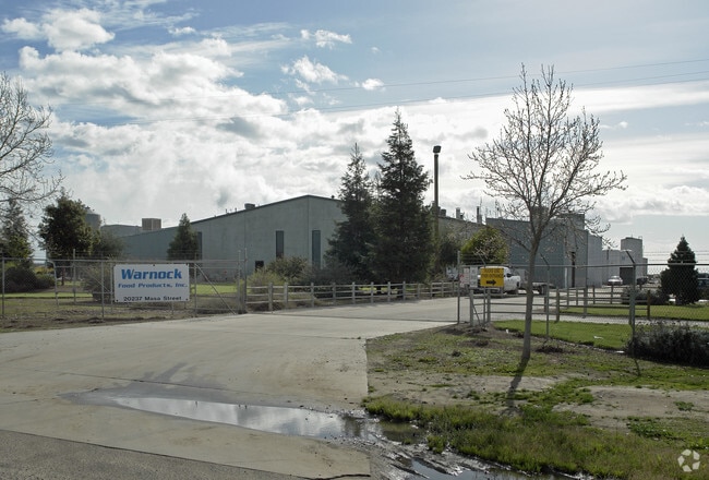
20237 Masa St, Madera, CA 93638


Property Detail
20237 Masa St
029-110-003
AMENDED MAP POR MADERA ESTATES 2 LOT 2
Industrialacreage
MADERA
IL
California
B and X Area of moderate flood hazard, usually the area between the limits of the 100-year and 500-year floods.
2
2024
37.32 AC
2025
Outlying Madera Cnty
000603
Fresno
29,000 SF
Fresno, CA
NEARBY LISTINGS FOR SALE OR LEASE
-
-
View all Madera listings for sale on LoopNet.com
DEMOGRAPHICS near 20237 Masa St
1 mile
3 mile
5 mile
2025 Total Population
316
2,108
13,468
2030 Population
323
2,161
13,891
Pop Growth 2025-2030
+ 2.22%
+ 2.51%
+ 3.14%
Average Age
41
40
38
2025 Total Households
12
234
2,525
HH Growth 2025-2030
+ 8.33%
+ 3.42%
+ 3.60%
Median Household Inc
$59,999
$59,654
$67,091
Avg Household Size
3.50
3.40
3.50
2025 Avg HH Vehicles
2.00
3.00
3.00
Median Home Value
$350,000
$486,538
$358,623
Median Year Built
1990
1978
1983
Nearby Places
Map Layers
Map Styles
 Street
 Aerial
Transit
 Traffic
 Biking
Places
Listings with unknown addresses are not visible on the map
- Restaurants
- Banks
- Shops
- Fitness
- Groceries
Nearby Properties
Address
Land Use
TOTAL SIZE
Lot Size
Zoning
Address
Land Use
TOTAL SIZE
Lot Size
Zoning
70 AC
ARE-20
Address
Land Use
TOTAL SIZE
Lot Size
Zoning
14,400 SF
181.61 AC
IL
Address
Land Use
TOTAL SIZE
Lot Size
Zoning
37,307 SF
28.44 AC
ARE-20
Address
Land Use
TOTAL SIZE
Lot Size
Zoning
17,998 SF
11.24 AC
CRG
Address
Land Use
TOTAL SIZE
Lot Size
Zoning
1,104 SF
189.04 AC
ARE-40
Address
Land Use
TOTAL SIZE
Lot Size
Zoning
2,832 SF
8.76 AC
IL
Address
Land Use
TOTAL SIZE
Lot Size
Zoning
557.97 AC
ARE-40
Address
Land Use
TOTAL SIZE
Lot Size
Zoning
3,660 SF
1.40 AC
IL
Address
Land Use
TOTAL SIZE
Lot Size
Zoning
636.37 AC
ARE-20
Address
Land Use
TOTAL SIZE
Lot Size
Zoning
2,018 SF
76.29 AC
ARE-40
Address
Land Use
TOTAL SIZE
Lot Size
Zoning
37.70 AC
ARE-40
Address
Land Use
TOTAL SIZE
Lot Size
Zoning
4,500 SF
3.35 AC
CRG
Address
Land Use
TOTAL SIZE
Lot Size
Zoning
1,379 SF
156.83 AC
ARE-40
Address
Land Use
TOTAL SIZE
Lot Size
Zoning
75.37 AC
IL
Address
Land Use
TOTAL SIZE
Lot Size
Zoning
12,800 SF
18 AC
ARE-20
Address
Land Use
TOTAL SIZE
Lot Size
Zoning
21,967 SF
1.36 AC
CRG
Address
Land Use
TOTAL SIZE
Lot Size
Zoning
40,000 SF
9.81 AC
IL
Address
Land Use
TOTAL SIZE
Lot Size
Zoning
Address
Land Use
TOTAL SIZE
Lot Size
Zoning
133.70 AC
ARE-40
Address
Land Use
TOTAL SIZE
Lot Size
Zoning
1,336 SF
157.58 AC
ARE-20
Address
Land Use
TOTAL SIZE
Lot Size
Zoning
1,554 SF
155.77 AC
ARE-40
Address
Land Use
TOTAL SIZE
Lot Size
Zoning
4,084 SF
106.31 AC
ARE-40
Address
Land Use
TOTAL SIZE
Lot Size
Zoning
8,000 SF
15.81 AC
ARE-20
Address
Land Use
TOTAL SIZE
Lot Size
Zoning
139.32 AC
ARE-20
Address
Land Use
TOTAL SIZE
Lot Size
Zoning
1,890 SF
174.57 AC
ARE-40
The World's #1 Commercial Real Estate Marketplace
Connect with us
© 2026 CoStar Group
The information above has been obtained from sources believed reliable. While we do not doubt its accuracy we have not verified it and make no guarantee, warranty or representation about it. It is your responsibility to independently confirm its accuracy and completeness. Any projections, opinions, assumptions, or estimates used are for example only and do not represent the current or future performance of the property. The value of this transaction to you depends on tax and other factors which should be evaluated by your tax, financial, and legal advisors. You and your advisors should conduct a careful, independent investigation of the property to determine to your satisfaction the suitability of the property for your needs.