Property Record
2024 Highway 87, Port Bolivar, TX 77650
NEARBY LISTINGS FOR SALE OR LEASE
-
-
View all Port Bolivar listings for sale on LoopNet.com
Property Detail
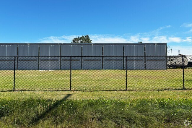
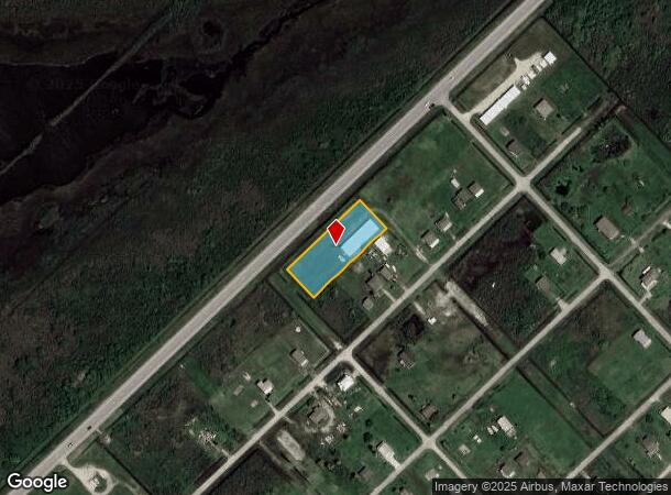
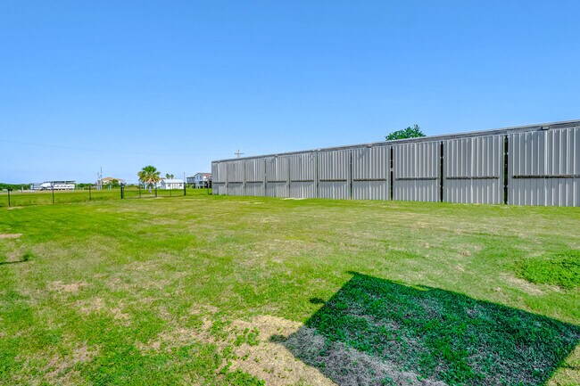
2024 Highway 87
Houston-The Woodlands-Sugar Land, TX
Port Bolivar Townsite
5960-0502-0013-000
ABST 162 S PARR SUR SO 120 FT OF LOTS 13 THRU 24 BLK 502 PORT BOLIVAR TOWNSITE
Commercialnec
Galveston
VE
Texas
48167C0295G
13-24
2024
0.85 AC
2025
East-Southeast Far
723900
Houston
5,120 SF
DEMOGRAPHICS near 2024 Highway 87
1 Mile
3 Mile
5 Mile
2024 Total Population
262
393
6,649
2029 Population
259
389
7,217
Pop Growth 2024-2029
(1.15%)
(1.02%)
+ 8.54%
Average Age
47
47
43
2024 Total Households
112
168
3,300
HH Growth 2024-2029
(0.89%)
(1.19%)
+ 9.61%
Median Household Inc
$80,803
$80,523
$51,126
Avg Household Size
2.20
2.20
1.80
2024 Avg HH Vehicles
2.00
2.00
1.00
Median Home Value
$385,134
$383,928
$384,817
Median Year Built
1977
1976
1975
Nearby Places
- Restaurants
- Banks
- Shops
- Fitness
- Groceries
SALE & LEASE HISTORY
LISTING DATE
SALE/LEASE

Jan 06, 2025
For Sale
Nearby Properties
Address
Land Use
TOTAL SIZE
Lot Size
Zoning
Address
Land Use
TOTAL SIZE
Lot Size
Zoning
3,260 SF
96.20 AC
Address
Land Use
TOTAL SIZE
Lot Size
Zoning
15,050 SF
25.62 AC
Address
Land Use
TOTAL SIZE
Lot Size
Zoning
20 SF
1.50 AC
Address
Land Use
TOTAL SIZE
Lot Size
Zoning
5,522 SF
8.08 AC
Address
Land Use
TOTAL SIZE
Lot Size
Zoning
4,208 SF
8.03 AC
Address
Land Use
TOTAL SIZE
Lot Size
Zoning
7,480 SF
0.50 AC
Address
Land Use
TOTAL SIZE
Lot Size
Zoning
Address
Land Use
TOTAL SIZE
Lot Size
Zoning
2,892 SF
1.90 AC
Address
Land Use
TOTAL SIZE
Lot Size
Zoning
5,390 SF
1.33 AC
Address
Land Use
TOTAL SIZE
Lot Size
Zoning
12,356 SF
0.92 AC
Address
Land Use
TOTAL SIZE
Lot Size
Zoning
Address
Land Use
TOTAL SIZE
Lot Size
Zoning
Address
Land Use
TOTAL SIZE
Lot Size
Zoning
Address
Land Use
TOTAL SIZE
Lot Size
Zoning
Address
Land Use
TOTAL SIZE
Lot Size
Zoning
Address
Land Use
TOTAL SIZE
Lot Size
Zoning
Address
Land Use
TOTAL SIZE
Lot Size
Zoning
Address
Land Use
TOTAL SIZE
Lot Size
Zoning
Address
Land Use
TOTAL SIZE
Lot Size
Zoning
Address
Land Use
TOTAL SIZE
Lot Size
Zoning
Address
Land Use
TOTAL SIZE
Lot Size
Zoning
Address
Land Use
TOTAL SIZE
Lot Size
Zoning
Address
Land Use
TOTAL SIZE
Lot Size
Zoning
Address
Land Use
TOTAL SIZE
Lot Size
Zoning
Address
Land Use
TOTAL SIZE
Lot Size
Zoning
2,471 SF
0.35 AC
Address
Land Use
TOTAL SIZE
Lot Size
Zoning
Address
Land Use
TOTAL SIZE
Lot Size
Zoning
Address
Land Use
TOTAL SIZE
Lot Size
Zoning
Address
Land Use
TOTAL SIZE
Lot Size
Zoning
Address
Land Use
TOTAL SIZE
Lot Size
Zoning
The World's #1 Commercial Real Estate Marketplace
Connect with us
© 2025 CoStar Group
The information above has been obtained from sources believed reliable. While we do not doubt its accuracy we have not verified it and make no guarantee, warranty or representation about it. It is your responsibility to independently confirm its accuracy and completeness. Any projections, opinions, assumptions, or estimates used are for example only and do not represent the current or future performance of the property. The value of this transaction to you depends on tax and other factors which should be evaluated by your tax, financial, and legal advisors. You and your advisors should conduct a careful, independent investigation of the property to determine to your satisfaction the suitability of the property for your needs.