Property Record
2025 Art Museum Dr, Jacksonville, FL 32207

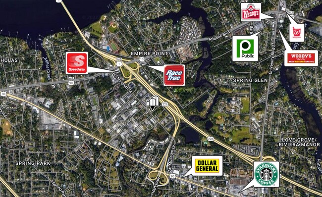
NEARBY LISTINGS FOR SALE OR LEASE
Property Detail
2025 Art Museum Dr
Jacksonville, FL
Valencia
136758-0000
11-22 29-2S-27E VALENCIA LOT 1 BLK 2
Sfr
Duval
X
Florida
12031C0386J
1
2024
0.12 AC
2025
Southside
015701
Jacksonville (Florida)
1,608 SF
DEMOGRAPHICS near 2025 Art Museum Dr
1 Mile
3 Mile
5 Mile
2024 Total Population
9,725
82,819
222,237
2029 Population
10,388
87,343
234,223
Pop Growth 2024-2029
+ 6.82%
+ 5.46%
+ 5.39%
Average Age
38
39
38
2024 Total Households
4,170
34,667
92,732
HH Growth 2024-2029
+ 6.86%
+ 5.74%
+ 5.65%
Median Household Inc
$42,347
$47,198
$48,099
Avg Household Size
2.30
2.30
2.20
2024 Avg HH Vehicles
1.00
1.00
1.00
Median Home Value
$255,113
$206,800
$201,712
Median Year Built
1969
1968
1972
Nearby Places
Map Layers
Map Styles
 Street
 Aerial
- Restaurants
- Banks
- Shops
- Fitness
- Groceries
PUBLIC TRANSPORTATION
AIRPORT
Jacksonville International
DRIVE
WALK
Distance
Jacksonville International
30 min
18.7 mi
Freight Ports
Jacksonville Port
DRIVE
WALK
Distance
Jacksonville Port
11 min
5.5 mi
SALE & LEASE HISTORY
LISTING DATE
SALE/LEASE

May 31, 2022
For Sale
Nearby Properties
Address
Land Use
TOTAL SIZE
Lot Size
Zoning
Address
Land Use
TOTAL SIZE
Lot Size
Zoning
1,150,143 SF
43.90 AC
CCBD
Address
Land Use
TOTAL SIZE
Lot Size
Zoning
442,972 SF
5.33 AC
PUD
Address
Land Use
TOTAL SIZE
Lot Size
Zoning
165,408 SF
2.45 AC
CCBD
Address
Land Use
TOTAL SIZE
Lot Size
Zoning
875,866 SF
22.33 AC
PBF-3
Address
Land Use
TOTAL SIZE
Lot Size
Zoning
521,850 SF
10.06 AC
CCBD
Address
Land Use
TOTAL SIZE
Lot Size
Zoning
831,560 SF
1.16 AC
PUD
Address
Land Use
TOTAL SIZE
Lot Size
Zoning
257,667 SF
3.91 AC
CCBD
Address
Land Use
TOTAL SIZE
Lot Size
Zoning
224,600 SF
3.41 AC
PUD
Address
Land Use
TOTAL SIZE
Lot Size
Zoning
565,202 SF
33.92 AC
RMD-D
Address
Land Use
TOTAL SIZE
Lot Size
Zoning
453,728 SF
8.20 AC
CCBD
Address
Land Use
TOTAL SIZE
Lot Size
Zoning
194,877 SF
11.64 AC
CCBD
Address
Land Use
TOTAL SIZE
Lot Size
Zoning
253,858 SF
4.93 AC
PUD
Address
Land Use
TOTAL SIZE
Lot Size
Zoning
146,636 SF
2.88 AC
CCBD
Address
Land Use
TOTAL SIZE
Lot Size
Zoning
270,000 SF
8.90 AC
PUD
Address
Land Use
TOTAL SIZE
Lot Size
Zoning
229,284 SF
7.24 AC
PUD
Address
Land Use
TOTAL SIZE
Lot Size
Zoning
335,832 SF
6.67 AC
PBF-2
Address
Land Use
TOTAL SIZE
Lot Size
Zoning
211,073 SF
8.99 AC
PUD
Address
Land Use
TOTAL SIZE
Lot Size
Zoning
189,151 SF
3.56 AC
PUD
Address
Land Use
TOTAL SIZE
Lot Size
Zoning
203,763 SF
9.97 AC
PUD
Address
Land Use
TOTAL SIZE
Lot Size
Zoning
430,668 SF
27.20 AC
RMD-D
Address
Land Use
TOTAL SIZE
Lot Size
Zoning
155,495 SF
3.01 AC
CCBD
Address
Land Use
TOTAL SIZE
Lot Size
Zoning
410,225 SF
22.11 AC
PUD
Address
Land Use
TOTAL SIZE
Lot Size
Zoning
181,522 SF
6.56 AC
PUD
Address
Land Use
TOTAL SIZE
Lot Size
Zoning
304,461 SF
62.44 AC
PBF-2
Address
Land Use
TOTAL SIZE
Lot Size
Zoning
187,581 SF
3.13 AC
PUD
Address
Land Use
TOTAL SIZE
Lot Size
Zoning
23,689 SF
19.97 AC
CCBD
Address
Land Use
TOTAL SIZE
Lot Size
Zoning
93,059 SF
8.54 AC
CCG-2
Address
Land Use
TOTAL SIZE
Lot Size
Zoning
268,892 SF
3.75 AC
CCBD
Address
Land Use
TOTAL SIZE
Lot Size
Zoning
436,458 SF
6.94 AC
PUD
Address
Land Use
TOTAL SIZE
Lot Size
Zoning
379,026 SF
24.02 AC
PUD
The World's #1 Commercial Real Estate Marketplace
Connect with us
© 2026 CoStar Group
The information above has been obtained from sources believed reliable. While we do not doubt its accuracy we have not verified it and make no guarantee, warranty or representation about it. It is your responsibility to independently confirm its accuracy and completeness. Any projections, opinions, assumptions, or estimates used are for example only and do not represent the current or future performance of the property. The value of this transaction to you depends on tax and other factors which should be evaluated by your tax, financial, and legal advisors. You and your advisors should conduct a careful, independent investigation of the property to determine to your satisfaction the suitability of the property for your needs.