Property Record
2025 Euler Rd, Brighton, MI 48114


Property Detail
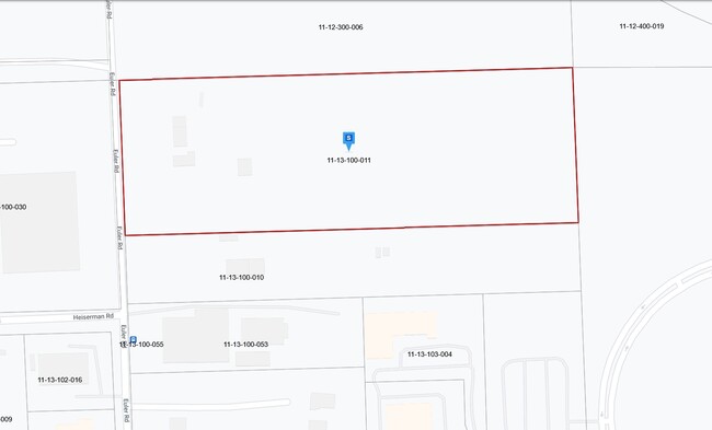
2025 Euler Rd
11-13-100-011
SEC. 13 T2N, R5E, N 20 A OF E 1/2 OF NW 1/4 EXC. S 200 FT. THEREOF
Commercialnec
Livingston
IND
Michigan
A Areas with a 1% annual chance of flooding and a 26% chance of flooding over the life of a 30-year mortgage.
14 AC
2024
Livingston County
2024
Detroit
742201
Detroit-Warren-Dearborn, MI
1,920 SF
NEARBY LISTINGS FOR SALE OR LEASE
DEMOGRAPHICS near 2025 Euler Rd
1 mile
3 mile
5 mile
2025 Total Population
3,065
18,463
56,414
2030 Population
3,112
18,706
56,965
Pop Growth 2025-2030
+ 1.53%
+ 1.32%
+ 0.98%
Average Age
48
45
44
2025 Total Households
1,384
7,606
22,268
HH Growth 2025-2030
+ 1.66%
+ 1.46%
+ 1.07%
Median Household Inc
$77,376
$101,076
$111,086
Avg Household Size
2.20
2.40
2.50
2025 Avg HH Vehicles
2.00
2.00
2.00
Median Home Value
$224,855
$371,064
$388,624
Median Year Built
1993
1990
1991
Nearby Places
Map Layers
Map Styles
 Street
 Aerial
Transit
 Traffic
 Biking
Places
Listings with unknown addresses are not visible on the map
- Restaurants
- Banks
- Shops
- Fitness
- Groceries
PUBLIC TRANSPORTATION
AIRPORT
Bishop International
Drive
Walk
Distance
Bishop International
54 min
39.0 mi
Detroit Metro Wayne County
Drive
Walk
Distance
Detroit Metro Wayne County
60 min
47.7 mi
SALE & LEASE HISTORY
LISTING DATE
SALE/LEASE

Sep 24, 2016
For Sale
Nearby Properties
Address
Land Use
TOTAL SIZE
Lot Size
Zoning
Address
Land Use
TOTAL SIZE
Lot Size
Zoning
222,504 SF
25.60 AC
C1
Address
Land Use
TOTAL SIZE
Lot Size
Zoning
4.30 AC
R5
Address
Land Use
TOTAL SIZE
Lot Size
Zoning
304,566 SF
27.31 AC
C1
Address
Land Use
TOTAL SIZE
Lot Size
Zoning
172,817 SF
7.87 AC
OS
Address
Land Use
TOTAL SIZE
Lot Size
Zoning
142,190 SF
23.24 AC
R4
Address
Land Use
TOTAL SIZE
Lot Size
Zoning
173,509 SF
18.06 AC
R-M
Address
Land Use
TOTAL SIZE
Lot Size
Zoning
240,114 SF
18.91 AC
R-M
Address
Land Use
TOTAL SIZE
Lot Size
Zoning
134,148 SF
11.43 AC
IA
Address
Land Use
TOTAL SIZE
Lot Size
Zoning
53,494 SF
10 AC
MUPUD
Address
Land Use
TOTAL SIZE
Lot Size
Zoning
124,157 SF
13.27 AC
OR
Address
Land Use
TOTAL SIZE
Lot Size
Zoning
110,602 SF
18.63 AC
R-M
Address
Land Use
TOTAL SIZE
Lot Size
Zoning
113,038 SF
9.73 AC
OR
Address
Land Use
TOTAL SIZE
Lot Size
Zoning
5,947 SF
104.68 AC
MHP
Address
Land Use
TOTAL SIZE
Lot Size
Zoning
80,573 SF
13.72 AC
OR
Address
Land Use
TOTAL SIZE
Lot Size
Zoning
19.60 AC
OR
Address
Land Use
TOTAL SIZE
Lot Size
Zoning
100,326 SF
8.61 AC
R4
Address
Land Use
TOTAL SIZE
Lot Size
Zoning
6 AC
R4
Address
Land Use
TOTAL SIZE
Lot Size
Zoning
41,261 SF
1.72 AC
OS
Address
Land Use
TOTAL SIZE
Lot Size
Zoning
5 AC
R4
Address
Land Use
TOTAL SIZE
Lot Size
Zoning
27,605 SF
3.82 AC
R-M
Address
Land Use
TOTAL SIZE
Lot Size
Zoning
51,408 SF
5.40 AC
OR
Address
Land Use
TOTAL SIZE
Lot Size
Zoning
25,337 SF
6.53 AC
OR
Address
Land Use
TOTAL SIZE
Lot Size
Zoning
51.99 AC
MHP
Address
Land Use
TOTAL SIZE
Lot Size
Zoning
39,260 SF
5.52 AC
R3
Address
Land Use
TOTAL SIZE
Lot Size
Zoning
30,954 SF
1.91 AC
CD-RZ
Address
Land Use
TOTAL SIZE
Lot Size
Zoning
55,341 SF
3.24 AC
IA
Address
Land Use
TOTAL SIZE
Lot Size
Zoning
44,348 SF
217.14 AC
PRF
Address
Land Use
TOTAL SIZE
Lot Size
Zoning
39,778 SF
10 AC
NSD
Address
Land Use
TOTAL SIZE
Lot Size
Zoning
59,526 SF
4.72 AC
OR
Address
Land Use
TOTAL SIZE
Lot Size
Zoning
66,582 SF
7.10 AC
PID
The World's #1 Commercial Real Estate Marketplace
Connect with us
© 2026 CoStar Group
The information above has been obtained from sources believed reliable. While we do not doubt its accuracy we have not verified it and make no guarantee, warranty or representation about it. It is your responsibility to independently confirm its accuracy and completeness. Any projections, opinions, assumptions, or estimates used are for example only and do not represent the current or future performance of the property. The value of this transaction to you depends on tax and other factors which should be evaluated by your tax, financial, and legal advisors. You and your advisors should conduct a careful, independent investigation of the property to determine to your satisfaction the suitability of the property for your needs.