Property Record
2025 Hunter Rd, New Braunfels, TX 78132
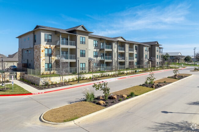


Property Detail
2025 Hunter Rd
San Antonio-New Braunfels, TX
GRUENEFIELD 1, BLOCK 1, LOT 3
20-0271-0114-00
COMAL
Commercialnec
Texas
2024
3
2025
13.13 AC
310905
Outer Comal
271,410 SF
San Antonio
NEARBY LISTINGS FOR SALE OR LEASE
-
-
View all New Braunfels listings for sale on LoopNet.com
DEMOGRAPHICS near 2025 Hunter Rd
1 mile
3 mile
5 mile
2025 Total Population
4,811
34,874
84,458
2030 Population
5,703
41,366
99,332
Pop Growth 2025-2030
+ 18.54%
+ 18.62%
+ 17.61%
Average Age
43
39
40
2025 Total Households
2,110
14,203
33,134
HH Growth 2025-2030
+ 18.67%
+ 18.74%
+ 17.79%
Median Household Inc
$76,971
$76,661
$84,606
Avg Household Size
2.20
2.40
2.50
2025 Avg HH Vehicles
2.00
2.00
2.00
Median Home Value
$464,999
$365,022
$390,834
Median Year Built
2009
2010
2006
Nearby Places
Map Layers
Map Styles
 Street
 Aerial
Layers
 Traffic
 Biking
Places
Listings with unknown addresses are not visible on the map
- Restaurants
- Banks
- Shops
- Fitness
- Groceries
PUBLIC TRANSPORTATION
AIRPORT
San Antonio International
Drive
Walk
Distance
San Antonio International
39 min
31.6 mi
Freight Ports
Calhoun Port
Drive
Walk
Distance
Calhoun Port
173 min
146.6 mi
Nearby Properties
Address
Land Use
TOTAL SIZE
Lot Size
Zoning
Address
Land Use
TOTAL SIZE
Lot Size
Zoning
396,438 SF
55.62 AC
Address
Land Use
TOTAL SIZE
Lot Size
Zoning
458,447 SF
19 AC
Address
Land Use
TOTAL SIZE
Lot Size
Zoning
350,595 SF
21.78 AC
Address
Land Use
TOTAL SIZE
Lot Size
Zoning
331,273 SF
14.02 AC
Address
Land Use
TOTAL SIZE
Lot Size
Zoning
464,934 SF
12.95 AC
Address
Land Use
TOTAL SIZE
Lot Size
Zoning
538,760 SF
21.01 AC
Address
Land Use
TOTAL SIZE
Lot Size
Zoning
292,822 SF
12.29 AC
Address
Land Use
TOTAL SIZE
Lot Size
Zoning
352,688 SF
23.58 AC
Address
Land Use
TOTAL SIZE
Lot Size
Zoning
Address
Land Use
TOTAL SIZE
Lot Size
Zoning
381,528 SF
82.50 AC
Address
Land Use
TOTAL SIZE
Lot Size
Zoning
414,220 SF
11.56 AC
Address
Land Use
TOTAL SIZE
Lot Size
Zoning
314,265 SF
10.10 AC
Address
Land Use
TOTAL SIZE
Lot Size
Zoning
325,518 SF
12.97 AC
Address
Land Use
TOTAL SIZE
Lot Size
Zoning
48,548 SF
125 AC
Address
Land Use
TOTAL SIZE
Lot Size
Zoning
319,423 SF
14.59 AC
Address
Land Use
TOTAL SIZE
Lot Size
Zoning
304,441 SF
17.46 AC
Address
Land Use
TOTAL SIZE
Lot Size
Zoning
261,155 SF
11.57 AC
Address
Land Use
TOTAL SIZE
Lot Size
Zoning
269,288 SF
16.32 AC
Address
Land Use
TOTAL SIZE
Lot Size
Zoning
Address
Land Use
TOTAL SIZE
Lot Size
Zoning
146,400 SF
17.36 AC
Address
Land Use
TOTAL SIZE
Lot Size
Zoning
282,995 SF
21.83 AC
Address
Land Use
TOTAL SIZE
Lot Size
Zoning
238,683 SF
9.42 AC
Address
Land Use
TOTAL SIZE
Lot Size
Zoning
257,960 SF
8.85 AC
Address
Land Use
TOTAL SIZE
Lot Size
Zoning
163,226 SF
29.14 AC
Address
Land Use
TOTAL SIZE
Lot Size
Zoning
152,240 SF
14.13 AC
Address
Land Use
TOTAL SIZE
Lot Size
Zoning
116,316 SF
12.21 AC
Address
Land Use
TOTAL SIZE
Lot Size
Zoning
170,019 SF
4.46 AC
Address
Land Use
TOTAL SIZE
Lot Size
Zoning
3,937 SF
87.21 AC
Address
Land Use
TOTAL SIZE
Lot Size
Zoning
179,869 SF
10 AC
The World's #1 Commercial Real Estate Marketplace
Connect with us
© 2026 CoStar Group
The information above has been obtained from sources believed reliable. While we do not doubt its accuracy we have not verified it and make no guarantee, warranty or representation about it. It is your responsibility to independently confirm its accuracy and completeness. Any projections, opinions, assumptions, or estimates used are for example only and do not represent the current or future performance of the property. The value of this transaction to you depends on tax and other factors which should be evaluated by your tax, financial, and legal advisors. You and your advisors should conduct a careful, independent investigation of the property to determine to your satisfaction the suitability of the property for your needs.