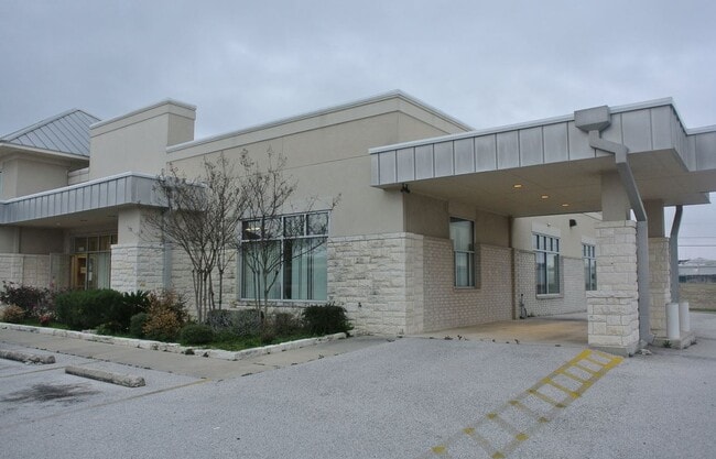
Property Record
2025 Memory Ln, Harker Heights, TX 76548

Current Lease Availabilities
Property Detail
2025 Memory Ln
Killeen-Temple, TX
JOSHUAS CROSSING, BLOCK 001, LOT 0002, ACRES 1.489
364600
Bell
Commercialnec
Texas
B and X Area of moderate flood hazard, usually the area between the limits of the 100-year and 500-year floods.
2
2025
1.49 AC
2025
Outlying Bell County
021905
Killeen/Temple/Fort Hood
11,981 SF
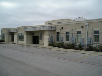
NEARBY LISTINGS FOR SALE OR LEASE
DEMOGRAPHICS near 2025 Memory Ln
1 mile
3 mile
5 mile
2025 Total Population
8,803
66,761
146,596
2030 Population
9,238
70,467
155,522
Pop Growth 2025-2030
+ 4.94%
+ 5.55%
+ 6.09%
Average Age
37
35
35
2025 Total Households
3,037
23,931
54,844
HH Growth 2025-2030
+ 5.17%
+ 5.67%
+ 6.24%
Median Household Inc
$83,774
$74,068
$65,759
Avg Household Size
2.80
2.70
2.60
2025 Avg HH Vehicles
2.00
2.00
2.00
Median Home Value
$278,756
$276,290
$245,630
Median Year Built
1997
2000
1994
Nearby Places
Map Layers
Map Styles
 Street
 Aerial
Transit
 Traffic
 Biking
Places
Listings with unknown addresses are not visible on the map
- Restaurants
- Banks
- Shops
- Fitness
- Groceries
PUBLIC TRANSPORTATION
AIRPORT
Killeen Municipal
Drive
Walk
Distance
Killeen Municipal
6 min
2.5 mi
Robert Gray AAF
Drive
Walk
Distance
Robert Gray AAF
27 min
16.4 mi
Nearby Properties
Address
Land Use
TOTAL SIZE
Lot Size
Zoning
Address
Land Use
TOTAL SIZE
Lot Size
Zoning
194,952 SF
38.61 AC
Address
Land Use
TOTAL SIZE
Lot Size
Zoning
233,780 SF
45.21 AC
Address
Land Use
TOTAL SIZE
Lot Size
Zoning
233,807 SF
16.12 AC
Address
Land Use
TOTAL SIZE
Lot Size
Zoning
Address
Land Use
TOTAL SIZE
Lot Size
Zoning
200,345 SF
42.44 AC
CUP
Address
Land Use
TOTAL SIZE
Lot Size
Zoning
464,093 SF
71.50 AC
Address
Land Use
TOTAL SIZE
Lot Size
Zoning
133,210 SF
8.52 AC
R-3
Address
Land Use
TOTAL SIZE
Lot Size
Zoning
1 SF
18.38 AC
Address
Land Use
TOTAL SIZE
Lot Size
Zoning
152,304 SF
68.80 AC
Address
Land Use
TOTAL SIZE
Lot Size
Zoning
160,143 SF
13.30 AC
Address
Land Use
TOTAL SIZE
Lot Size
Zoning
1 SF
30 AC
Address
Land Use
TOTAL SIZE
Lot Size
Zoning
154,910 SF
9.38 AC
Address
Land Use
TOTAL SIZE
Lot Size
Zoning
157,552 SF
9.61 AC
Address
Land Use
TOTAL SIZE
Lot Size
Zoning
146,182 SF
8.59 AC
Address
Land Use
TOTAL SIZE
Lot Size
Zoning
386,344 SF
171.40 AC
B-5
Address
Land Use
TOTAL SIZE
Lot Size
Zoning
132,202 SF
11.52 AC
R-3
Address
Land Use
TOTAL SIZE
Lot Size
Zoning
89,117 SF
5.31 AC
Address
Land Use
TOTAL SIZE
Lot Size
Zoning
133,648 SF
6.52 AC
Address
Land Use
TOTAL SIZE
Lot Size
Zoning
62,226 SF
0.68 AC
Address
Land Use
TOTAL SIZE
Lot Size
Zoning
121,285 SF
11.75 AC
Address
Land Use
TOTAL SIZE
Lot Size
Zoning
41,832 SF
4.30 AC
Address
Land Use
TOTAL SIZE
Lot Size
Zoning
210,437 SF
19.98 AC
Address
Land Use
TOTAL SIZE
Lot Size
Zoning
120,948 SF
32.68 AC
Address
Land Use
TOTAL SIZE
Lot Size
Zoning
2,233 SF
29.99 AC
Address
Land Use
TOTAL SIZE
Lot Size
Zoning
72,368 SF
9.34 AC
Address
Land Use
TOTAL SIZE
Lot Size
Zoning
1 SF
24.80 AC
Address
Land Use
TOTAL SIZE
Lot Size
Zoning
91,475 SF
11.33 AC
Address
Land Use
TOTAL SIZE
Lot Size
Zoning
112,176 SF
4.28 AC
Address
Land Use
TOTAL SIZE
Lot Size
Zoning
141,654 SF
31.81 AC
Address
Land Use
TOTAL SIZE
Lot Size
Zoning
1 SF
13.02 AC
The World's #1 Commercial Real Estate Marketplace
Connect with us
© 2026 CoStar Group
The information above has been obtained from sources believed reliable. While we do not doubt its accuracy we have not verified it and make no guarantee, warranty or representation about it. It is your responsibility to independently confirm its accuracy and completeness. Any projections, opinions, assumptions, or estimates used are for example only and do not represent the current or future performance of the property. The value of this transaction to you depends on tax and other factors which should be evaluated by your tax, financial, and legal advisors. You and your advisors should conduct a careful, independent investigation of the property to determine to your satisfaction the suitability of the property for your needs.