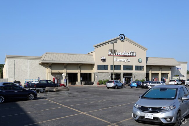
Property Record
2025 W Ben White Blvd, Austin, TX 78704


NEARBY LISTINGS FOR SALE OR LEASE
-
-
-
-
-
-
-
-
-
-
-
-
-
-
No Photo
-
View all Austin listings for sale on LoopNet.com
Property Detail
2025 W Ben White Blvd
Austin-Round Rock, TX
Safeway Addn No 12
509200
LOT 1 SAFEWAY ADDN NO 12
Supermarket
Travis
X
Texas
48453C0585H
1
2024
3.27 AC
2025
South
030300
Austin
41,755 SF
DEMOGRAPHICS near 2025 W Ben White Blvd
1 Mile
3 Mile
5 Mile
2024 Total Population
17,919
124,685
346,412
2029 Population
19,449
135,496
375,811
Pop Growth 2024-2029
+ 8.54%
+ 8.67%
+ 8.49%
Average Age
38
38
36
2024 Total Households
9,139
60,408
157,236
HH Growth 2024-2029
+ 9.21%
+ 9.37%
+ 9.48%
Median Household Inc
$71,138
$80,470
$79,833
Avg Household Size
1.80
2.00
2.10
2024 Avg HH Vehicles
1.00
2.00
2.00
Median Home Value
$539,352
$551,170
$500,486
Median Year Built
1982
1987
1994
Nearby Places
Map Layers
Map Styles
 Street
 Aerial
- Restaurants
- Banks
- Shops
- Fitness
- Groceries
PUBLIC TRANSPORTATION
COMMUTER RAIL
Austin (Texas Eagle - Amtrak)
DRIVE
WALK
Distance
Austin (Texas Eagle - Amtrak)
10 min
4.0 mi
AIRPORT
Austin-Bergstrom International
DRIVE
WALK
Distance
Austin-Bergstrom International
21 min
10.5 mi
Freight Ports
Calhoun Port
DRIVE
WALK
Distance
Calhoun Port
187 min
153.9 mi
Nearby Properties
Address
Land Use
TOTAL SIZE
Lot Size
Zoning
Address
Land Use
TOTAL SIZE
Lot Size
Zoning
498,684 SF
61.86 AC
Address
Land Use
TOTAL SIZE
Lot Size
Zoning
Address
Land Use
TOTAL SIZE
Lot Size
Zoning
881,940 SF
80.11 AC
Address
Land Use
TOTAL SIZE
Lot Size
Zoning
8,213 SF
36.95 AC
Address
Land Use
TOTAL SIZE
Lot Size
Zoning
442,023 SF
8.97 AC
Address
Land Use
TOTAL SIZE
Lot Size
Zoning
368,349 SF
17.13 AC
Address
Land Use
TOTAL SIZE
Lot Size
Zoning
456,650 SF
15 AC
Address
Land Use
TOTAL SIZE
Lot Size
Zoning
551,881 SF
34.85 AC
Address
Land Use
TOTAL SIZE
Lot Size
Zoning
300,530 SF
3.62 AC
Address
Land Use
TOTAL SIZE
Lot Size
Zoning
413,880 SF
30.21 AC
Address
Land Use
TOTAL SIZE
Lot Size
Zoning
316,847 SF
10.35 AC
Address
Land Use
TOTAL SIZE
Lot Size
Zoning
342,956 SF
6.15 AC
Address
Land Use
TOTAL SIZE
Lot Size
Zoning
69.49 AC
Address
Land Use
TOTAL SIZE
Lot Size
Zoning
539,533 SF
26.50 AC
Address
Land Use
TOTAL SIZE
Lot Size
Zoning
398,436 SF
30.81 AC
Address
Land Use
TOTAL SIZE
Lot Size
Zoning
432,404 SF
37.29 AC
Address
Land Use
TOTAL SIZE
Lot Size
Zoning
386,952 SF
6.77 AC
Address
Land Use
TOTAL SIZE
Lot Size
Zoning
401,771 SF
59.77 AC
Address
Land Use
TOTAL SIZE
Lot Size
Zoning
198,532 SF
2.06 AC
Address
Land Use
TOTAL SIZE
Lot Size
Zoning
324,860 SF
8.36 AC
Address
Land Use
TOTAL SIZE
Lot Size
Zoning
425,720 SF
28.49 AC
Address
Land Use
TOTAL SIZE
Lot Size
Zoning
263,050 SF
4.04 AC
Address
Land Use
TOTAL SIZE
Lot Size
Zoning
256,182 SF
3.63 AC
Address
Land Use
TOTAL SIZE
Lot Size
Zoning
281,588 SF
6.29 AC
Address
Land Use
TOTAL SIZE
Lot Size
Zoning
258,637 SF
3.03 AC
Address
Land Use
TOTAL SIZE
Lot Size
Zoning
270,600 SF
3.90 AC
Address
Land Use
TOTAL SIZE
Lot Size
Zoning
404,812 SF
31.32 AC
Address
Land Use
TOTAL SIZE
Lot Size
Zoning
366,275 SF
39.95 AC
Address
Land Use
TOTAL SIZE
Lot Size
Zoning
372,125 SF
26.22 AC
Address
Land Use
TOTAL SIZE
Lot Size
Zoning
9.80 AC
The World's #1 Commercial Real Estate Marketplace
Connect with us
© 2025 CoStar Group
The information above has been obtained from sources believed reliable. While we do not doubt its accuracy we have not verified it and make no guarantee, warranty or representation about it. It is your responsibility to independently confirm its accuracy and completeness. Any projections, opinions, assumptions, or estimates used are for example only and do not represent the current or future performance of the property. The value of this transaction to you depends on tax and other factors which should be evaluated by your tax, financial, and legal advisors. You and your advisors should conduct a careful, independent investigation of the property to determine to your satisfaction the suitability of the property for your needs.