Property Record
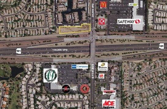
20251 N 67Th Ave, Glendale, AZ 85308
Property Detail
20251 N 67Th Ave
200-21-957
S 645F OF E 642.46F SE4 SEC 24 EX E 55F RD & EX S 45F RD & EX RD P/F 87-241910 & EX RD DAF COM SE COR SD SEC TH N 577.06F TH W 72.70F TO POB TH S 84D 25MW 642.46F TH N 118.15F TO A PT TH E 642.46F TH E 574.27F TH S 645F TH S 3D 50M W 67.51F TO POB
Residentialacreage
MARICOPA
M-M
Arizona
C and X Area of minimal flood hazard, usually depicted on FIRMs as above the 500-year flood level.
0.17 AC
2025
Arrowhead
2025
Phoenix
614200
Phoenix-Mesa-Chandler, AZ
NEARBY LISTINGS FOR SALE OR LEASE
DEMOGRAPHICS near 20251 N 67Th Ave
1 mile
3 mile
5 mile
2025 Total Population
14,818
91,720
276,380
2030 Population
15,262
94,802
286,034
Pop Growth 2025-2030
+ 3.00%
+ 3.36%
+ 3.49%
Average Age
41
42
42
2025 Total Households
5,847
34,716
105,314
HH Growth 2025-2030
+ 3.03%
+ 3.46%
+ 3.58%
Median Household Inc
$108,101
$107,455
$98,790
Avg Household Size
2.50
2.50
2.50
2025 Avg HH Vehicles
2.00
2.00
2.00
Median Home Value
$588,645
$503,329
$470,061
Median Year Built
1994
1994
1992
Nearby Places
Map Layers
Map Styles
 Street
 Aerial
Layers
 Traffic
 Biking
Places
Listings with unknown addresses are not visible on the map
- Restaurants
- Banks
- Shops
- Fitness
- Groceries
PUBLIC TRANSPORTATION
AIRPORT
Phoenix Sky Harbor International
Drive
Walk
Distance
Phoenix Sky Harbor International
39 min
27.9 mi
Freight Ports
Port of San Diego
Drive
Walk
Distance
Port of San Diego
401 min
360.1 mi
SALE & LEASE HISTORY
LISTING DATE
SALE/LEASE

Jul 17, 2018
For Sale
Nearby Properties
Address
Land Use
TOTAL SIZE
Lot Size
Zoning
Address
Land Use
TOTAL SIZE
Lot Size
Zoning
45,900 SF
11.09 AC
PAD
Address
Land Use
TOTAL SIZE
Lot Size
Zoning
1,360,424 SF
88.31 AC
C-BP
Address
Land Use
TOTAL SIZE
Lot Size
Zoning
7,916 SF
5.26 AC
C-C
Address
Land Use
TOTAL SIZE
Lot Size
Zoning
812,333 SF
31.75 AC
SR-30
Address
Land Use
TOTAL SIZE
Lot Size
Zoning
239,750 SF
85.34 AC
SR43
Address
Land Use
TOTAL SIZE
Lot Size
Zoning
4,500 SF
13.50 AC
PAD
Address
Land Use
TOTAL SIZE
Lot Size
Zoning
284,223 SF
10.02 AC
C-C
Address
Land Use
TOTAL SIZE
Lot Size
Zoning
708,928 SF
44.86 AC
Address
Land Use
TOTAL SIZE
Lot Size
Zoning
360,026 SF
74.94 AC
R-6
Address
Land Use
TOTAL SIZE
Lot Size
Zoning
0.47 AC
Address
Land Use
TOTAL SIZE
Lot Size
Zoning
235,399 SF
41.79 AC
M-M
Address
Land Use
TOTAL SIZE
Lot Size
Zoning
399,561 SF
16.30 AC
Address
Land Use
TOTAL SIZE
Lot Size
Zoning
291,137 SF
38.49 AC
AG
Address
Land Use
TOTAL SIZE
Lot Size
Zoning
226,169 SF
20.48 AC
Address
Land Use
TOTAL SIZE
Lot Size
Zoning
348,803 SF
15.91 AC
PAD
Address
Land Use
TOTAL SIZE
Lot Size
Zoning
133,377 SF
17.52 AC
PAD
Address
Land Use
TOTAL SIZE
Lot Size
Zoning
280,356 SF
12.73 AC
PAD
Address
Land Use
TOTAL SIZE
Lot Size
Zoning
440,494 SF
26.25 AC
PAD
Address
Land Use
TOTAL SIZE
Lot Size
Zoning
392,885 SF
17.67 AC
M-H
Address
Land Use
TOTAL SIZE
Lot Size
Zoning
126,781 SF
10.06 AC
C-C
Address
Land Use
TOTAL SIZE
Lot Size
Zoning
344,908 SF
20.69 AC
C-C
Address
Land Use
TOTAL SIZE
Lot Size
Zoning
126,814 SF
31.56 AC
R17
Address
Land Use
TOTAL SIZE
Lot Size
Zoning
244,979 SF
35.16 AC
C-BP
Address
Land Use
TOTAL SIZE
Lot Size
Zoning
200,658 SF
23.14 AC
C-BP
Address
Land Use
TOTAL SIZE
Lot Size
Zoning
245,400 SF
22.90 AC
PAD
Address
Land Use
TOTAL SIZE
Lot Size
Zoning
112,300 SF
13.72 AC
PAD
Address
Land Use
TOTAL SIZE
Lot Size
Zoning
319,723 SF
10.79 AC
PAD
Address
Land Use
TOTAL SIZE
Lot Size
Zoning
127,100 SF
3.57 AC
PAD
Address
Land Use
TOTAL SIZE
Lot Size
Zoning
96,016 SF
4.47 AC
PAD
Address
Land Use
TOTAL SIZE
Lot Size
Zoning
311,614 SF
19.03 AC
PAD
The World's #1 Commercial Real Estate Marketplace
Connect with us
© 2026 CoStar Group
The information above has been obtained from sources believed reliable. While we do not doubt its accuracy we have not verified it and make no guarantee, warranty or representation about it. It is your responsibility to independently confirm its accuracy and completeness. Any projections, opinions, assumptions, or estimates used are for example only and do not represent the current or future performance of the property. The value of this transaction to you depends on tax and other factors which should be evaluated by your tax, financial, and legal advisors. You and your advisors should conduct a careful, independent investigation of the property to determine to your satisfaction the suitability of the property for your needs.