Property Record
2026 Boston St Se, Grand Rapids, MI 49506
NEARBY LISTINGS FOR SALE OR LEASE
Property Detail
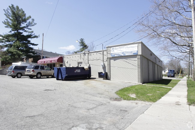
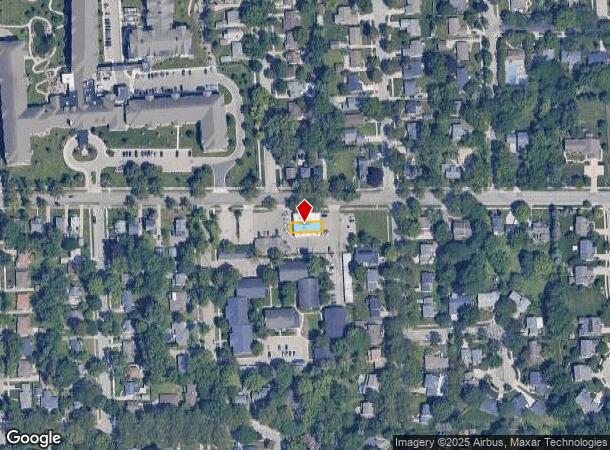
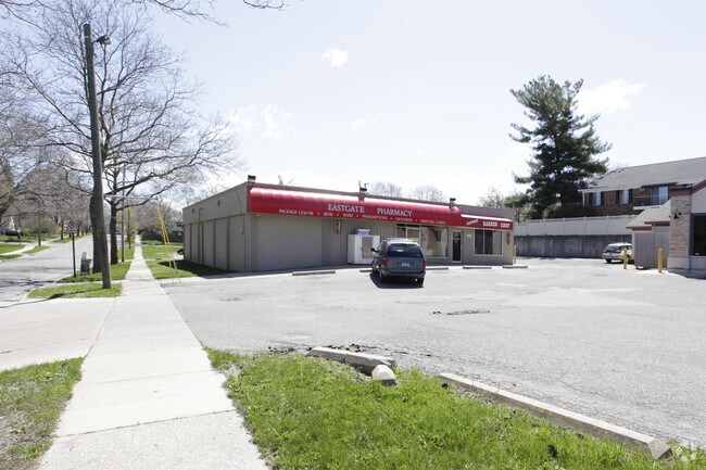
2026 Boston St Se
Grand Rapids-Wyoming, MI
Eastgate
41-18-04-401-003
PART OF LOT 20 COM AT A PT WHICH IS 24.8 FT S FROM N LINE & 81.15 FT W FROM E LINE OF SD LOT TH W LY 91 FT TO A PT WHICH IS
Supermarket
Kent
X
Michigan
26081C0436D
20
2024
0.06 AC
2025
Central Grand Rapids
003400
West Michigan
2,220 SF
DEMOGRAPHICS near 2026 Boston St Se
1 Mile
3 Mile
5 Mile
2024 Total Population
16,950
113,092
264,815
2029 Population
17,063
113,445
266,161
Pop Growth 2024-2029
+ 0.67%
+ 0.31%
+ 0.51%
Average Age
38
37
36
2024 Total Households
6,373
43,303
102,740
HH Growth 2024-2029
+ 0.64%
+ 0.32%
+ 0.58%
Median Household Inc
$99,533
$67,039
$62,702
Avg Household Size
2.60
2.50
2.40
2024 Avg HH Vehicles
2.00
2.00
2.00
Median Home Value
$282,295
$241,962
$214,252
Median Year Built
1955
1954
1960
Nearby Places
Map Layers
Map Styles
 Street
 Aerial
- Restaurants
- Banks
- Shops
- Fitness
- Groceries
PUBLIC TRANSPORTATION
COMMUTER RAIL
DRIVE
WALK
Distance
12 min
4.3 mi
AIRPORT
Gerald R Ford International
DRIVE
WALK
Distance
Gerald R Ford International
19 min
8.8 mi
Nearby Properties
Address
Land Use
TOTAL SIZE
Lot Size
Zoning
Address
Land Use
TOTAL SIZE
Lot Size
Zoning
563,998 SF
31.75 AC
C3
Address
Land Use
TOTAL SIZE
Lot Size
Zoning
446,986 SF
72.57 AC
R4
Address
Land Use
TOTAL SIZE
Lot Size
Zoning
521,735 SF
52.16 AC
MON-C
Address
Land Use
TOTAL SIZE
Lot Size
Zoning
126,805 SF
9.36 AC
C4
Address
Land Use
TOTAL SIZE
Lot Size
Zoning
151,708 SF
7.22 AC
C4
Address
Land Use
TOTAL SIZE
Lot Size
Zoning
250,170 SF
16.13 AC
R-1
Address
Land Use
TOTAL SIZE
Lot Size
Zoning
211,760 SF
TN-CC
Address
Land Use
TOTAL SIZE
Lot Size
Zoning
341,808 SF
27.73 AC
HC-PUD
Address
Land Use
TOTAL SIZE
Lot Size
Zoning
194,153 SF
15.84 AC
MCN-C
Address
Land Use
TOTAL SIZE
Lot Size
Zoning
1,426,319 SF
54.81 AC
SD-IT
Address
Land Use
TOTAL SIZE
Lot Size
Zoning
22.46 AC
MON-MDR
Address
Land Use
TOTAL SIZE
Lot Size
Zoning
19.40 AC
MON-MDR
Address
Land Use
TOTAL SIZE
Lot Size
Zoning
127,141 SF
17.04 AC
C2
Address
Land Use
TOTAL SIZE
Lot Size
Zoning
88,327 SF
2.74 AC
TN-CC
Address
Land Use
TOTAL SIZE
Lot Size
Zoning
138,278 SF
35.63 AC
R-1
Address
Land Use
TOTAL SIZE
Lot Size
Zoning
15.94 AC
MON-MDR
Address
Land Use
TOTAL SIZE
Lot Size
Zoning
97,263 SF
19.37 AC
MON-MDR
Address
Land Use
TOTAL SIZE
Lot Size
Zoning
13.71 AC
MCN-LDR
Address
Land Use
TOTAL SIZE
Lot Size
Zoning
16.91 AC
MON-MDR
Address
Land Use
TOTAL SIZE
Lot Size
Zoning
154,643 SF
10.96 AC
O-PUD
Address
Land Use
TOTAL SIZE
Lot Size
Zoning
146,732 SF
21.16 AC
R4
Address
Land Use
TOTAL SIZE
Lot Size
Zoning
17,671 SF
15.18 AC
MON-MDR
Address
Land Use
TOTAL SIZE
Lot Size
Zoning
158,883 SF
16.53 AC
MCN-LDR
Address
Land Use
TOTAL SIZE
Lot Size
Zoning
536,296 SF
26.16 AC
SD-IT
Address
Land Use
TOTAL SIZE
Lot Size
Zoning
209,417 SF
19.51 AC
C4
Address
Land Use
TOTAL SIZE
Lot Size
Zoning
225,504 SF
0.50 AC
TN-CC
Address
Land Use
TOTAL SIZE
Lot Size
Zoning
348,367 SF
12.15 AC
SD-IT
Address
Land Use
TOTAL SIZE
Lot Size
Zoning
159,721 SF
5.51 AC
C-1
Address
Land Use
TOTAL SIZE
Lot Size
Zoning
18.86 AC
MON-MDR
Address
Land Use
TOTAL SIZE
Lot Size
Zoning
105,029 SF
5.65 AC
C
The World's #1 Commercial Real Estate Marketplace
Connect with us
© 2025 CoStar Group
The information above has been obtained from sources believed reliable. While we do not doubt its accuracy we have not verified it and make no guarantee, warranty or representation about it. It is your responsibility to independently confirm its accuracy and completeness. Any projections, opinions, assumptions, or estimates used are for example only and do not represent the current or future performance of the property. The value of this transaction to you depends on tax and other factors which should be evaluated by your tax, financial, and legal advisors. You and your advisors should conduct a careful, independent investigation of the property to determine to your satisfaction the suitability of the property for your needs.