Property Record
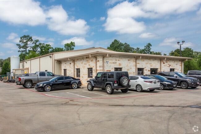
2027 Airport Rd, Conroe, TX 77301

NEARBY LISTINGS FOR SALE OR LEASE
Property Detail
2027 Airport Rd
0002-01-00417
Allen W S
Industrialgeneral
A0002 - ALLEN W S, TRACT 12, 13-A, 99-D (CHILDERS SUB P#2007015658 RES A), ACRES 2.824
X
Montgomery
48339C0385G
Texas
2024
2.82 AC
2025
Montgomery County
693902
Houston
18,808 SF
Houston-The Woodlands-Sugar Land, TX
DEMOGRAPHICS near 2027 Airport Rd
1 Mile
3 Mile
5 Mile
2024 Total Population
5,276
41,062
90,128
2029 Population
6,466
50,038
110,468
Pop Growth 2024-2029
+ 22.55%
+ 21.86%
+ 22.57%
Average Age
34
35
36
2024 Total Households
1,554
13,402
31,535
HH Growth 2024-2029
+ 22.78%
+ 23.01%
+ 23.16%
Median Household Inc
$76,484
$51,970
$63,771
Avg Household Size
3.10
2.80
2.70
2024 Avg HH Vehicles
2.00
2.00
2.00
Median Home Value
$230,446
$166,132
$241,887
Median Year Built
2009
1992
2000
Nearby Places
Map Layers
Map Styles
 Street
 Aerial
- Restaurants
- Banks
- Shops
- Fitness
- Groceries
PUBLIC TRANSPORTATION
AIRPORT
George Bush Intcntl/Houston
DRIVE
WALK
Distance
George Bush Intcntl/Houston
45 min
34.2 mi
Freight Ports
Port of Houston
DRIVE
WALK
Distance
Port of Houston
68 min
50.0 mi
Nearby Properties
Address
Land Use
TOTAL SIZE
Lot Size
Zoning
Address
Land Use
TOTAL SIZE
Lot Size
Zoning
322,082 SF
36.56 AC
1
Address
Land Use
TOTAL SIZE
Lot Size
Zoning
776,164 SF
71.74 AC
Address
Land Use
TOTAL SIZE
Lot Size
Zoning
165,071 SF
16.01 AC
Address
Land Use
TOTAL SIZE
Lot Size
Zoning
398,842 SF
23.75 AC
1
Address
Land Use
TOTAL SIZE
Lot Size
Zoning
619,770 SF
81.76 AC
Address
Land Use
TOTAL SIZE
Lot Size
Zoning
308,438 SF
14.35 AC
Address
Land Use
TOTAL SIZE
Lot Size
Zoning
361,388 SF
16.32 AC
Address
Land Use
TOTAL SIZE
Lot Size
Zoning
191,700 SF
19.41 AC
1
Address
Land Use
TOTAL SIZE
Lot Size
Zoning
366,709 SF
27.72 AC
Address
Land Use
TOTAL SIZE
Lot Size
Zoning
206,008 SF
107.61 AC
Address
Land Use
TOTAL SIZE
Lot Size
Zoning
211,275 SF
12.58 AC
Address
Land Use
TOTAL SIZE
Lot Size
Zoning
191,006 SF
9.19 AC
Address
Land Use
TOTAL SIZE
Lot Size
Zoning
142,800 SF
7.82 AC
Address
Land Use
TOTAL SIZE
Lot Size
Zoning
141,100 SF
25.34 AC
Address
Land Use
TOTAL SIZE
Lot Size
Zoning
62,296 SF
20.62 AC
Address
Land Use
TOTAL SIZE
Lot Size
Zoning
171,124 SF
9.03 AC
1
Address
Land Use
TOTAL SIZE
Lot Size
Zoning
75,048 SF
10.59 AC
Address
Land Use
TOTAL SIZE
Lot Size
Zoning
214,039 SF
20 AC
Address
Land Use
TOTAL SIZE
Lot Size
Zoning
123,674 SF
21.67 AC
Address
Land Use
TOTAL SIZE
Lot Size
Zoning
376,980 SF
24.37 AC
1
Address
Land Use
TOTAL SIZE
Lot Size
Zoning
242,944 SF
179.58 AC
Address
Land Use
TOTAL SIZE
Lot Size
Zoning
235,219 SF
40.03 AC
Address
Land Use
TOTAL SIZE
Lot Size
Zoning
332,274 SF
40 AC
Address
Land Use
TOTAL SIZE
Lot Size
Zoning
205,088 SF
79.14 AC
Address
Land Use
TOTAL SIZE
Lot Size
Zoning
221,890 SF
17.18 AC
Address
Land Use
TOTAL SIZE
Lot Size
Zoning
93,668 SF
45.56 AC
Address
Land Use
TOTAL SIZE
Lot Size
Zoning
236,986 SF
19.54 AC
Address
Land Use
TOTAL SIZE
Lot Size
Zoning
121,018 SF
7.81 AC
Address
Land Use
TOTAL SIZE
Lot Size
Zoning
210,383 SF
15.84 AC
Address
Land Use
TOTAL SIZE
Lot Size
Zoning
186,100 SF
29.68 AC
1
The World's #1 Commercial Real Estate Marketplace
Connect with us
© 2025 CoStar Group
The information above has been obtained from sources believed reliable. While we do not doubt its accuracy we have not verified it and make no guarantee, warranty or representation about it. It is your responsibility to independently confirm its accuracy and completeness. Any projections, opinions, assumptions, or estimates used are for example only and do not represent the current or future performance of the property. The value of this transaction to you depends on tax and other factors which should be evaluated by your tax, financial, and legal advisors. You and your advisors should conduct a careful, independent investigation of the property to determine to your satisfaction the suitability of the property for your needs.