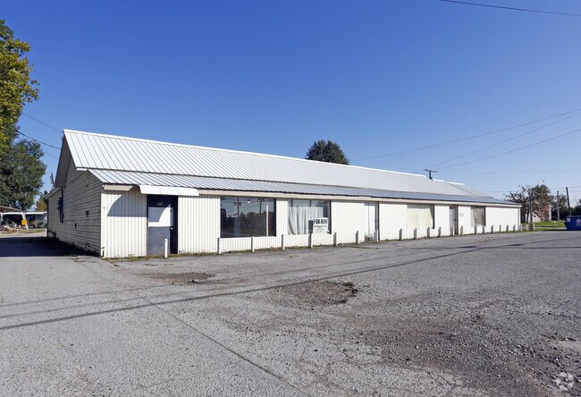
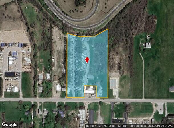
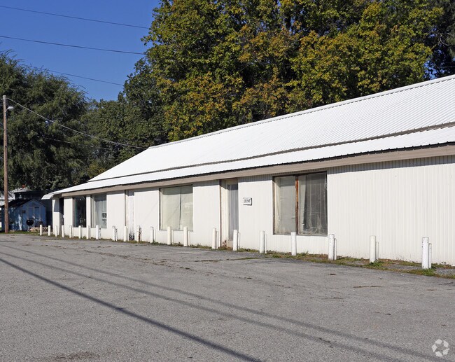
Property Record
2029 E State Rd, Port Clinton, OH 43452
NEARBY LISTINGS FOR SALE OR LEASE
Property Detail
2029 E State Rd
020-2091134448000
S04 T06 R17 W PT NE 1/4 BET STATE RD & R
Mobilehomepark
Ottawa
X
Ohio
39123C0145D
6.12 AC
2024
Ottawa County
2024
Toledo
051201
Port Clinton, OH
3,200 SF
DEMOGRAPHICS near 2029 E State Rd
1 Mile
3 Mile
5 Mile
2024 Total Population
1,490
7,865
13,182
2029 Population
1,527
7,739
13,254
Pop Growth 2024-2029
+ 2.48%
(1.60%)
+ 0.55%
Average Age
44
43
47
2024 Total Households
689
3,503
6,022
HH Growth 2024-2029
+ 1.31%
(2.23%)
+ 0.10%
Median Household Inc
$70,290
$54,144
$56,893
Avg Household Size
2.00
2.10
2.10
2024 Avg HH Vehicles
2.00
2.00
2.00
Median Home Value
$140,721
$147,443
$179,356
Median Year Built
1969
1960
1973
Nearby Places
Map Layers
Map Styles
 Street
 Aerial
- Restaurants
- Banks
- Shops
- Fitness
- Groceries
Nearby Properties
Address
Land Use
TOTAL SIZE
Lot Size
Zoning
Address
Land Use
TOTAL SIZE
Lot Size
Zoning
169,534 SF
34.20 AC
Address
Land Use
TOTAL SIZE
Lot Size
Zoning
37,972 SF
4.82 AC
Address
Land Use
TOTAL SIZE
Lot Size
Zoning
104,766 SF
10.06 AC
Address
Land Use
TOTAL SIZE
Lot Size
Zoning
196,122 SF
24.71 AC
Address
Land Use
TOTAL SIZE
Lot Size
Zoning
44,359 SF
4.10 AC
Address
Land Use
TOTAL SIZE
Lot Size
Zoning
5,472 SF
303.61 AC
Address
Land Use
TOTAL SIZE
Lot Size
Zoning
22,947 SF
4.94 AC
Address
Land Use
TOTAL SIZE
Lot Size
Zoning
62,149 SF
14.85 AC
Address
Land Use
TOTAL SIZE
Lot Size
Zoning
39,130 SF
6.70 AC
Address
Land Use
TOTAL SIZE
Lot Size
Zoning
58,090 SF
9.32 AC
Address
Land Use
TOTAL SIZE
Lot Size
Zoning
7,412 SF
5.21 AC
Address
Land Use
TOTAL SIZE
Lot Size
Zoning
10.64 AC
Address
Land Use
TOTAL SIZE
Lot Size
Zoning
31,228 SF
3.12 AC
Address
Land Use
TOTAL SIZE
Lot Size
Zoning
26,996 SF
2.85 AC
Address
Land Use
TOTAL SIZE
Lot Size
Zoning
55,190 SF
2.72 AC
Address
Land Use
TOTAL SIZE
Lot Size
Zoning
20,550 SF
7.56 AC
Address
Land Use
TOTAL SIZE
Lot Size
Zoning
1,537 SF
28.60 AC
Address
Land Use
TOTAL SIZE
Lot Size
Zoning
52,493 SF
8.26 AC
Address
Land Use
TOTAL SIZE
Lot Size
Zoning
4,900 SF
15.52 AC
Address
Land Use
TOTAL SIZE
Lot Size
Zoning
15,722 SF
5 AC
Address
Land Use
TOTAL SIZE
Lot Size
Zoning
7,556 SF
19 AC
Address
Land Use
TOTAL SIZE
Lot Size
Zoning
28,615 SF
4.29 AC
Address
Land Use
TOTAL SIZE
Lot Size
Zoning
Address
Land Use
TOTAL SIZE
Lot Size
Zoning
3,156 SF
0.95 AC
Address
Land Use
TOTAL SIZE
Lot Size
Zoning
2,760 SF
42.24 AC
Address
Land Use
TOTAL SIZE
Lot Size
Zoning
9,928 SF
4.19 AC
Address
Land Use
TOTAL SIZE
Lot Size
Zoning
53,330 SF
4.90 AC
Address
Land Use
TOTAL SIZE
Lot Size
Zoning
30,942 SF
2.41 AC
Address
Land Use
TOTAL SIZE
Lot Size
Zoning
27,380 SF
2.01 AC
Address
Land Use
TOTAL SIZE
Lot Size
Zoning
7,284 SF
3.98 AC
The World's #1 Commercial Real Estate Marketplace
Connect with us
© 2025 CoStar Group
The information above has been obtained from sources believed reliable. While we do not doubt its accuracy we have not verified it and make no guarantee, warranty or representation about it. It is your responsibility to independently confirm its accuracy and completeness. Any projections, opinions, assumptions, or estimates used are for example only and do not represent the current or future performance of the property. The value of this transaction to you depends on tax and other factors which should be evaluated by your tax, financial, and legal advisors. You and your advisors should conduct a careful, independent investigation of the property to determine to your satisfaction the suitability of the property for your needs.