Property Record
2029 Lipscomb Rd E, Wilson, NC 27893
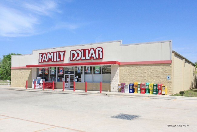

Property Detail
2029 Lipscomb Rd E
Commercialnec
2029 LIPSCOMB RD E 1.03AC
GC
Wilson
B and X Area of moderate flood hazard, usually the area between the limits of the 100-year and 500-year floods.
North Carolina
2024
1.03 AC
2025
Other Market Areas
000701
Wilson, NC
7,804 SF
3731-15-5656.000
NEARBY LISTINGS FOR SALE OR LEASE
DEMOGRAPHICS near 2029 Lipscomb Rd E
1 mile
3 mile
5 mile
2025 Total Population
4,693
22,855
44,827
2030 Population
4,853
23,838
46,027
Pop Growth 2025-2030
+ 3.41%
+ 4.30%
+ 2.68%
Average Age
39
40
41
2025 Total Households
1,882
9,206
18,452
HH Growth 2025-2030
+ 3.56%
+ 4.37%
+ 2.73%
Median Household Inc
$29,457
$36,168
$44,609
Avg Household Size
2.40
2.30
2.30
2025 Avg HH Vehicles
1.00
1.00
2.00
Median Home Value
$113,087
$95,820
$204,466
Median Year Built
1988
1972
1979
Nearby Places
Map Layers
Map Styles
 Street
 Aerial
Transit
 Traffic
 Biking
Places
Listings with unknown addresses are not visible on the map
- Restaurants
- Banks
- Shops
- Fitness
- Groceries
PUBLIC TRANSPORTATION
COMMUTER RAIL
Wilson (Carolinian - Amtrak, Palmetto - Amtrak)
Drive
Walk
Distance
Wilson (Carolinian - Amtrak, Palmetto - Amtrak)
3 min
1.7 mi
AIRPORT
Pitt-Greenville
Drive
Walk
Distance
Pitt-Greenville
43 min
36.1 mi
Freight Ports
Port of Morehead City
Drive
Walk
Distance
Port of Morehead City
165 min
116.8 mi
Nearby Properties
Address
Land Use
TOTAL SIZE
Lot Size
Zoning
Address
Land Use
TOTAL SIZE
Lot Size
Zoning
21,655 SF
34.44 AC
ICD
Address
Land Use
TOTAL SIZE
Lot Size
Zoning
220,639 SF
1.94 AC
CCMX
Address
Land Use
TOTAL SIZE
Lot Size
Zoning
6,704 SF
75.58 AC
ICD
Address
Land Use
TOTAL SIZE
Lot Size
Zoning
259,000 SF
69.97 AC
HI
Address
Land Use
TOTAL SIZE
Lot Size
Zoning
10,152 SF
29.71 AC
ICD
Address
Land Use
TOTAL SIZE
Lot Size
Zoning
59,319 SF
1.01 AC
CCMX
Address
Land Use
TOTAL SIZE
Lot Size
Zoning
77,125 SF
2.98 AC
GC
Address
Land Use
TOTAL SIZE
Lot Size
Zoning
90,035 SF
91.87 AC
ICD
Address
Land Use
TOTAL SIZE
Lot Size
Zoning
80,000 SF
101.30 AC
HI
Address
Land Use
TOTAL SIZE
Lot Size
Zoning
25,888 SF
73.36 AC
LI
Address
Land Use
TOTAL SIZE
Lot Size
Zoning
192,420 SF
34.36 AC
HI
Address
Land Use
TOTAL SIZE
Lot Size
Zoning
91,637 SF
1.95 AC
CCMX
Address
Land Use
TOTAL SIZE
Lot Size
Zoning
75,622 SF
9.13 AC
ICD
Address
Land Use
TOTAL SIZE
Lot Size
Zoning
33,650 SF
35.52 AC
ICD
Address
Land Use
TOTAL SIZE
Lot Size
Zoning
13,672 SF
7.68 AC
NC
Address
Land Use
TOTAL SIZE
Lot Size
Zoning
20,705 SF
7.88 AC
GR6
Address
Land Use
TOTAL SIZE
Lot Size
Zoning
6,600 SF
707.94 AC
M2
Address
Land Use
TOTAL SIZE
Lot Size
Zoning
35,406 SF
2.91 AC
GR6
Address
Land Use
TOTAL SIZE
Lot Size
Zoning
7,552 SF
51.19 AC
HI
Address
Land Use
TOTAL SIZE
Lot Size
Zoning
74,555 SF
2.37 AC
CCMX
Address
Land Use
TOTAL SIZE
Lot Size
Zoning
108,510 SF
1.47 AC
CCMX
Address
Land Use
TOTAL SIZE
Lot Size
Zoning
129,404 SF
2.61 AC
HI
Address
Land Use
TOTAL SIZE
Lot Size
Zoning
1,080 SF
22.05 AC
RMX
Address
Land Use
TOTAL SIZE
Lot Size
Zoning
9,548 SF
33.53 AC
LI
Address
Land Use
TOTAL SIZE
Lot Size
Zoning
195,718 SF
36.18 AC
HI
Address
Land Use
TOTAL SIZE
Lot Size
Zoning
13,798 SF
1.88 AC
NMX
Address
Land Use
TOTAL SIZE
Lot Size
Zoning
1,416 SF
32.32 AC
ICD
Address
Land Use
TOTAL SIZE
Lot Size
Zoning
171,360 SF
1.78 AC
CCMX
Address
Land Use
TOTAL SIZE
Lot Size
Zoning
51,620 SF
5.71 AC
GR6
Address
Land Use
TOTAL SIZE
Lot Size
Zoning
4,347 SF
228.61 AC
HI
The World's #1 Commercial Real Estate Marketplace
Connect with us
© 2026 CoStar Group
The information above has been obtained from sources believed reliable. While we do not doubt its accuracy we have not verified it and make no guarantee, warranty or representation about it. It is your responsibility to independently confirm its accuracy and completeness. Any projections, opinions, assumptions, or estimates used are for example only and do not represent the current or future performance of the property. The value of this transaction to you depends on tax and other factors which should be evaluated by your tax, financial, and legal advisors. You and your advisors should conduct a careful, independent investigation of the property to determine to your satisfaction the suitability of the property for your needs.