Property Record
2029 Lynnhaven Pky, Virginia Beach, VA 23456


NEARBY LISTINGS FOR SALE OR LEASE
Property Detail
2029 Lynnhaven Pky
Virginia Beach-Norfolk-Newport News, VA-NC
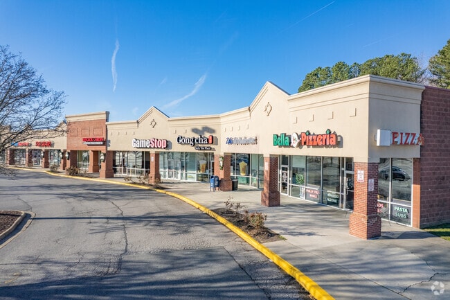
Salem Crossing Shoppin G
1475-86-8600
SALEM CROSSING SHOPPIN G PAR B 19.665 AC BY PLAT
Regionalshoppingcenterormallwithanchorstore
Virginia Beach
X
Virginia
5155310111G
00900
2024
19.67 AC
2025
Princess Anne
046014
Hampton Roads
93,022 SF
DEMOGRAPHICS near 2029 Lynnhaven Pky
1 Mile
3 Mile
5 Mile
2024 Total Population
20,072
126,172
248,339
2029 Population
19,959
124,487
245,947
Pop Growth 2024-2029
(0.56%)
(1.34%)
(0.96%)
Average Age
38
38
39
2024 Total Households
7,127
46,121
92,062
HH Growth 2024-2029
(0.67%)
(1.48%)
(1.09%)
Median Household Inc
$92,196
$83,678
$82,081
Avg Household Size
2.70
2.70
2.60
2024 Avg HH Vehicles
2.00
2.00
2.00
Median Home Value
$281,817
$273,098
$285,745
Median Year Built
1987
1983
1982
Nearby Places
Map Layers
Map Styles
 Street
 Aerial
- Restaurants
- Banks
- Shops
- Fitness
- Groceries
PUBLIC TRANSPORTATION
AIRPORT
Norfolk International
DRIVE
WALK
Distance
Norfolk International
22 min
12.9 mi
Freight Ports
Virginia Port Authority - Portsmouth
DRIVE
WALK
Distance
Virginia Port Authority - Portsmouth
31 min
15.9 mi
SALE & LEASE HISTORY
LISTING DATE
SALE/LEASE

Sep 26, 2016
For Lease
Sep 11, 2019
For Lease
Jan 27, 2017
For Lease
Nearby Properties
Address
Land Use
TOTAL SIZE
Lot Size
Zoning
Address
Land Use
TOTAL SIZE
Lot Size
Zoning
693,172 SF
O2
Address
Land Use
TOTAL SIZE
Lot Size
Zoning
536,135 SF
115.04 AC
P1
Address
Land Use
TOTAL SIZE
Lot Size
Zoning
1 SF
44.31 AC
A18
Address
Land Use
TOTAL SIZE
Lot Size
Zoning
23.06 AC
A36
Address
Land Use
TOTAL SIZE
Lot Size
Zoning
4 SF
19.85 AC
A12
Address
Land Use
TOTAL SIZE
Lot Size
Zoning
153 SF
88.33 AC
R75
Address
Land Use
TOTAL SIZE
Lot Size
Zoning
309,512 SF
65.15 AC
P1
Address
Land Use
TOTAL SIZE
Lot Size
Zoning
349,667 SF
35.30 AC
Address
Land Use
TOTAL SIZE
Lot Size
Zoning
3 SF
13.58 AC
A12
Address
Land Use
TOTAL SIZE
Lot Size
Zoning
9.62 AC
A36
Address
Land Use
TOTAL SIZE
Lot Size
Zoning
287,520 SF
13.10 AC
A18
Address
Land Use
TOTAL SIZE
Lot Size
Zoning
289,581 SF
49.99 AC
R5D
Address
Land Use
TOTAL SIZE
Lot Size
Zoning
1 SF
18.64 AC
PDH1
Address
Land Use
TOTAL SIZE
Lot Size
Zoning
366,189 SF
55.78 AC
B2
Address
Land Use
TOTAL SIZE
Lot Size
Zoning
1 SF
16.15 AC
PDH1
Address
Land Use
TOTAL SIZE
Lot Size
Zoning
Address
Land Use
TOTAL SIZE
Lot Size
Zoning
1 SF
12.01 AC
PDH1
Address
Land Use
TOTAL SIZE
Lot Size
Zoning
252,686 SF
50.05 AC
PDH1
Address
Land Use
TOTAL SIZE
Lot Size
Zoning
174,868 SF
65.46 AC
AG1
Address
Land Use
TOTAL SIZE
Lot Size
Zoning
1 SF
10.64 AC
PDH1
Address
Land Use
TOTAL SIZE
Lot Size
Zoning
128,577 SF
15.28 AC
I1
Address
Land Use
TOTAL SIZE
Lot Size
Zoning
1 SF
12.42 AC
A18
Address
Land Use
TOTAL SIZE
Lot Size
Zoning
259,135 SF
50.10 AC
R10
Address
Land Use
TOTAL SIZE
Lot Size
Zoning
1 SF
11.50 AC
PDH1
Address
Land Use
TOTAL SIZE
Lot Size
Zoning
68,731 SF
5.80 AC
Address
Land Use
TOTAL SIZE
Lot Size
Zoning
177,802 SF
4.90 AC
A36
Address
Land Use
TOTAL SIZE
Lot Size
Zoning
246,625 SF
35 AC
R10
Address
Land Use
TOTAL SIZE
Lot Size
Zoning
1 SF
9.90 AC
PDH1
Address
Land Use
TOTAL SIZE
Lot Size
Zoning
1 SF
9.07 AC
PDH1
Address
Land Use
TOTAL SIZE
Lot Size
Zoning
86,174 SF
33.02 AC
R5D
The World's #1 Commercial Real Estate Marketplace
Connect with us
© 2026 CoStar Group
The information above has been obtained from sources believed reliable. While we do not doubt its accuracy we have not verified it and make no guarantee, warranty or representation about it. It is your responsibility to independently confirm its accuracy and completeness. Any projections, opinions, assumptions, or estimates used are for example only and do not represent the current or future performance of the property. The value of this transaction to you depends on tax and other factors which should be evaluated by your tax, financial, and legal advisors. You and your advisors should conduct a careful, independent investigation of the property to determine to your satisfaction the suitability of the property for your needs.