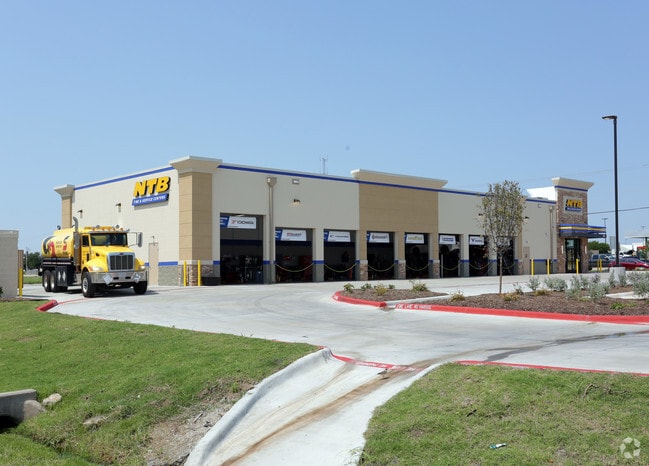
Property Record
2029 N Highway 78, Wylie, TX 75098

Property Detail
2029 N Highway 78
R-10396-00A-004B-1
WYLIE RETAIL OFFICE PARK ADDITION, BLK A, LOT 4B; (REPLAT)
Commercialnec
COLLIN
COMMERCIAL
Texas
B and X Area of moderate flood hazard, usually the area between the limits of the 100-year and 500-year floods.
4b
2025
1.36 AC
2025
Murphy/Wylie
031320
Dallas/Ft Worth
6,713 SF
Dallas-Fort Worth-Arlington, TX
NEARBY LISTINGS FOR SALE OR LEASE
DEMOGRAPHICS near 2029 N Highway 78
1 mile
3 mile
5 mile
2025 Total Population
6,246
41,197
113,213
2030 Population
7,186
47,180
129,576
Pop Growth 2025-2030
+ 15.05%
+ 14.52%
+ 14.45%
Average Age
37
37
37
2025 Total Households
2,033
13,354
36,076
HH Growth 2025-2030
+ 15.25%
+ 14.69%
+ 14.70%
Median Household Inc
$120,988
$118,491
$123,644
Avg Household Size
3.10
3.10
3.10
2025 Avg HH Vehicles
2.00
2.00
2.00
Median Home Value
$389,694
$413,394
$448,556
Median Year Built
2007
2005
2007
Nearby Places
Map Layers
Map Styles
 Street
 Aerial
Layers
 Traffic
 Biking
Places
Listings with unknown addresses are not visible on the map
- Restaurants
- Banks
- Shops
- Fitness
- Groceries
PUBLIC TRANSPORTATION
AIRPORT
Dallas Love Field
Drive
Walk
Distance
Dallas Love Field
47 min
31.4 mi
Freight Ports
Port of Shreveport
Drive
Walk
Distance
Port of Shreveport
222 min
194.9 mi
Nearby Properties
Address
Land Use
TOTAL SIZE
Lot Size
Zoning
Address
Land Use
TOTAL SIZE
Lot Size
Zoning
603,573 SF
58.20 AC
Address
Land Use
TOTAL SIZE
Lot Size
Zoning
266,957 SF
11.34 AC
MFR
Address
Land Use
TOTAL SIZE
Lot Size
Zoning
393,054 SF
55.95 AC
Address
Land Use
TOTAL SIZE
Lot Size
Zoning
257,718 SF
13.10 AC
RESIDENTIA
Address
Land Use
TOTAL SIZE
Lot Size
Zoning
274,329 SF
44.89 AC
Address
Land Use
TOTAL SIZE
Lot Size
Zoning
274,416 SF
18.40 AC
PD
Address
Land Use
TOTAL SIZE
Lot Size
Zoning
132,306 SF
7.85 AC
MF
Address
Land Use
TOTAL SIZE
Lot Size
Zoning
106,866 SF
15.69 AC
Address
Land Use
TOTAL SIZE
Lot Size
Zoning
97,898 SF
10.82 AC
Address
Land Use
TOTAL SIZE
Lot Size
Zoning
203,192 SF
17.69 AC
Address
Land Use
TOTAL SIZE
Lot Size
Zoning
128,849 SF
7.70 AC
Address
Land Use
TOTAL SIZE
Lot Size
Zoning
304,978 SF
81.51 AC
Address
Land Use
TOTAL SIZE
Lot Size
Zoning
88,580 SF
38.80 AC
Address
Land Use
TOTAL SIZE
Lot Size
Zoning
145,635 SF
12.15 AC
Address
Land Use
TOTAL SIZE
Lot Size
Zoning
125,000 SF
22.42 AC
FLOOD
Address
Land Use
TOTAL SIZE
Lot Size
Zoning
151,759 SF
14.02 AC
MF
Address
Land Use
TOTAL SIZE
Lot Size
Zoning
109 SF
17.90 AC
Z268
Address
Land Use
TOTAL SIZE
Lot Size
Zoning
267,312 SF
10.05 AC
Address
Land Use
TOTAL SIZE
Lot Size
Zoning
54,240 SF
2.12 AC
MF
Address
Land Use
TOTAL SIZE
Lot Size
Zoning
33,638 SF
7.14 AC
AG
Address
Land Use
TOTAL SIZE
Lot Size
Zoning
67,031 SF
18.83 AC
Address
Land Use
TOTAL SIZE
Lot Size
Zoning
94,981 SF
11.55 AC
Address
Land Use
TOTAL SIZE
Lot Size
Zoning
40,762 SF
4.70 AC
CR
Address
Land Use
TOTAL SIZE
Lot Size
Zoning
108,582 SF
10 AC
Address
Land Use
TOTAL SIZE
Lot Size
Zoning
62,487 SF
7.25 AC
CR
Address
Land Use
TOTAL SIZE
Lot Size
Zoning
88,452 SF
7.96 AC
Address
Land Use
TOTAL SIZE
Lot Size
Zoning
65,987 SF
4.99 AC
Address
Land Use
TOTAL SIZE
Lot Size
Zoning
74,124 SF
14.57 AC
Address
Land Use
TOTAL SIZE
Lot Size
Zoning
70,900 SF
13.16 AC
Address
Land Use
TOTAL SIZE
Lot Size
Zoning
42,665 SF
3.21 AC
The World's #1 Commercial Real Estate Marketplace
Connect with us
© 2026 CoStar Group
The information above has been obtained from sources believed reliable. While we do not doubt its accuracy we have not verified it and make no guarantee, warranty or representation about it. It is your responsibility to independently confirm its accuracy and completeness. Any projections, opinions, assumptions, or estimates used are for example only and do not represent the current or future performance of the property. The value of this transaction to you depends on tax and other factors which should be evaluated by your tax, financial, and legal advisors. You and your advisors should conduct a careful, independent investigation of the property to determine to your satisfaction the suitability of the property for your needs.