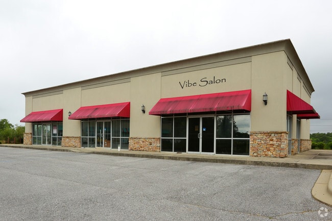
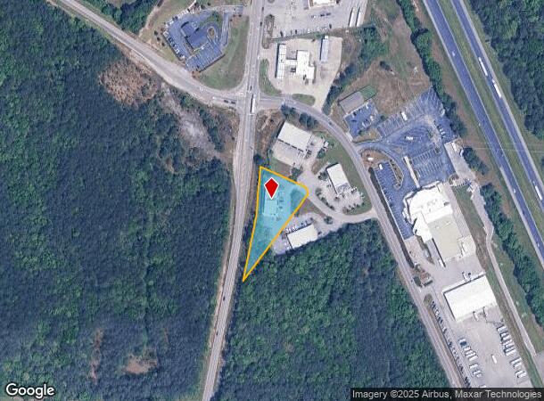
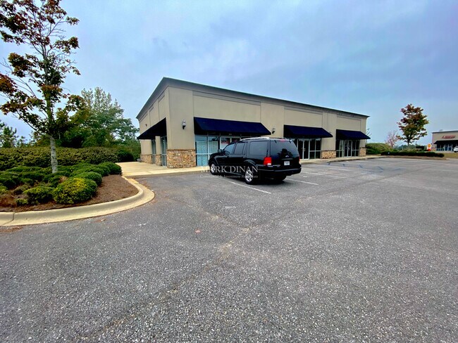
Property Record
203 Airport Commons Dr, Alabaster, AL 35007

NEARBY LISTINGS FOR SALE OR LEASE
-
-
View all Alabaster listings for sale on LoopNet.com
Property Detail
203 Airport Commons Dr
Birmingham-Hoover, AL
Airport Commons
22-9-32-2-001-001-025
SEC/TWNSHP/RAN 32 21S 02W NBRHD: 03 CALERA COMMERCIAL R-2
Storesoffices
Shelby
X
Alabama
01117C0392E
3
2024
0.88 AC
2024
I-65 Corr/S Shelby County
030306
Birmingham
3,910 SF
DEMOGRAPHICS near 203 Airport Commons Dr
1 Mile
3 Mile
5 Mile
2024 Total Population
3,726
13,743
31,086
2029 Population
4,077
14,981
33,893
Pop Growth 2024-2029
+ 9.42%
+ 9.01%
+ 9.03%
Average Age
35
38
38
2024 Total Households
1,431
5,175
11,500
HH Growth 2024-2029
+ 9.50%
+ 9.14%
+ 9.18%
Median Household Inc
$73,328
$78,222
$73,748
Avg Household Size
2.50
2.60
2.70
2024 Avg HH Vehicles
2.00
2.00
2.00
Median Home Value
$193,103
$219,720
$224,114
Median Year Built
2006
2003
2001
Nearby Places
Map Layers
Map Styles
 Street
 Aerial
- Restaurants
- Banks
- Shops
- Fitness
- Groceries
PUBLIC TRANSPORTATION
AIRPORT
Birmingham-Shuttlesworth International
DRIVE
WALK
Distance
Birmingham-Shuttlesworth International
42 min
32.6 mi
Freight Ports
Port of Mobile
DRIVE
WALK
Distance
Port of Mobile
250 min
229.8 mi
SALE & LEASE HISTORY
LISTING DATE
SALE/LEASE

Sep 25, 2016
For Lease
Sep 24, 2016
For Sale
Oct 25, 2023
For Sale
Nearby Properties
Address
Land Use
TOTAL SIZE
Lot Size
Zoning
Address
Land Use
TOTAL SIZE
Lot Size
Zoning
14,160 SF
6.75 AC
Address
Land Use
TOTAL SIZE
Lot Size
Zoning
139,905 SF
34.78 AC
Address
Land Use
TOTAL SIZE
Lot Size
Zoning
416,160 SF
58.85 AC
Address
Land Use
TOTAL SIZE
Lot Size
Zoning
573,600 SF
19.96 AC
Address
Land Use
TOTAL SIZE
Lot Size
Zoning
3,941 SF
5.60 AC
Address
Land Use
TOTAL SIZE
Lot Size
Zoning
500,500 SF
17.45 AC
Address
Land Use
TOTAL SIZE
Lot Size
Zoning
220,000 SF
21.76 AC
Address
Land Use
TOTAL SIZE
Lot Size
Zoning
368,066 SF
20.66 AC
Address
Land Use
TOTAL SIZE
Lot Size
Zoning
129,305 SF
50 AC
Address
Land Use
TOTAL SIZE
Lot Size
Zoning
270,600 SF
21.75 AC
Address
Land Use
TOTAL SIZE
Lot Size
Zoning
249,500 SF
16.15 AC
Address
Land Use
TOTAL SIZE
Lot Size
Zoning
6,234 SF
33 AC
Address
Land Use
TOTAL SIZE
Lot Size
Zoning
8,416 SF
16.12 AC
Address
Land Use
TOTAL SIZE
Lot Size
Zoning
208,000 SF
11.91 AC
Address
Land Use
TOTAL SIZE
Lot Size
Zoning
154,440 SF
12.03 AC
Address
Land Use
TOTAL SIZE
Lot Size
Zoning
46,031 SF
11.09 AC
Address
Land Use
TOTAL SIZE
Lot Size
Zoning
9,728 SF
11.01 AC
Address
Land Use
TOTAL SIZE
Lot Size
Zoning
116,219 SF
35.20 AC
Address
Land Use
TOTAL SIZE
Lot Size
Zoning
121,500 SF
13.80 AC
Address
Land Use
TOTAL SIZE
Lot Size
Zoning
50,558 SF
22.76 AC
Address
Land Use
TOTAL SIZE
Lot Size
Zoning
139,170 SF
15.30 AC
Address
Land Use
TOTAL SIZE
Lot Size
Zoning
104,643 SF
5.39 AC
Address
Land Use
TOTAL SIZE
Lot Size
Zoning
53,022 SF
2.20 AC
Address
Land Use
TOTAL SIZE
Lot Size
Zoning
8,328 SF
6.89 AC
Address
Land Use
TOTAL SIZE
Lot Size
Zoning
672 SF
7.33 AC
Address
Land Use
TOTAL SIZE
Lot Size
Zoning
241.36 AC
Address
Land Use
TOTAL SIZE
Lot Size
Zoning
73,825 SF
15 AC
Address
Land Use
TOTAL SIZE
Lot Size
Zoning
6,275 SF
290 AC
Address
Land Use
TOTAL SIZE
Lot Size
Zoning
14,163 SF
12.78 AC
The World's #1 Commercial Real Estate Marketplace
Connect with us
© 2025 CoStar Group
The information above has been obtained from sources believed reliable. While we do not doubt its accuracy we have not verified it and make no guarantee, warranty or representation about it. It is your responsibility to independently confirm its accuracy and completeness. Any projections, opinions, assumptions, or estimates used are for example only and do not represent the current or future performance of the property. The value of this transaction to you depends on tax and other factors which should be evaluated by your tax, financial, and legal advisors. You and your advisors should conduct a careful, independent investigation of the property to determine to your satisfaction the suitability of the property for your needs.