Property Record
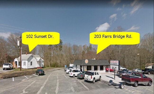
203 Farrs Bridge Rd, Pickens, SC 29671

This Property Is For Sale
NEARBY LISTINGS FOR SALE OR LEASE
Property Detail
203 Farrs Bridge Rd
4191-10-36-4286
N/SIDE HWY 183, AUNTIE ANNS RESTAURANT PLAT 230/13
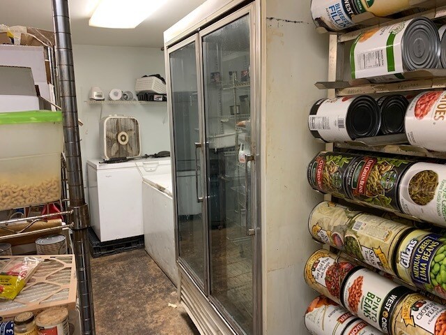
Restaurantbuilding
Pickens
X
South Carolina
45077C0165E
1.16 AC
2025
Pickens County
2024
Greenville/Spartanburg
010502
Greenville-Anderson-Greer, SC
1,456 SF
DEMOGRAPHICS near 203 Farrs Bridge Rd
1 Mile
3 Mile
5 Mile
2024 Total Population
2,010
10,736
21,990
2029 Population
2,108
11,229
23,001
Pop Growth 2024-2029
+ 4.88%
+ 4.59%
+ 4.60%
Average Age
43
42
42
2024 Total Households
775
4,231
8,632
HH Growth 2024-2029
+ 4.90%
+ 4.68%
+ 4.69%
Median Household Inc
$38,231
$46,423
$44,763
Avg Household Size
2.50
2.40
2.50
2024 Avg HH Vehicles
2.00
2.00
2.00
Median Home Value
$151,764
$170,637
$155,734
Median Year Built
1976
1980
1985
Nearby Places
Map Layers
Map Styles
 Street
 Aerial
- Restaurants
- Banks
- Shops
- Fitness
- Groceries
PUBLIC TRANSPORTATION
AIRPORT
Greenville Spartanburg International
DRIVE
WALK
Distance
Greenville Spartanburg International
51 min
32.5 mi
Nearby Properties
Address
Land Use
TOTAL SIZE
Lot Size
Zoning
Address
Land Use
TOTAL SIZE
Lot Size
Zoning
56,599 SF
8.02 AC
RM16
Address
Land Use
TOTAL SIZE
Lot Size
Zoning
29,595 SF
2.94 AC
R12
Address
Land Use
TOTAL SIZE
Lot Size
Zoning
5,356 SF
17.33 AC
Address
Land Use
TOTAL SIZE
Lot Size
Zoning
138.86 AC
GBD
Address
Land Use
TOTAL SIZE
Lot Size
Zoning
12,466 SF
2.32 AC
R12
Address
Land Use
TOTAL SIZE
Lot Size
Zoning
4,829 SF
2 AC
Address
Land Use
TOTAL SIZE
Lot Size
Zoning
5,645 SF
0.67 AC
Address
Land Use
TOTAL SIZE
Lot Size
Zoning
4,080 SF
2.56 AC
GBD
Address
Land Use
TOTAL SIZE
Lot Size
Zoning
6,070 SF
1.71 AC
CBD
Address
Land Use
TOTAL SIZE
Lot Size
Zoning
2,679 SF
0.58 AC
Address
Land Use
TOTAL SIZE
Lot Size
Zoning
19,852 SF
47.45 AC
GBD
Address
Land Use
TOTAL SIZE
Lot Size
Zoning
5,250 SF
1.35 AC
GBD
Address
Land Use
TOTAL SIZE
Lot Size
Zoning
5,468 SF
0.75 AC
CBD
Address
Land Use
TOTAL SIZE
Lot Size
Zoning
4,133 SF
5.15 AC
R12
Address
Land Use
TOTAL SIZE
Lot Size
Zoning
91,940 SF
15.07 AC
GBD
Address
Land Use
TOTAL SIZE
Lot Size
Zoning
1,056 SF
34.54 AC
R12
Address
Land Use
TOTAL SIZE
Lot Size
Zoning
3,850 SF
12.40 AC
GBD
Address
Land Use
TOTAL SIZE
Lot Size
Zoning
2,766 SF
0.78 AC
CBD
Address
Land Use
TOTAL SIZE
Lot Size
Zoning
1,296 SF
11.05 AC
Address
Land Use
TOTAL SIZE
Lot Size
Zoning
5,400 SF
2.20 AC
GBD
Address
Land Use
TOTAL SIZE
Lot Size
Zoning
2,997 SF
1.50 AC
GBD
Address
Land Use
TOTAL SIZE
Lot Size
Zoning
4,140 SF
0.06 AC
CBD
Address
Land Use
TOTAL SIZE
Lot Size
Zoning
32,181 SF
2.90 AC
GBD
Address
Land Use
TOTAL SIZE
Lot Size
Zoning
1,716 SF
1.01 AC
GBD
Address
Land Use
TOTAL SIZE
Lot Size
Zoning
1,514 SF
0.34 AC
Address
Land Use
TOTAL SIZE
Lot Size
Zoning
51,730 SF
6.75 AC
RM16
Address
Land Use
TOTAL SIZE
Lot Size
Zoning
14,461 SF
2.48 AC
GBD
Address
Land Use
TOTAL SIZE
Lot Size
Zoning
23.39 AC
GBD
Address
Land Use
TOTAL SIZE
Lot Size
Zoning
29,565 SF
1.86 AC
GBD
Address
Land Use
TOTAL SIZE
Lot Size
Zoning
37,388 SF
4.29 AC
RM16
The World's #1 Commercial Real Estate Marketplace
Connect with us
© 2026 CoStar Group
The information above has been obtained from sources believed reliable. While we do not doubt its accuracy we have not verified it and make no guarantee, warranty or representation about it. It is your responsibility to independently confirm its accuracy and completeness. Any projections, opinions, assumptions, or estimates used are for example only and do not represent the current or future performance of the property. The value of this transaction to you depends on tax and other factors which should be evaluated by your tax, financial, and legal advisors. You and your advisors should conduct a careful, independent investigation of the property to determine to your satisfaction the suitability of the property for your needs.