Property Record
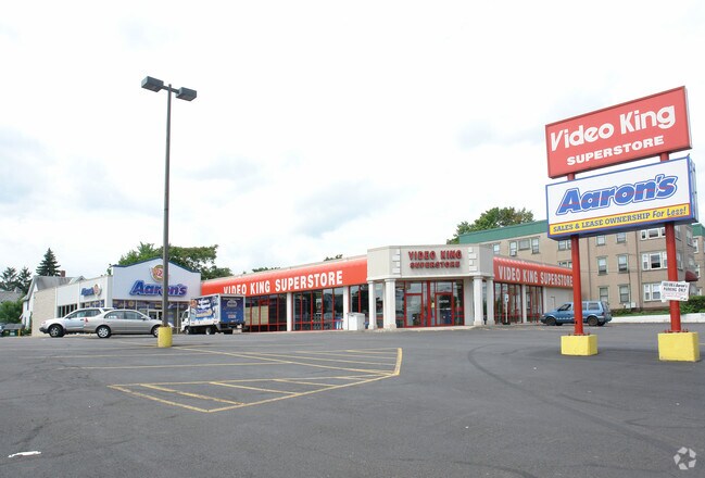
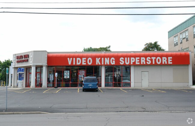
203 Main St, Binghamton, NY 13905

NEARBY LISTINGS FOR SALE OR LEASE
Property Detail
203 Main St
Binghamton, NY
Sliter Day And Seagers Farm Subdivision
030200-160-021-0004-004-000-0000
Broome
Storesoffices
New York
2025
4.000
2024
0.96 AC
000100
Broome County
12,815 SF
Syracuse
DEMOGRAPHICS near 203 Main St
1 Mile
3 Mile
5 Mile
2024 Total Population
20,294
78,747
105,683
2029 Population
19,793
77,308
103,807
Pop Growth 2024-2029
(2.47%)
(1.83%)
(1.78%)
Average Age
39
39
40
2024 Total Households
8,830
31,421
42,409
HH Growth 2024-2029
(2.68%)
(2.08%)
(2.01%)
Median Household Inc
$41,757
$43,996
$49,580
Avg Household Size
2.10
2.10
2.20
2024 Avg HH Vehicles
1.00
1.00
1.00
Median Home Value
$125,155
$122,552
$136,858
Median Year Built
1947
1951
1955
Nearby Places
- Restaurants
- Banks
- Shops
- Fitness
- Groceries
SALE & LEASE HISTORY
LISTING DATE
SALE/LEASE

Jul 29, 2020
For Lease
Jan 08, 2021
For Lease
Nearby Properties
Address
Land Use
TOTAL SIZE
Lot Size
Zoning
Address
Land Use
TOTAL SIZE
Lot Size
Zoning
65,256 SF
579.06 AC
Address
Land Use
TOTAL SIZE
Lot Size
Zoning
9,790 SF
11.23 AC
ID
Address
Land Use
TOTAL SIZE
Lot Size
Zoning
418,288 SF
33.64 AC
Address
Land Use
TOTAL SIZE
Lot Size
Zoning
88,796 SF
20.04 AC
Address
Land Use
TOTAL SIZE
Lot Size
Zoning
30,334 SF
238.95 AC
Address
Land Use
TOTAL SIZE
Lot Size
Zoning
470,272 SF
5.30 AC
Address
Land Use
TOTAL SIZE
Lot Size
Zoning
283,373 SF
1.47 AC
Address
Land Use
TOTAL SIZE
Lot Size
Zoning
20,411 SF
0.66 AC
Address
Land Use
TOTAL SIZE
Lot Size
Zoning
87,453 SF
6.77 AC
C-2
Address
Land Use
TOTAL SIZE
Lot Size
Zoning
68,845 SF
4.74 AC
C-2
Address
Land Use
TOTAL SIZE
Lot Size
Zoning
124,053 SF
7.63 AC
RC
Address
Land Use
TOTAL SIZE
Lot Size
Zoning
0.98 AC
RR
Address
Land Use
TOTAL SIZE
Lot Size
Zoning
153,616 SF
2.73 AC
Address
Land Use
TOTAL SIZE
Lot Size
Zoning
143,718 SF
1.37 AC
Address
Land Use
TOTAL SIZE
Lot Size
Zoning
117,267 SF
17.65 AC
C-2
Address
Land Use
TOTAL SIZE
Lot Size
Zoning
102,306 SF
1.92 AC
Address
Land Use
TOTAL SIZE
Lot Size
Zoning
41,535 SF
4.16 AC
Address
Land Use
TOTAL SIZE
Lot Size
Zoning
203,296 SF
3.73 AC
Address
Land Use
TOTAL SIZE
Lot Size
Zoning
180,095 SF
3.86 AC
Address
Land Use
TOTAL SIZE
Lot Size
Zoning
313,570 SF
4.88 AC
Address
Land Use
TOTAL SIZE
Lot Size
Zoning
184,243 SF
11.46 AC
Address
Land Use
TOTAL SIZE
Lot Size
Zoning
0.53 AC
RR
Address
Land Use
TOTAL SIZE
Lot Size
Zoning
88,625 SF
2.33 AC
Address
Land Use
TOTAL SIZE
Lot Size
Zoning
97,204 SF
1.45 AC
C-1
Address
Land Use
TOTAL SIZE
Lot Size
Zoning
34,606 SF
4.10 AC
Address
Land Use
TOTAL SIZE
Lot Size
Zoning
97,087 SF
1.66 AC
C-2
Address
Land Use
TOTAL SIZE
Lot Size
Zoning
18,104 SF
9.94 AC
RC
Address
Land Use
TOTAL SIZE
Lot Size
Zoning
95,892 SF
1.18 AC
CD
Address
Land Use
TOTAL SIZE
Lot Size
Zoning
69,983 SF
10.29 AC
C-2
Address
Land Use
TOTAL SIZE
Lot Size
Zoning
52,295 SF
12.30 AC
The World's #1 Commercial Real Estate Marketplace
Connect with us
© 2025 CoStar Group
The information above has been obtained from sources believed reliable. While we do not doubt its accuracy we have not verified it and make no guarantee, warranty or representation about it. It is your responsibility to independently confirm its accuracy and completeness. Any projections, opinions, assumptions, or estimates used are for example only and do not represent the current or future performance of the property. The value of this transaction to you depends on tax and other factors which should be evaluated by your tax, financial, and legal advisors. You and your advisors should conduct a careful, independent investigation of the property to determine to your satisfaction the suitability of the property for your needs.